Information gathered from a distance
Remote sensing—the acquisition of information from a distance—has had a profound impact on human affairs in modern history. This image of British Beach (the WWII code name for one landing spot of the June 1944 Normandy invasion) taken from a specially equipped US Army F5, reveals rifle troops on the beach coming in from various large and small landing craft. Seven decades later—even as its application has expanded to unimaginable reaches—remote sensing remains the most significant of reconnaissance and earth observation technologies.
Many platforms, many applications
Modern imagery is captured from a broad range of altitudes starting from ground level to over 22,000 miles above earth. The images that come from each altitude offer distinct advantages for each application. While not meant to be an exhaustive inventory, let’s take a look at some of the most commonly used sensor altitudes.
Geosynchronous—22,236 miles
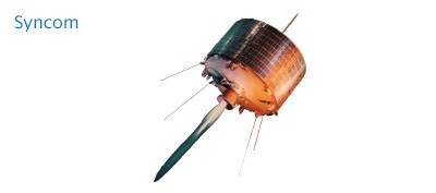
Satellites that match Earth’s rotation appear stationary in the sky to ground observers. While most commonly used for communications, geosynchronous orbiting satellites like the hyperspectral GIFTS imager are also useful for monitoring changing phenomena such as weather conditions. NASA’s Syncom, launched in the early 1960s, was the first successful “high flyer.”
Sun synchronous—375–500 miles
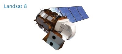
Satellites in this orbit keep the angle of sunlight on the surface of the earth as consistent as possible, which means that scientists can compare images from the same season over several years, as with Landsat imagery. This is the bread-and-butter zone for earth observing sensors.
Atmospheric satellite—100,000 feet
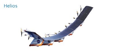
Also known as pseudo-satellites, these unmanned vehicles skim the highest edges of detectable atmosphere. NASA’s experimental Helios craft measured solar flares before crashing in the Pacific Ocean near Kauai.
Jet aircraft—90,000-30,000 feet
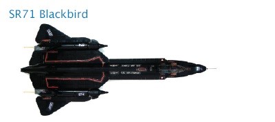
Jet aircraft flying at 30,000 feet and higher can be flown over disaster areas in a very short time, making them a good platform for certain types of optical and multispectral image applications.
General aviation aircraft—100-10,000 feet
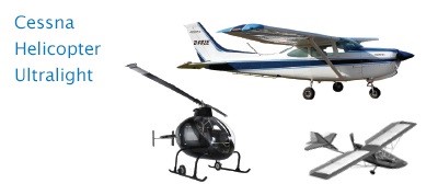
Small aircraft able to fly at low speed and low altitude have long been the sweet spot for high-quality aerial and orthophotography. From Cessnas to ultralights to helicopters, these are the workhorses of urban optical imagery.
Drones—100-500 feet
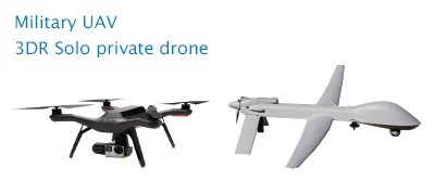
Drones are the new kids on the block. Their ability to fly low, hover, and be remotely controlled offer attractive advantages for aerial photography, with resolution down to sub-1 inch. Military UAVs can be either smaller drones or actual airplanes.
Ground based/handheld—Ground level
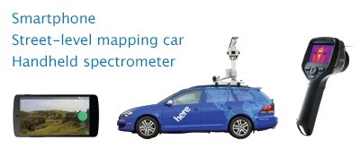
Increasingly, imagery taken at ground level is finding its way into GIS workflows. Things like Google Street View, HERE streel-level imagery, and Mapillary; handheld multispectral imagers; and other terrestrial sensors are finding applications in areas like pipelines, security, tourism, real estate, natural resources, and entertainment.
This post is excerpted from The ArcGIS Imagery Book: New View, New Vision. Imagery is suddenly a big deal, and those who are adept at finding it, analyzing it, and understanding what it actually means are going to be in demand in the years ahead. The purpose of this book is to help everyone from GIS professionals to app developers, and web designers to virtually anyone how to become smarter, more skillful, and more powerful appliers of image data. The book is available through Amazon.com and other booksellers, and is also available at http://www.TheArcGISImageryBook.com for free.