Using elevation to enable accurate image georeferencing
Imagery has an amazing amount of information, but raw aerial or satellite imagery cannot be used in a GIS until it has been processed such that all pixels are in an accurate (x,y) position on the ground. Photogrammetry is a discipline, developed over many decades, for processing imagery to generate accurately georeferenced images, referred to as orthorectified images (or sometimes simply orthoimages). Orthorectified images have been processed to apply corrections for optical distortions from the sensor system, and apparent changes in the position of ground objects caused by the perspective of the sensor view angle and ground terrain.
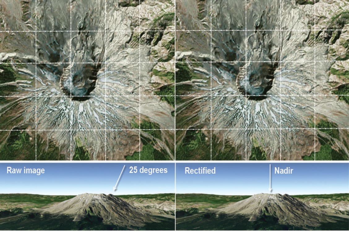
The orthorectification process requires: An accurate description of the sensor, typically called the sensor model; detailed information about the sensor location and orientation for every image; and an accurate terrain model, such as the World Elevation service available from ArcGIS Online. After imagery has been orthorectified, it can be used within a GIS and accurately overlaid with other data layers.