This year, National Mosquito Control Awareness Week is June 26, 2016 – July 2, 2016. Mosquito Awareness week highlights the importance of mosquito control to further bring awareness about efforts to prevent and protect residents from mosquito borne diseases. According to the American Mosquito Control Association, over one million people worldwide die from mosquito-borne diseases every year. Mosquito vectored diseases include, malaria, and viruses such as yellow fever, dengue, chikungunya, West Nile virus and Zika virus. Below you will find six examples of organizations keeping their communities informed about vector aid and vector control efforts.
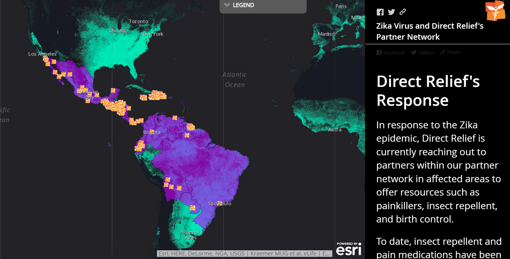
1. Direct Relief
Recently, Zika virus is exploding across the Americas. Direct Relief is reaching out to their partner network in affected regions to offer resources. In this map, one can click on the partner network icon and see the partner name and location to get resources such as painkillers, insect repellent, and birth control.
View Larger Map
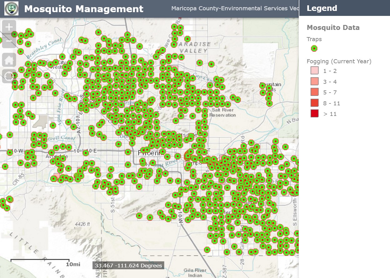
2. Maricopa County Environmental Services
In this map, residents can see the routine trap locations in with more details such as the last fogging date, when the trap was set, which control district it is in, and a description.
View Larger Map
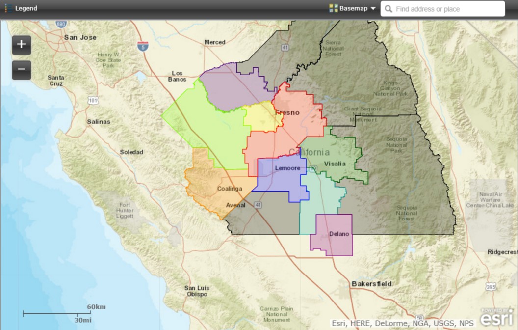
3. Fresno County – Consolidated Mosquito Abatement District Map
In this map, residents can determine which district services their location and how to contact them. When you click on the map, a pop-up window indicates which district services that particular area. Residents can also type in their address in the search bar in the upper right hand corner of the map to navigate to their residence.
View Larger Map
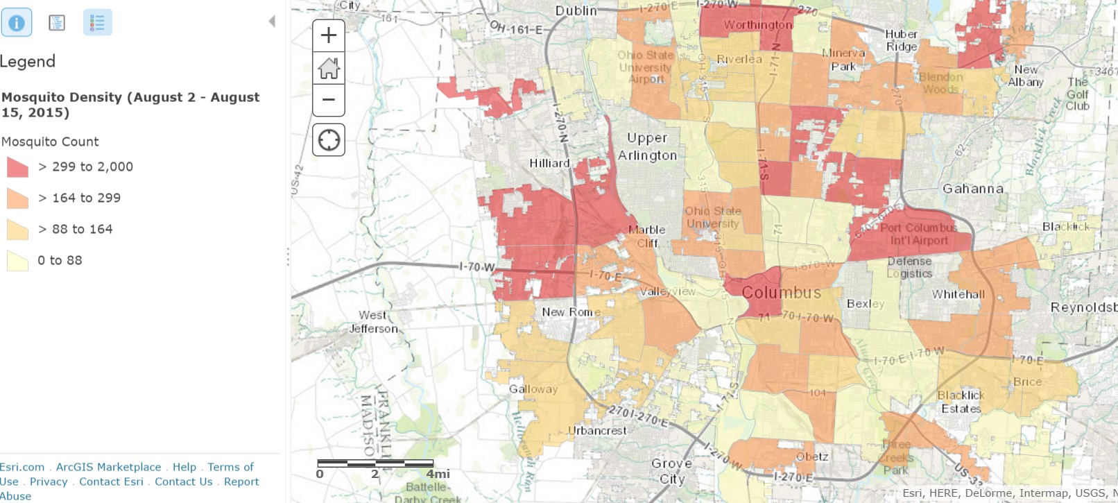
4. The City of Columbus Public Health
Columbus Public Health begins trapping mosquitoes in June each year to test them for West Nile virus. Below is a map showing the density of mosquitoes trapped by Columbus Public Health in Columbus and Worthington. Each area on the map displays a mosquito trapping district. Traps are set in each district once every two weeks. By clicking on a district you will be able to see the date a mosquito trap was set and how many mosquitoes were caught there overnight.
5. Martin County
This interactive web map application indicates the mosquito spray zones that will be sprayed everyday. It is updated daily at 4 p.m. It allows the public to view the currently active spray zones and to determine the spray zone of a particular address. Residents can enter an address into the search box and then click in the general area and a pop up box with the spray zone information will appear.

View Larger Map
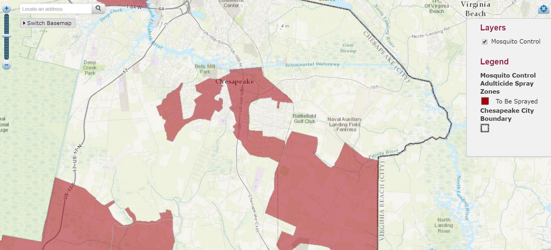
6. City of Chesapeake
The Mosquito Control Commission of the City of Chesapeake is committed to protecting the health, safety, and comfort of the citizens in the most environmentally safe and economically efficient manner possible. One way the city does that is with their public facing map showing adulticide zones to be sprayed. Residents can view which spray zones are being sprayed. The City updates the map daily after 3 p.m.
View Larger Map
Public facing maps are one component of a smart vector control strategy. You can learn how to take a smart approach to vector control in an upcoming webinar, Transform Your Vector Control Strategy with GIS. Register today, go.esri.com/vector_control.
insider