By Jessica Wyland
To identify customers, many product manufacturers are turning to location-based data. A recent Harvard Business Review article reported the use of “increasingly granular data, from detailed demographics and psychographics” including age, gender, address, income, and lifestyle.
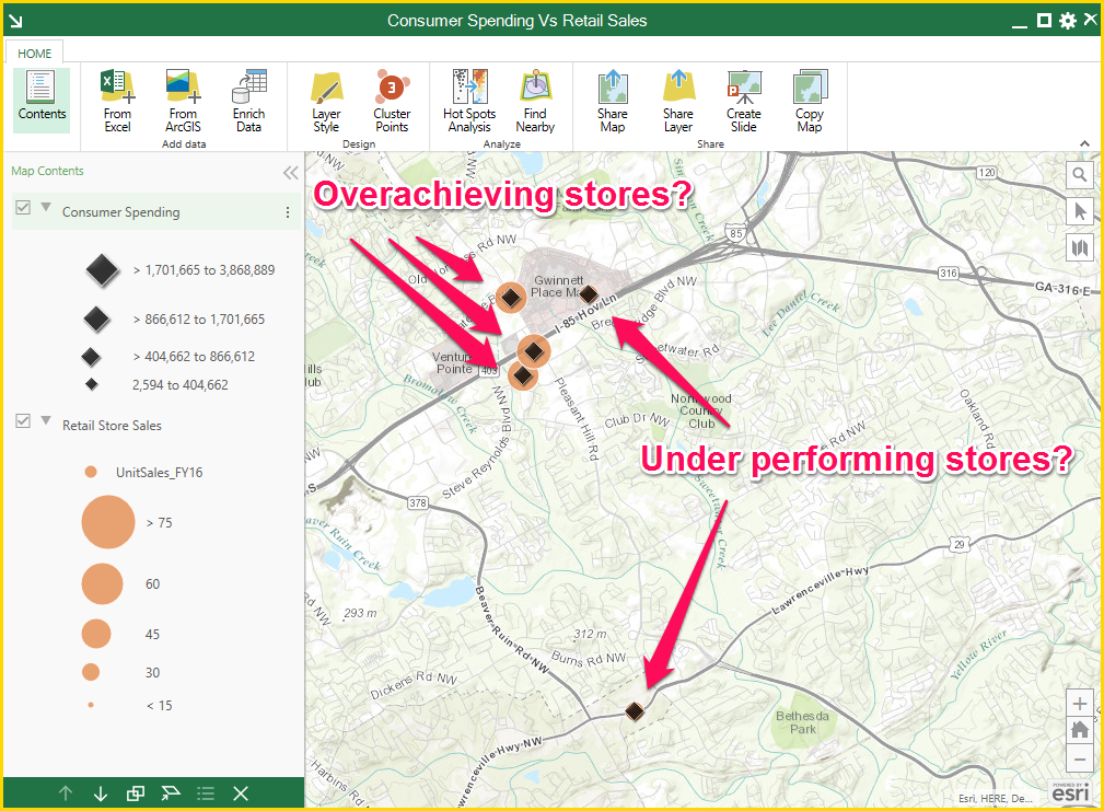
“You’d be surprised how often a product manufacturer discovers that unexpected consumer groups are accounting for more purchases,” says James Hibbard, an expert in location intelligence and GIS manager for MarketSource.
MarketSource, a proven alternative to sales outsourcing, provides comprehensive solutions for the entire sales ecosystem. Hibbard uses data and maps to help MarketSource’s Fortune 500 clients determine who is actually buying at the retail level. One of the tools Hibbard relies on is ArcGIS Maps for Office.
Hibbard explained how some MarketSource clients use ArcGIS Maps for Office.
“They can take an Excel list of retail locations that includes unit sales per location and enrich it with Esri’s demographic and consumer data,” he said. “Then they run correlations and find strong clues about which factors suggest sales success.”
insider