Dr. Aileen Buckley is a cartographer who’s been at Esri since 2003. She finds and shares best practices for mapping and analysis with ArcGIS, which leads her to publish widely and present world-wide.
Dr. Aileen Buckley is a cartographer who’s been at Esri since 2003. She finds and shares best practices for mapping and analysis with ArcGIS, which leads her to publish widely and present world-wide.
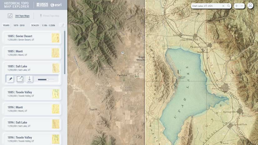
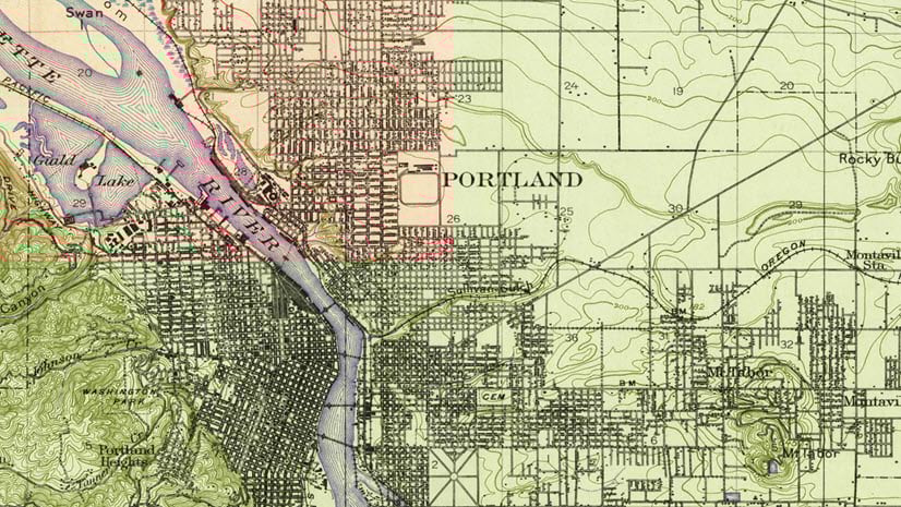
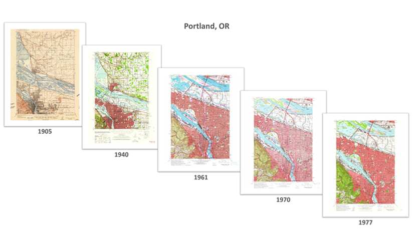
We recently updated our online USGS historical topographic map collection with over 1,745 new maps for a new total of over 181,000 maps.
The Mapmaker's Mantra reminds the mapmaking community of their ethical and moral responsibility to tell the truth with maps.
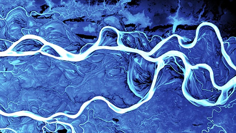
I share information about the Ob River and how I mapped it using the Terrain layer in ArcGIS Living Atlas of the World.
I share information about Mount Taranaki and how I mapped it using the Terrain layer in ArcGIS Living Atlas of the World.
ArcGIS Living Atlas data reveals some of the world’s strange and most wonderful landforms. This blog post series shares some of my favorites.
Use the updated USGS Historical Topographic Map Explorer to create web maps you can digitize from in ArcGIS Pro.
Esri collaborated with the US Geological Survey to update the USGS historical topographic map collection and the Topo Explorer app.
By Aileen Buckley, PhD, Esri Research Cartographer Are you trying to get up to speed with temporal data in ArcGIS? In this set of less...
By Aileen Buckley, Research Cartographer Quite some time ago, I wrote a blog post about the zoom levels used for web maps. Since these...