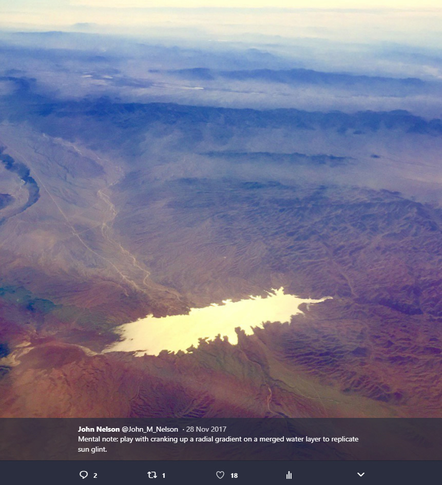
While engaging in the miracle of human flight I like to look down at the wrinkled surface of our earth. And if the sun angle is just right, given the direction I’m facing, a radial sun glint chases me, shimmering on and off bodies of water below, tracking with my gaze.
I got to thinking that I should try to do something similar with a map, but rather than the subdued cartographic water gradients that I was used to seeing, I’d try to ratchet up the gradient to something like real life, which, like lots of things in real life, is actually pretty extreme. Also, in the examples I’d seen, the gradient was typically applied to each water body independently, resulting in a series of radial gradient lakes. I wanted the radial gradient to fill them as though they were a single surface, to help reinforce the singular curved face of planet.
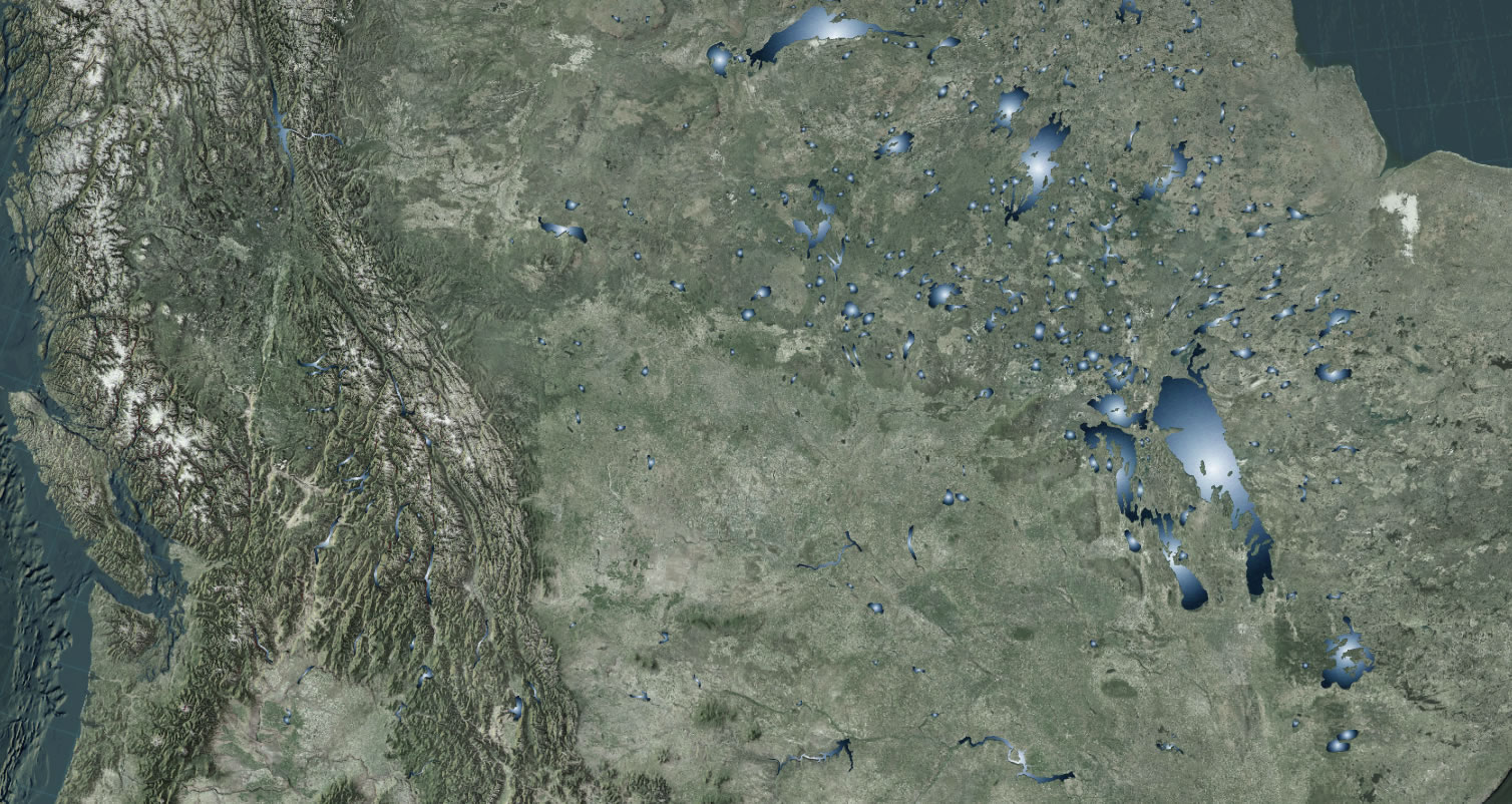
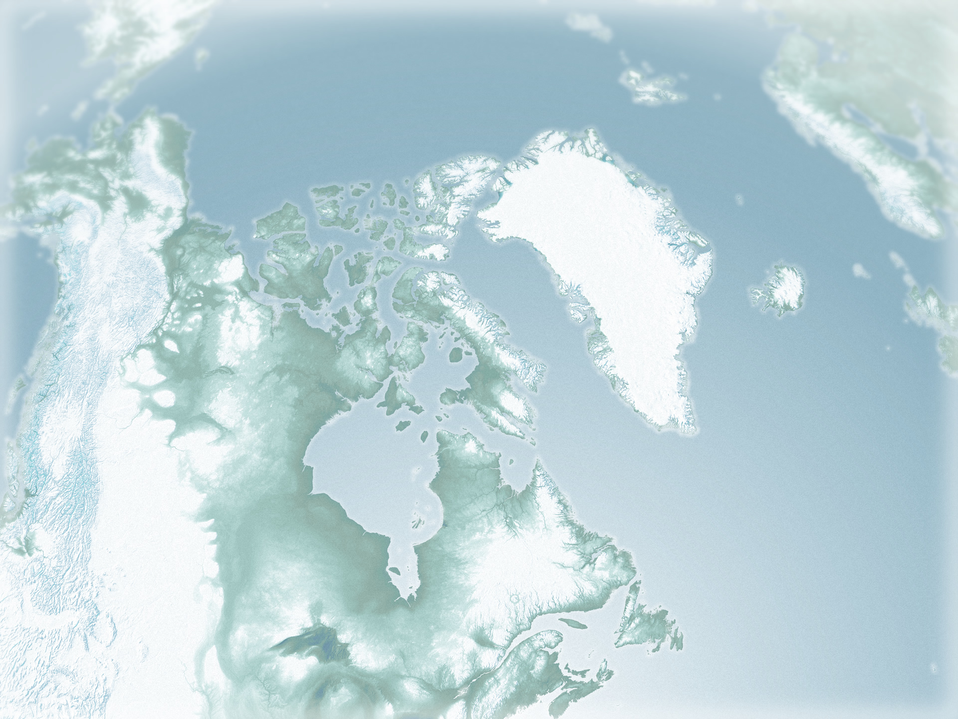
Here is a look at northern Canada, home to thousands of lakes. You can almost hear the mosquitoes from here. A handy test bed:
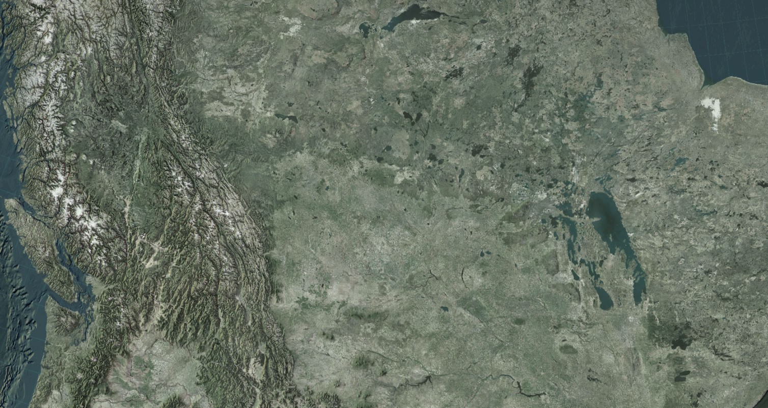
Here is a lakes layer from Natural Earth, with a solid dark blue fill:
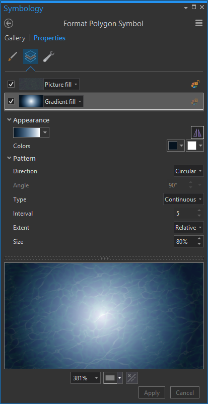
Next, I changed the lake polygon fill from solid to a radial gradient of white to dark-water blue. Play with the Pattern settings until you get a radial effect that works for you. I also added a water ripple texture (steal it here) because I just can’t help myself from doing stuff like that. I have to admit, I caught myself just staring into the abyss of this fill symbology.
The result, however, is super nasty:
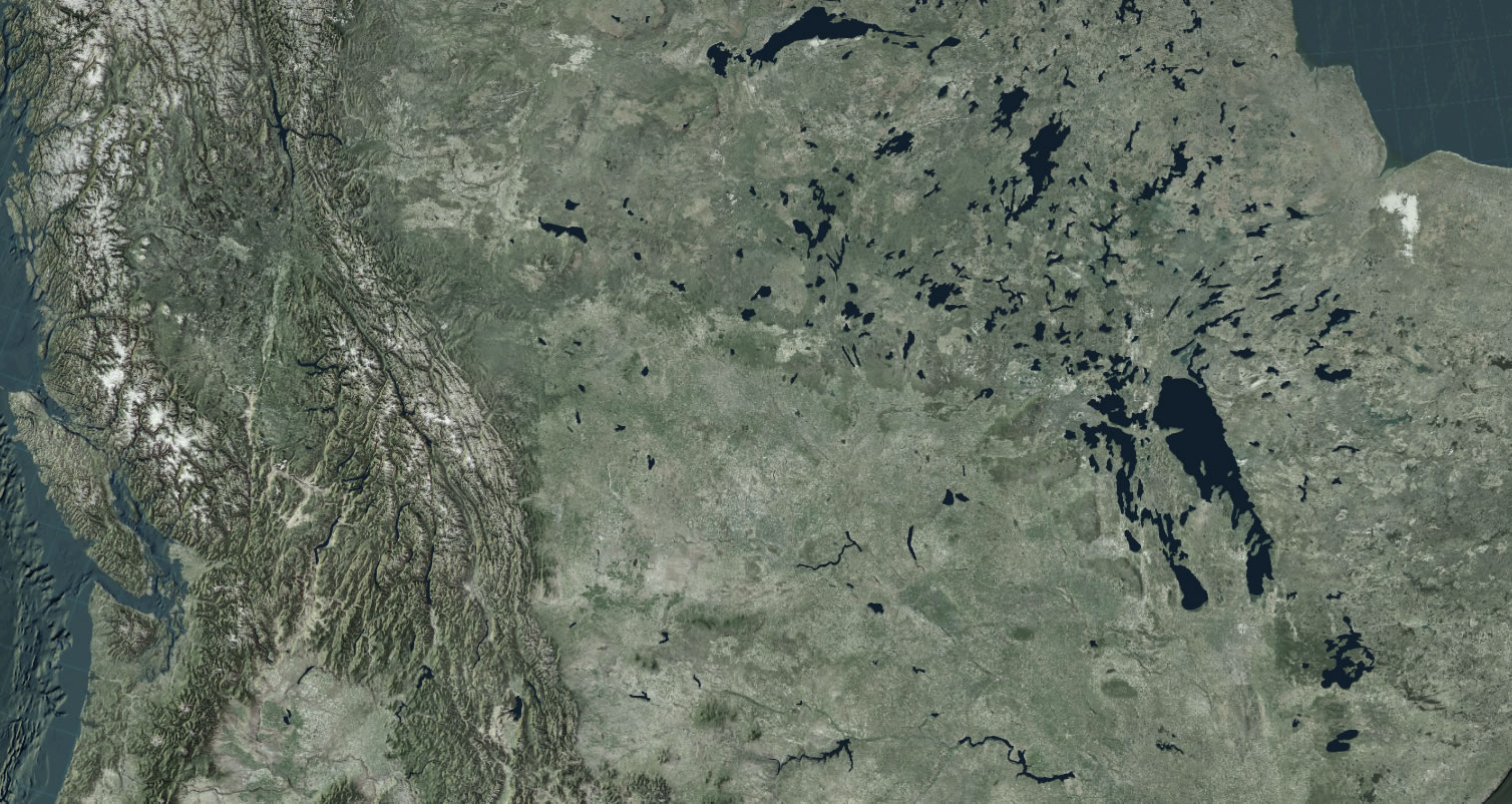
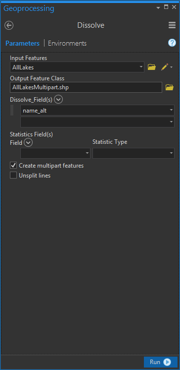
But even the supernastiest symbology shows promise. What I needed to do was to unify all of these individual singlepart features into a single multipart feature. That way, a single radial gradient will span across all of the lakes, just like in real life.
I dissolved all of the features in my view into one multipart feature using the Dissolve tool. The dissolve tool is an old friend of the GIS folk, one of the very first tools taught to new map makers. I dissolved the lakes by an attribute that was the same for all features (if you don’t have an attribute that all of your features share, you can just make a new field and fill it with a default of 0).
It’s amazing the difference this makes:
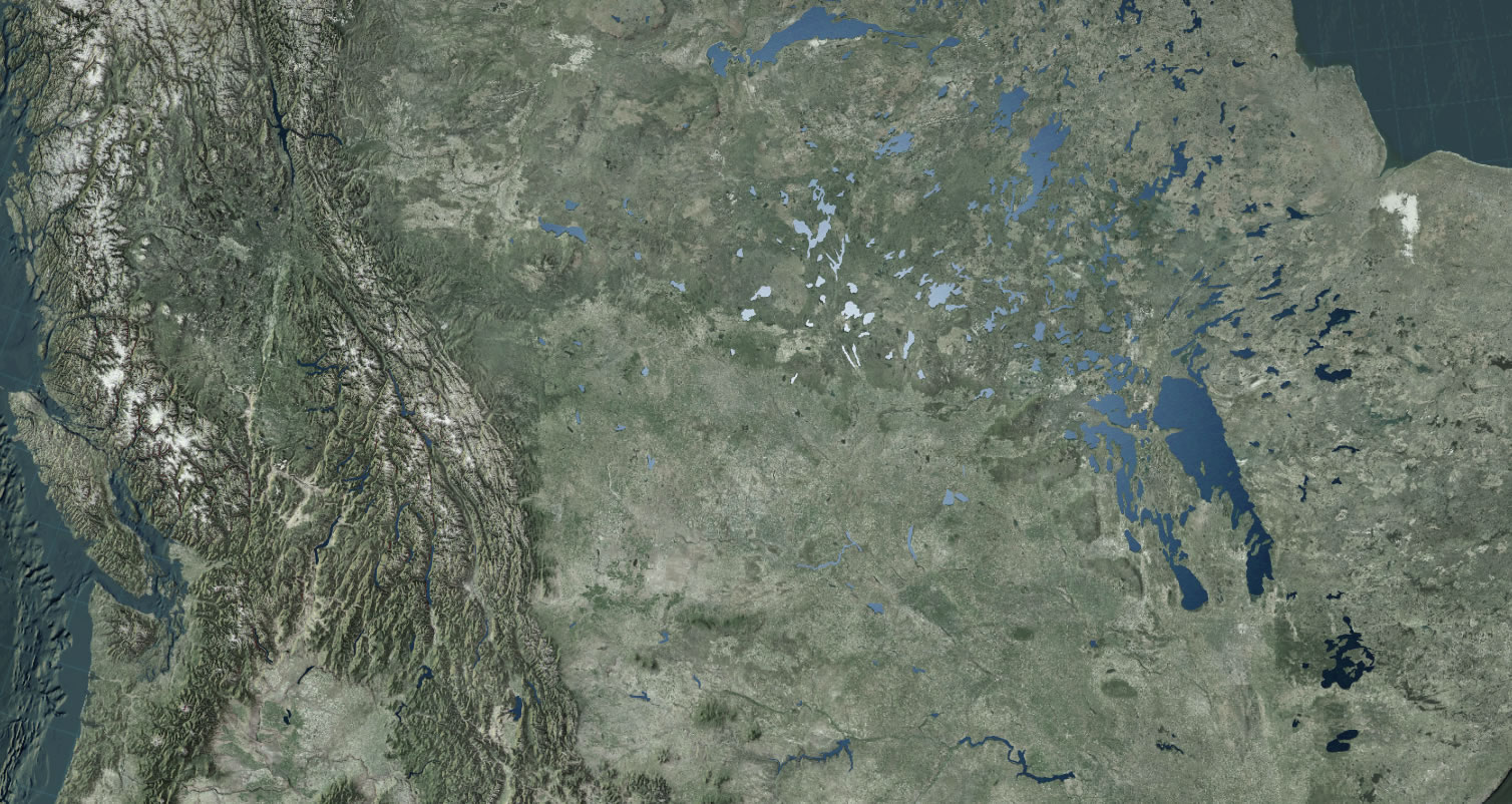
Hey now, that looks kinda-pseudo-plausibly-realistic! And that’s all there is to it…pretty much. If you want to crank this up to eleven, then you’ll have to add a sunglint image in your ArcGIS Pro layout. Just like in real life, there is often a sharp flare of light right where the nadir of the rays bounce directly up into your airborne pupils.
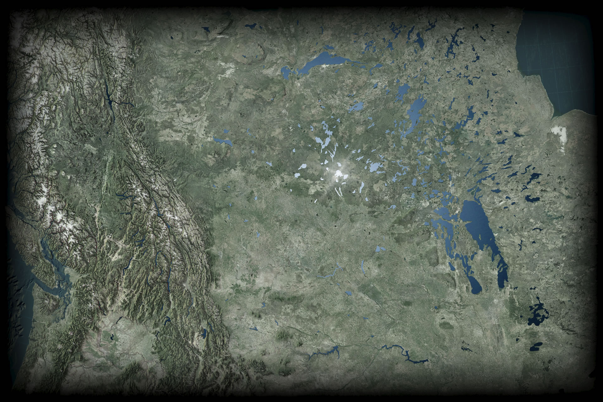
And I wrapped the layout in a vignette image, as is my way.
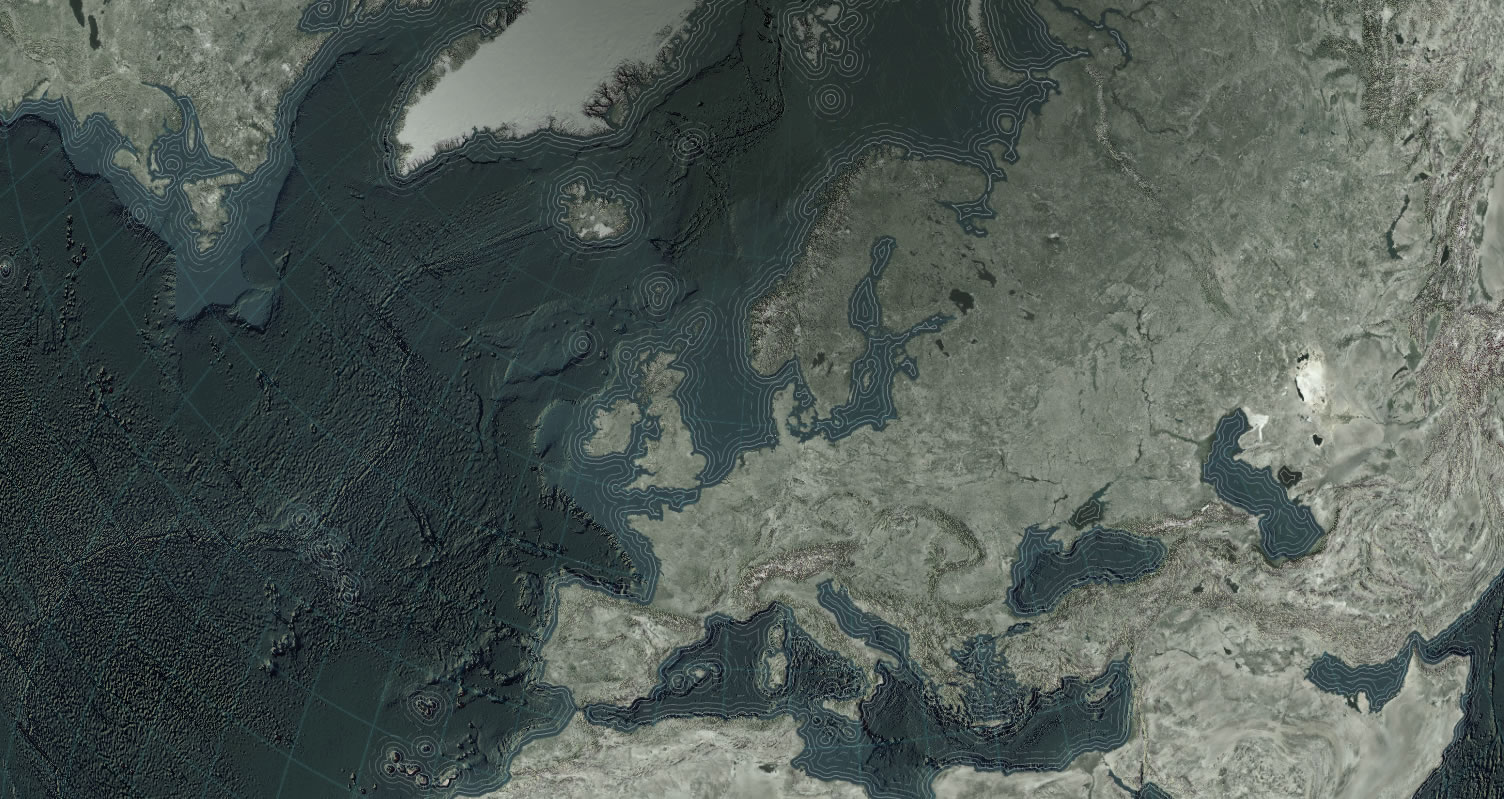
Sure this works for swiss-cheese lakes. But can it work for something as big and unified as the oceans? Sure! Here is a look at the polar sea, in the Firefly basemap with a bumpified surface and some intriguingly-spaced waterlines. Meh.
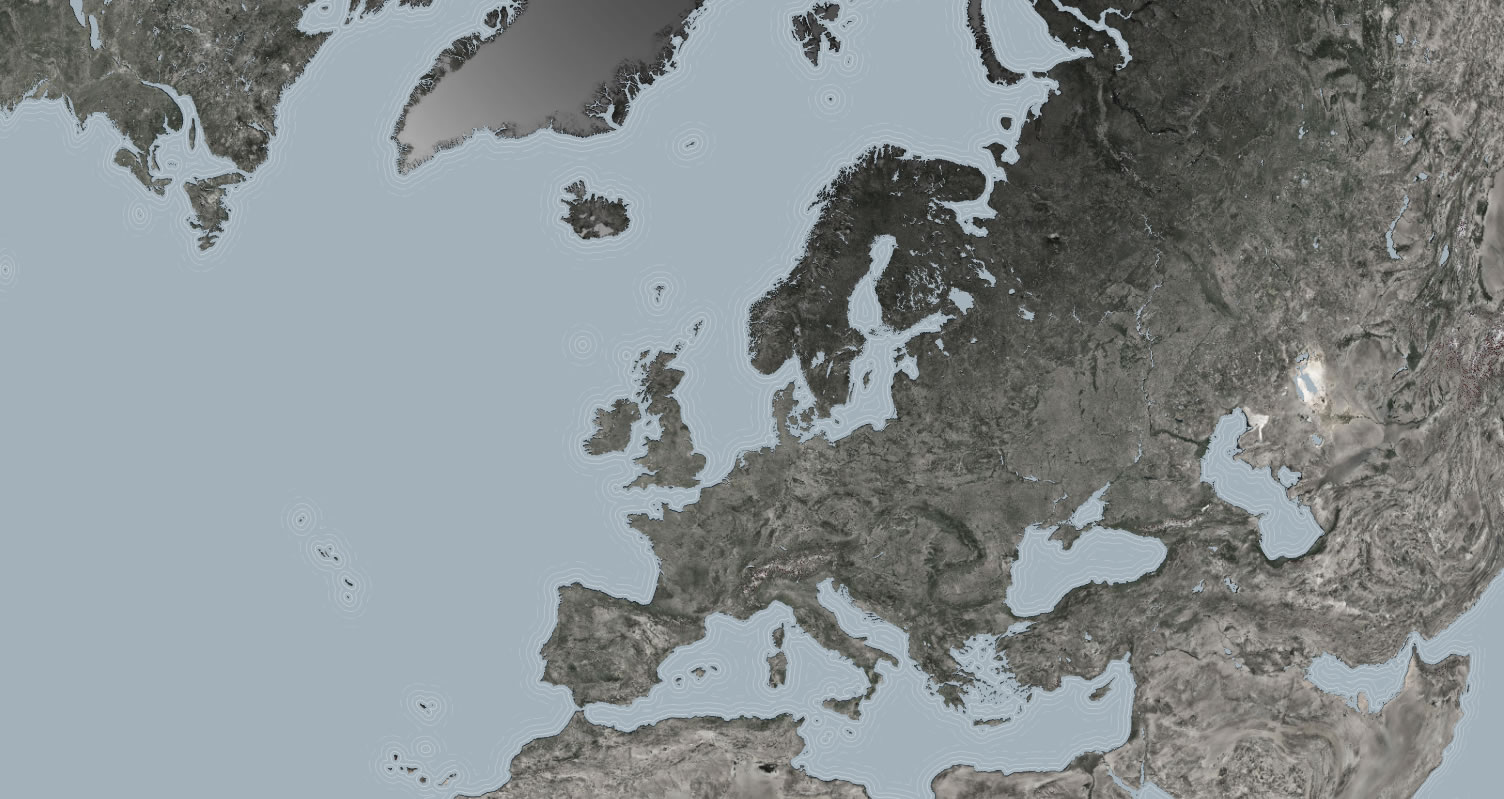
Here it is with a single-featured layer of oceans. Pretty nice. Sort of flat, though.
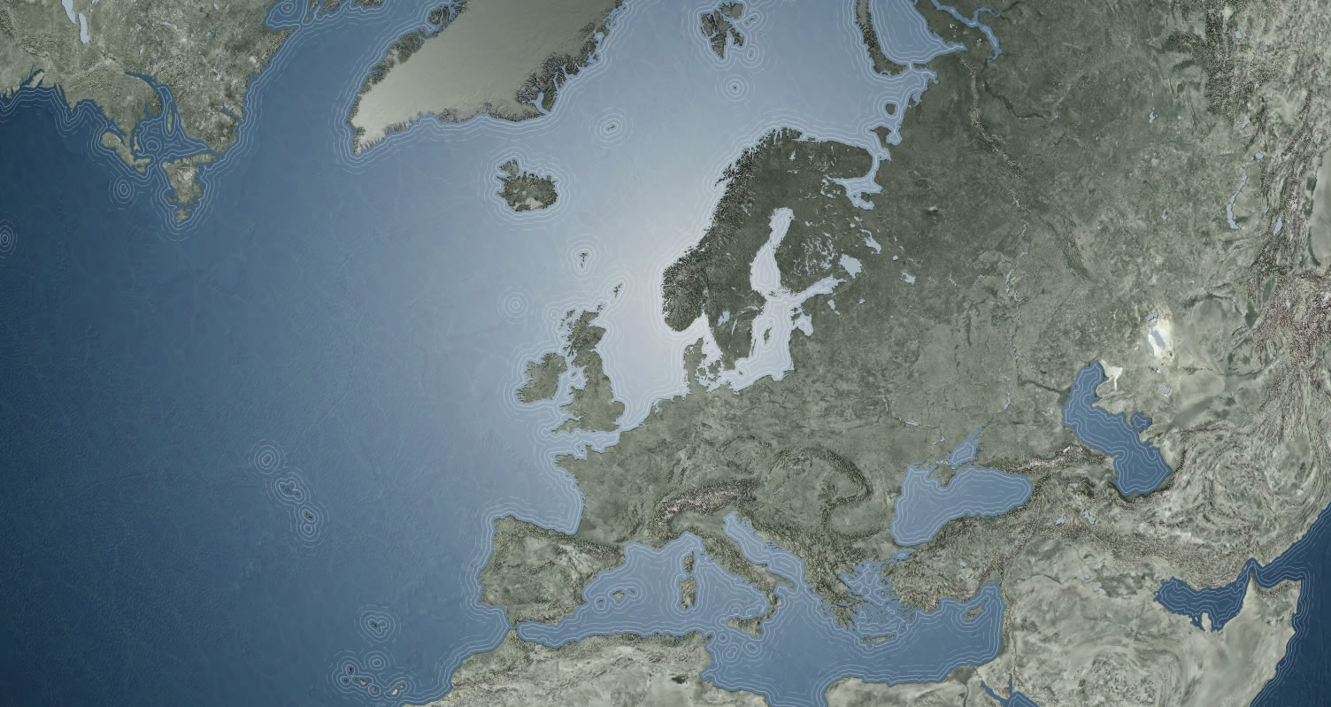
Here it is with a radial fill. Heyyyyy…
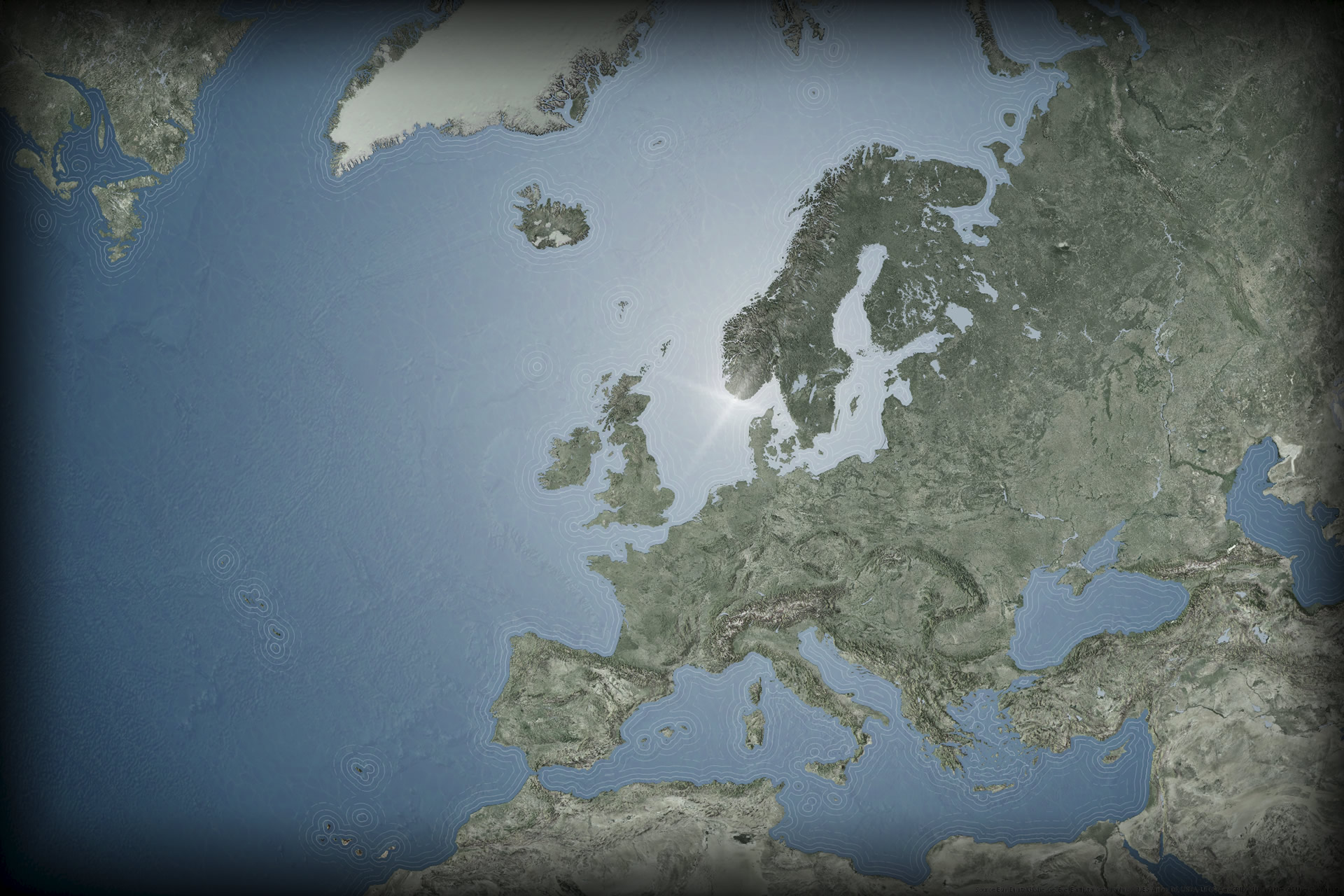
And of course here it is nignette-ified with a sun glint right at the center of the gradient.
Just because you are giving your water a fun realism-inspired radial fill, does that mean the map itself has to try to look real? No way. Whatever works for you map works for your map. This effect just helps tease at a roundness of the map. You can have something totally symbolic and still give the radial fill a shot. The important thing is to ask new questions and try new things and ask new questions based on the new things you tried. That way you build up a toolkit of options when you build any map. And it’s nice to have options.
Happy sun glint mapping! John


Commenting is not enabled for this article.