Hunting down good data used to involve a lot of work just to get a GIS project started. These days, using ready-made basemaps and authenticated data from ArcGIS Online, GIS analysts are able to spend more time thinking analytically, which really gets to the heart of what makes global GIS work.
So what kind of data is available in ArcGIS Online?
Imagery
Imagery layers enable you to view recent, high-resolution imagery for most of the world; multispectral imagery of the planet updated daily; and near real-time imagery for parts of the world affected by major events, such as natural disasters.
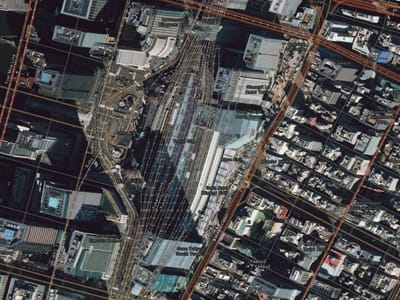 Tokyo Station is in the center of the Japanese capital. This imagery layer is useful, and its metadata (resolution, age, and source) is but a click away.
Boundaries and Places
Many places are logically defined by a boundary. These map layers describe areas at many levels of geography, including countries, administrative areas, postal codes, census boundaries, and more.
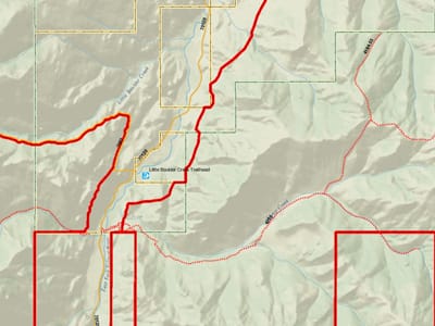 Boundaries and Places are the bread and butter of vector GIS. Basically anything that can be depicted as point, line, or polygon features is found here. This web app features hiking trails in Idaho, a line feature.
Demographics and Lifestyles
Demographics and lifestyles maps—of the United States and more than 120 other countries—include recent information about total population, family size, household income, spending, and much more.
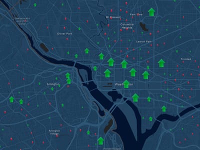 This story map is a gateway to daytime population data for the entire United States.
Basemaps
Basemaps provide reference maps of the world and the context for your work. Built from the best available data from the GIS community of reliable data providers, these maps are presented in multiple cartographic styles provide the foundation for GIS apps.
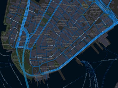 This basemap provides a detailed representation of the world symbolized with a custom street map style that is designed for use at night or in other low-light environments. (Lower Manhattan is shown here.)
Transportation
These are the maps and layers that describe the systems that people use to move between places. They include a variety of global, national, and local maps on various topics from infrastructure projects to rest areas. Some of these layers are dynamic, such as the live World Traffic map, which is updated every few minutes with data on traffic incidents and congestion.
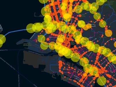 In places where high automobile and truck traffic exist, daily traffic counts reveal highly impacted patterns. (Los Angeles is shown here.)
Earth Observations
These maps and layers are collected from sensors on the ground and in space. They describe our planet’s current conditions, from earthquakes and fires to severe weather and hurricanes.
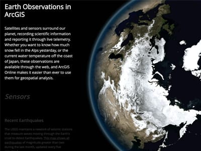 Whether you want to know how much snow fell in the Alps yesterday, or the current water temperature off the coast of Japan, these observations are available through ArcGIS.
Urban Systems
These layers depict data about human activity in the built world and its economic activities and include such things as utility infrastructures, parcel boundaries, 3D cityscapes, housing, and employment statistics.
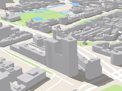 3D buildings, often in high detail, are being integrated into the Living Atlas. This is a scene of Rotterdam, the Netherlands.
Historical Maps
This collection includes scanned raster maps and dynamic image layers. These layers can be viewed individually as a basemap or displayed against a current basemap for comparison purposes.
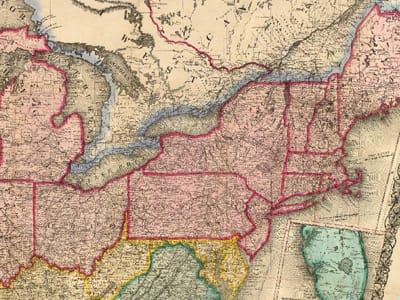 The David Rumsey Map Collection in ArcGIS Online features some of the most popular maps from the complete historical map collection, which focuses on rare 18th- and 19th-century North American and South American maps.
—–
This post is excerpted from The ArcGIS Book, Second Edition: 10 Big Ideas about Applying The Science of Where, by Christian Harder and Clint Brown. The twin goals of this book are to open your eyes to what is now possible with Web GIS, and then spur you into action by putting the technology and deep data resources in your hands. The book is available through Amazon.com and other booksellers, and is also available at TheArcGISBook.com for free.

Commenting is not enabled for this article.