ArcGIS Online and ArcGIS Living Atlas of the World Provide Rich Geospatial Content
ArcGIS Online is rapidly emerging as the platform of choice for the creation and dissemination of authoritative geographic data content. ArcGIS Living Atlas of the World is a highly active network of contributors and curators whose output is accessed billions of times weekly.
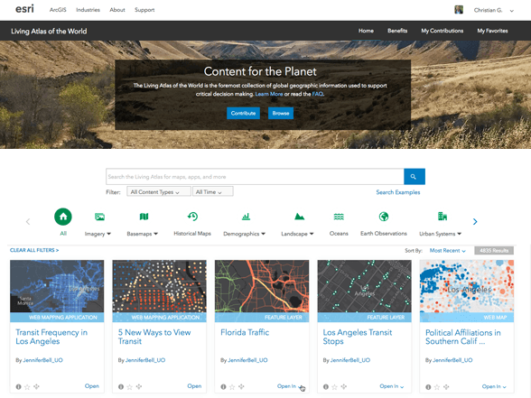 ArcGIS Living Atlas of the World includes beautiful and authoritative maps on thousands of topics. Explore maps and data from Esri and other organizations and combine them with your own data to create new maps and apps.
Living Atlas is a treasure trove of information, a dynamic collection of thousands of maps, datasets, images, tools, and apps produced by ArcGIS users worldwide (in conjunction with data curation and creation by Esri and its partners). It is the foremost and largest collection of global geographic information used to support critical decision-making. Think of it as a thematically organized, curated subset of the best available ArcGIS Online content, created and maintained by the GIS community. This deep and definitive catalog of information awaits your exploration and discovery. And that’s the big idea of this chapter, that you can combine content from this repository with your own data to create powerful new maps and apps. And it’s a two-way street: you can use the Contributor tools to add your own data to Living Atlas.
Living Atlas represents the collective work of the global mapping community—the people who use the ArcGIS platform as the system of record for their work. As such, it is fast emerging as the most extensive and authoritative source of geographic information on the planet.
Hunting down good data used to involve a lot of work just to get a GIS project started. These days, using ready-made basemaps and authenticated data from ArcGIS Online, GIS analysts are able to spend more time thinking analytically, which really gets to the heart of what makes global GIS work.
The GIS Data Community: A Global Network for Creating and Sharing
All GIS organizations have a core mission, a reason to exist, in support of their mandate and area of focus. As part of this work, these organizations are committed to building key authoritative data layers to support their core mission. This work includes the compilation of foundational data layers as well as standard basemap layers and operational data for their geographies and applications.
For such organizations—and they are innumerable in local, regional, state, and national levels around the globe—this information serves as the basis for all their comprehensive GIS applications. In the early days of GIS, the creation of these data layers from scratch was, in fact, job number one for these GIS organizations.
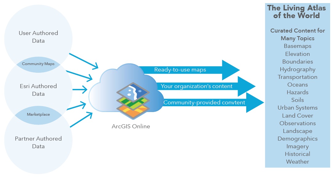 ArcGIS Living Atlas of the World is a curated section of the larger ArcGIS Online data ecosystem, which includes user-, Esri-, and partner-authored data.
Foundation Building
As accurate new authoritative geospatial data is developed, GIS users have been able to leverage their information resources in all kinds of GIS applications by extending their own work and helping their constituents.
The result is that all these different agencies have created data that is considered the official system of record maintained to support their mandated domain. The pace of migrating this data into Web GIS is increasing exponentially, and we now see many contributions coming online that fill in gaps for the entire world. The result is a continuous coverage of geographic information worldwide—the GIS of the world.
What can you do to get started?
Browse ArcGIS Living Atlas of the World
 ArcGIS Living Atlas of the World includes beautiful and authoritative maps and layers on hundreds of topics. These maps are shared by Esri, our partners, and members of the ArcGIS user community. Living Atlas is curated so you, and others, can count on finding high-quality information for your ArcGIS apps.
Contribute to Living Atlas
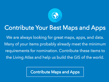 You can help enrich the Living Atlas by sharing your maps and apps. To share your content items with the ArcGIS community, simply nominate your publicly shared ArcGIS Online maps and apps for review by our curators.
Unlock Earth’s Secrets with Landsat Imagery
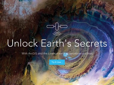
Landsat sees Earth in a unique way. It takes images of every location in the world to reveal hidden patterns in everything from volcanic activity to urban sprawl.
Explore Community Maps
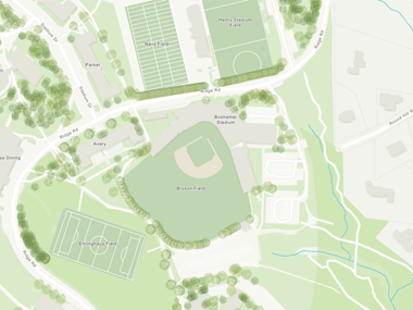 Large-scale map layers add context and increased usability to basemaps. This story map details these map layers, features, and select contributor sites and provides examples of applied use.
Living Atlas Community Webinar
 Watch a 1-hour webinar about using and contributing to ArcGIS Living Atlas of the World.
Learn ArcGIS Lesson: Conduct a Demographic Analysis Using ArcGIS Demographic Data
You are the marketing manager for a chain of high-end beauty salons in the Ottawa, Canada, area. The owners recently opened a new location, and revenue isn’t yet matching expectations—you need to create a new, loyal customer base! At a recent Women’s Show convention, you held a drawing at your booth and collected a large amount of new contact information. You want to streamline this list to identify people who might realistically become new clients at the new salon, and send them a special promotional package to entice them to book an appointment.
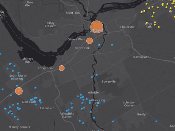 To do this, you’ll use ArcGIS Maps for Office to visualize salon locations on a map in Microsoft Excel. You’ll also add the locations of the new, potential customers and enrich the customer data with demographic information to ensure that you’re pursuing more affluent customers. You’ll analyze the data to determine which potential customers are within a reasonable driving distance from the new salon. Then you’ll filter the analysis results to select only those particular customers so you can create a customized mailing list for your promotional package. Finally, you’ll add a dynamic map slide to a Microsoft PowerPoint presentation to show your findings to your boss.
—–
This post is excerpted from The ArcGIS Book, Second Edition: 10 Big Ideas about Applying The Science of Where, by Christian Harder and Clint Brown. The twin goals of this book are to open your eyes to what is now possible with Web GIS, and then spur you into action by putting the technology and deep data resources in your hands. The book is available through Amazon.com and other booksellers, and is also available at TheArcGISBook.com for free.
Commenting is not enabled for this article.