ArcGIS Enterprise 10.6 was released yesterday, January 17! Alongside many other enhancements, this release brings new features and functionality to the product to expand your analytical workflows.
In today’s blog, we’ll focus on five new analytical features now available in ArcGIS Enterprise: custom web tools, clustering, hosted feature layer views, tools for distributed analytics, and new scene viewer styles. (Also, be sure to visit yesterday’s blog for highlights on what else is new in 10.6.)
Share custom analytics with your organization
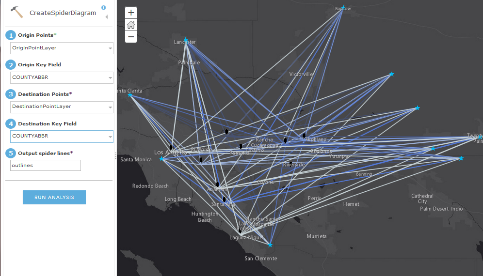
You can now share custom web tools directly from ArcGIS Pro to your ArcGIS Enterprise portal.
Web tools are an update to the traditional way of publishing geoprocessing services; unlike traditional geoprocessing services, web tools can be accessed from the portal’s standard analysis tools.
This makes custom analytics easier to access by everyone in your organization. In line with this new capability, a new privilege has been introduced with 10.6 to allow publishing of web tools – meaning an administrator role is no longer needed!
Here’s an example of a custom web tool published from ArcGIS Pro that can now be shared and run through the ArcGIS Enterprise portal’s Map Viewer:
Learn more: Explore custom web tools
Declutter your web maps with point clustering
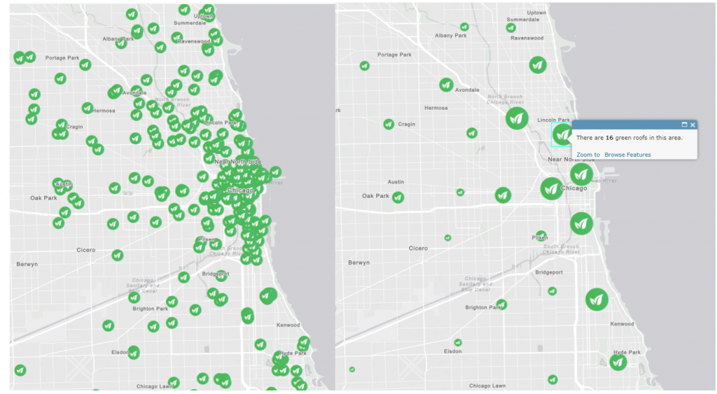
The extremely popular clustering smart mapping style is now available within ArcGIS Enterprise. This renderer automatically clusters data points that have a close geographic proximity to one another. Clustering helps you create beautiful maps that display general trends when zoomed out and exact data points when zoomed in.
Here’s an example of green roofs in the city of Chicago. Unclustered point data is side-by-side clustered data. You can see how, at a glance, the information is easy to digest when in a clustered format. (We’ve also configured popups using an Arcade expression to tell us how many green roofs there are in a cluster!)
Learn more: Discover more about point clustering
Hosted feature layer views
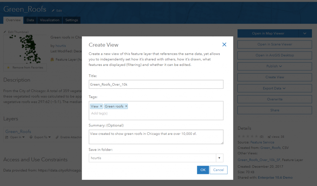
Hosted feature layer views are now available in ArcGIS Enterprise. By creating a view of your feature data, you can choose which groups it is shared to and apply different editing settings and other privileges. You can also configure feature or field definitions to control what information is exposed through the view.
To begin configuring a view, navigate to ‘View’ on the source layer and set a title and tags. A new hosted feature layer (view) will be created, where you can then set your custom settings for that view:
New distributed analytics tools
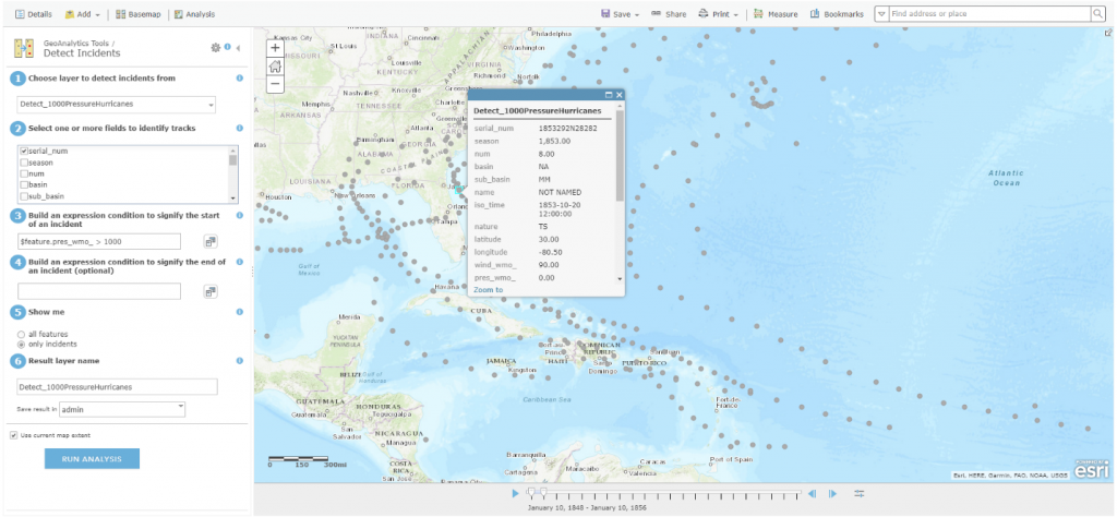
New tools are available within the distributed analytics capabilities of ArcGIS Enterprise. GeoAnalytics Server includes three new tools: Detect Incidents, Geocode Locations from Table, and Calculate Field. Raster analytics includes six new hydrology functions to help model the flow of water across a surface, and four new tools to analyze distance and proximity.
Here, using GeoAnalytics, we’re running the new Detect Incidents tool to identify hurricanes that have a pressure over 1,000 mbar. Since we selected ‘only incidents,’ we’ll only see hurricanes that meet that condition. This isolates certain data so we can visualize it better and…detect notable incidents!
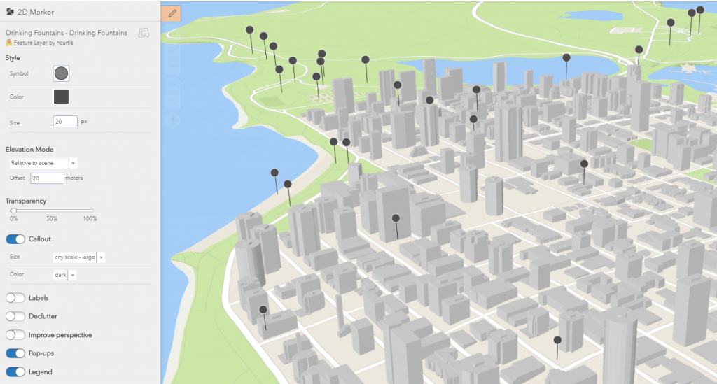
Scene viewer styles
New point styles are available in the Enterprise scene viewer to visualize point data more effectively. The Relative-to-Scene elevation mode, Callouts, Improve Perspective and Set Declutter options all help you tell your 3D story more easily. Here’s an example of a Vancouver scene, where we’ve toggled callouts on. Our point data now includes vertical callout lines, elevating the points so that they are more visible:
We hope you are excited about these new features and can begin utilizing them in 10.6! For more on what’s new in ArcGIS Enterprise 10.6, visit what’s new in our documentation.

Commenting is not enabled for this article.