During the December 2017 ArcGIS Solutions Release 30 new Solution Products were added to ArcGIS, 27 Solution Products were updated and 12 Solution Products changed lifecycle phase.
ArcGIS Solutions are industry-specific app and capability configurations and are available to ArcGIS users at no additional cost.
New Solution Products
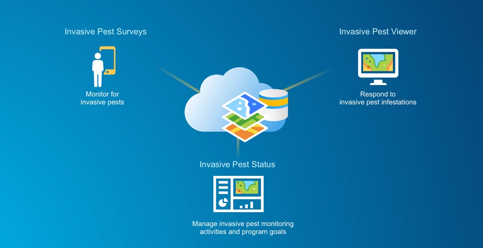
Agriculture collection with 3 new configurations:
- Invasive Pest Surveys enables organizations to monitor locations for invasive agricultural pests
- Invasive Pest Status manages invasive pest monitoring activities and progress towards program goals
- Invasive Pest Viewer helps organizations understand and respond to invasive pest infestations
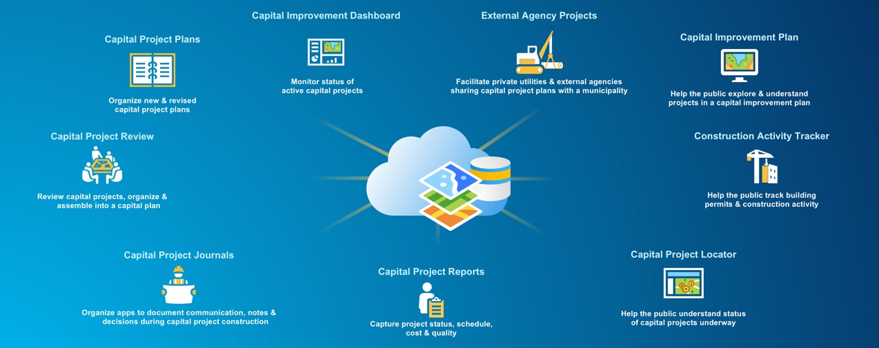
Capital Improvement Configurations collection with 9 new configurations:
- Capital Improvement Plan helps the public explore and understand projects included in a capital improvement plan
- Capital Project Dashboard assists public works executives to monitor status of active capital projects
- Capital Project Journals organizes a collection of apps to document communication, notes, and decisions during construction of capital projects
- Capital Project Locator informs the public about the status of capital projects underway
- Capital Project Plans organizes new and revised capital project plans during the planning process
- Capital Project Reports captures the status of project schedule, cost and quality
- Capital Project Review helps staff review individual capital projects, organize capital project portfolios and assemble a capital improvement plan
- Construction Activity Tracker informs the public about building permits and construction activity
- External Agency Projects facilitates private utilities and other external agencies sharing capital project plans with a municipality
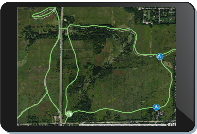
Cycling Infrastructure Inventory enables public works field staff to inventory bikeways, bike parking and bike share locations
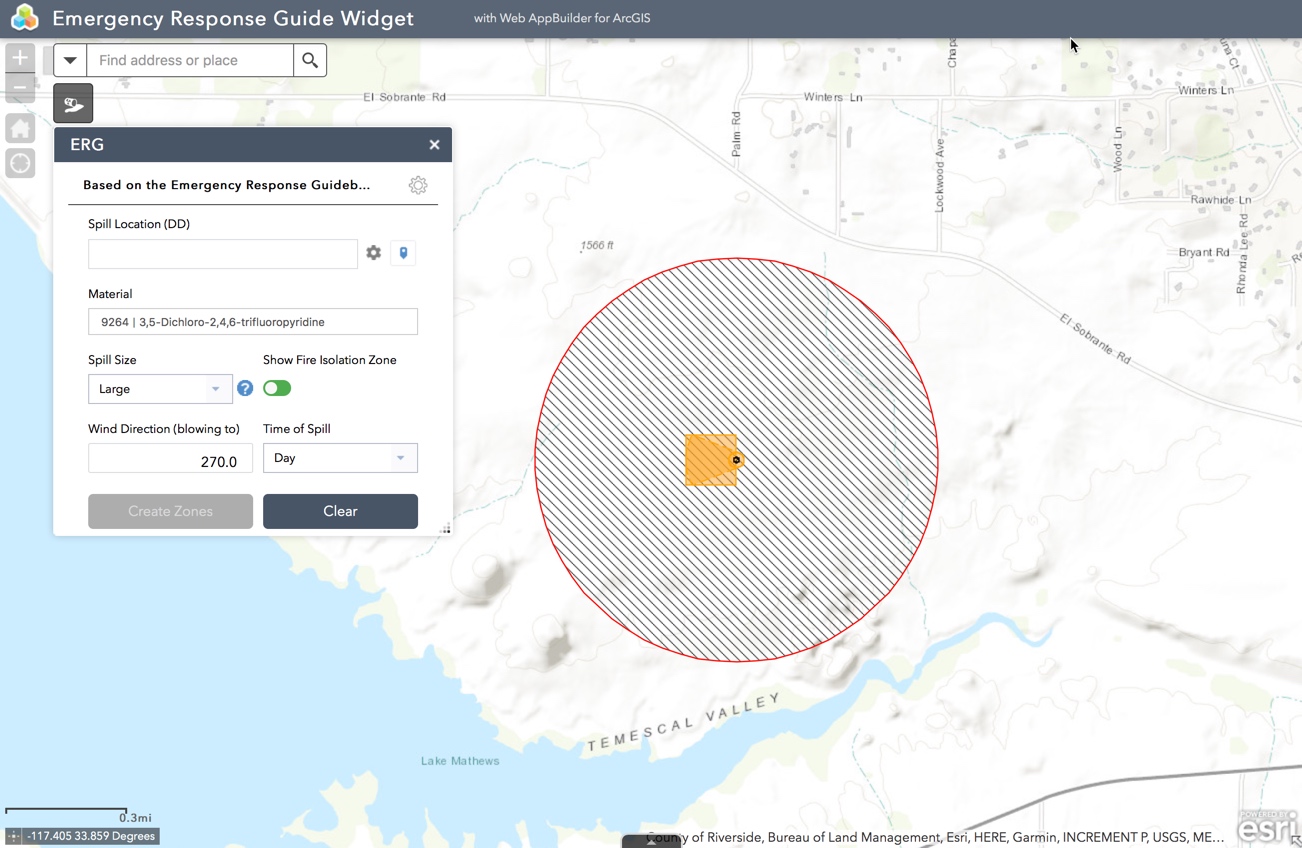
Emergency Response Guide (ERG) Widget assesses potential hazards from spills, finds materials and responses from the 2016 Emergency Response Guidebook, and generates Initial Isolation and Protective Action Zones
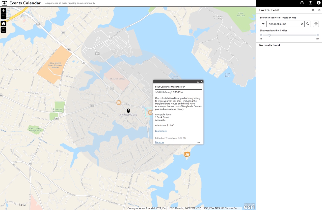
Events Calendar enables the public to discover festivals, shows, concerts and other events
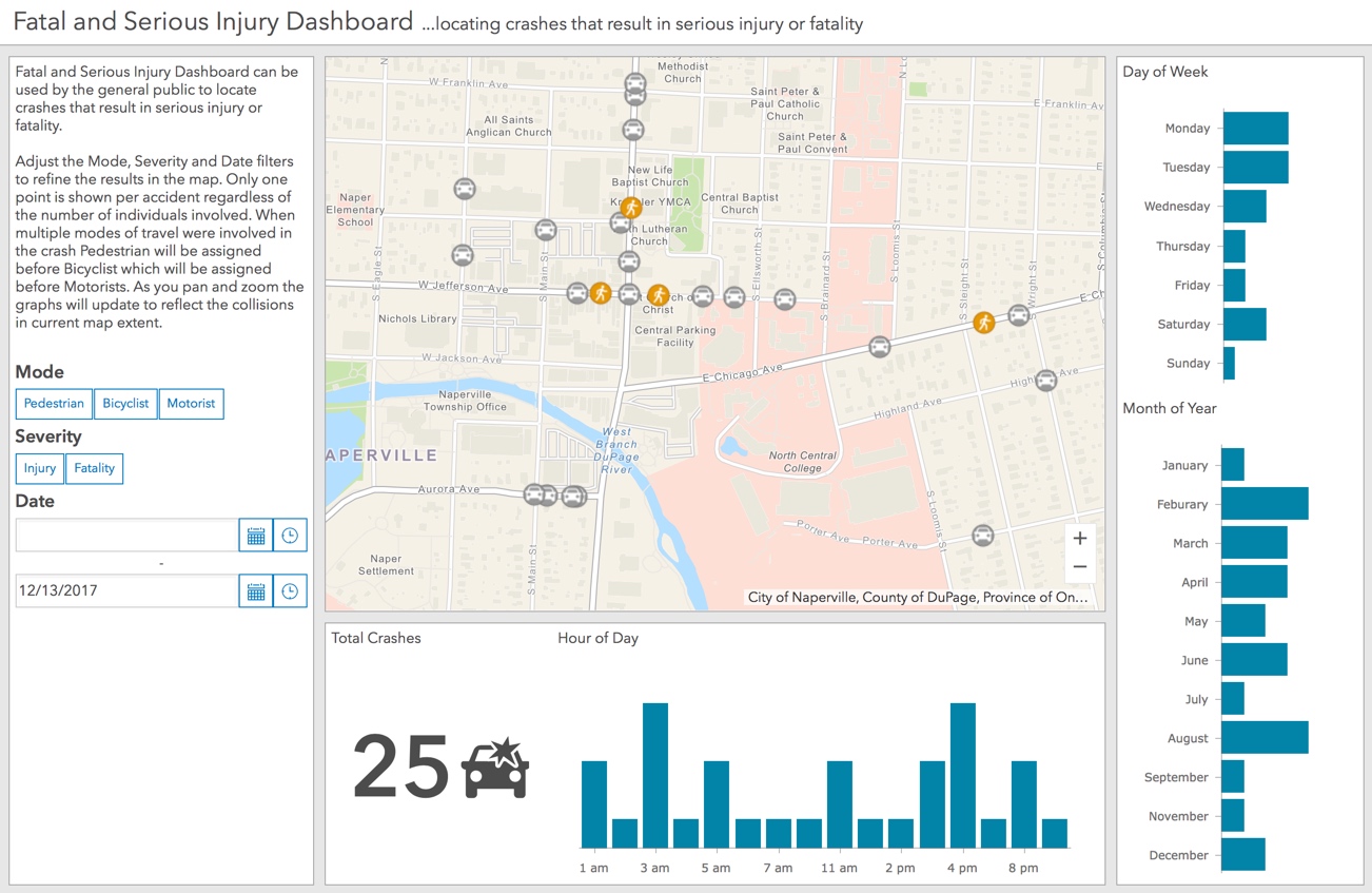
Fatal and Serious Injury Dashboard enables the public to better understand fatal and serious crash locations
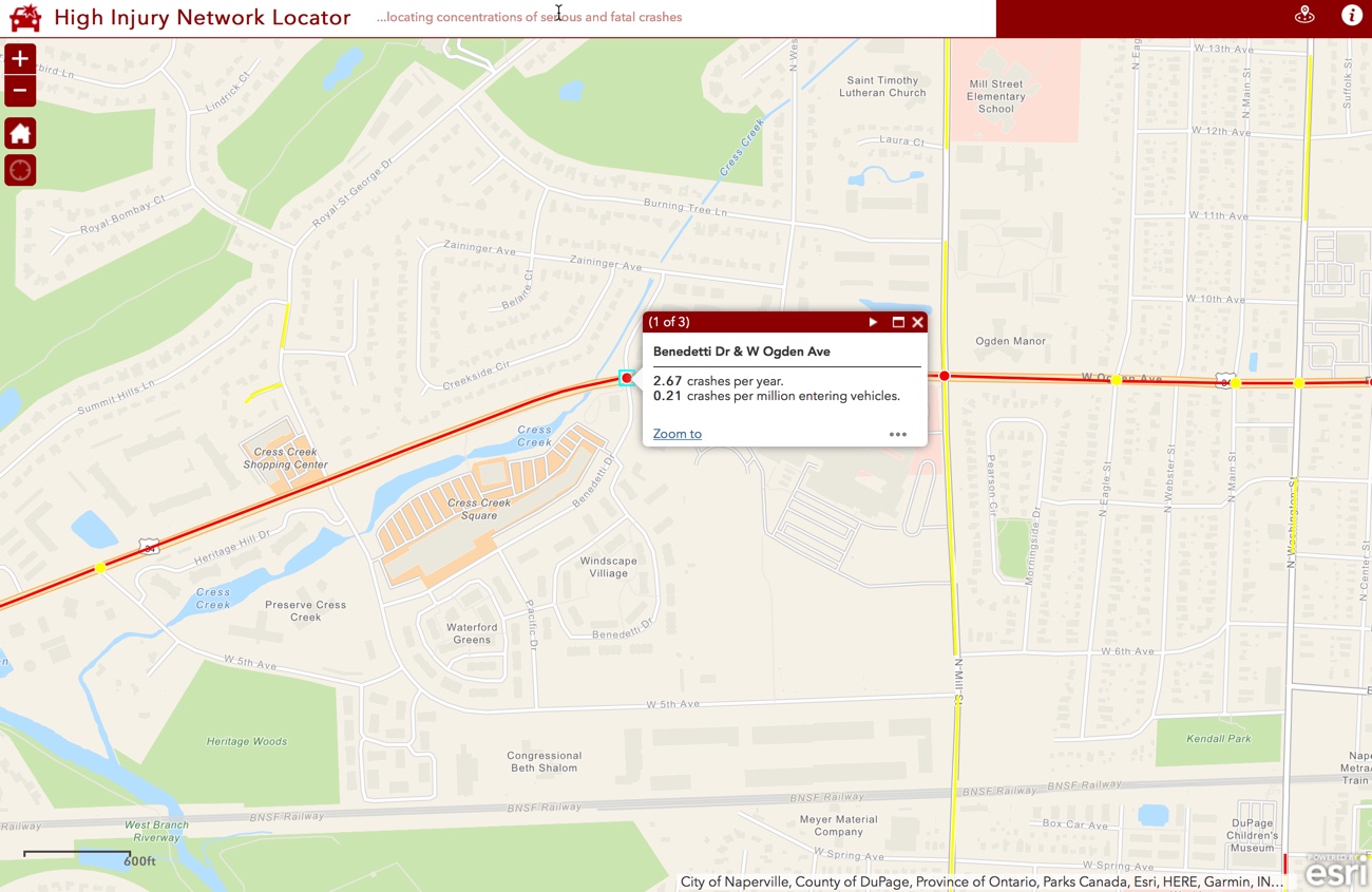
High Injury Network Locator informs the public about streets and intersections with concentrations of serious and fatal crashes
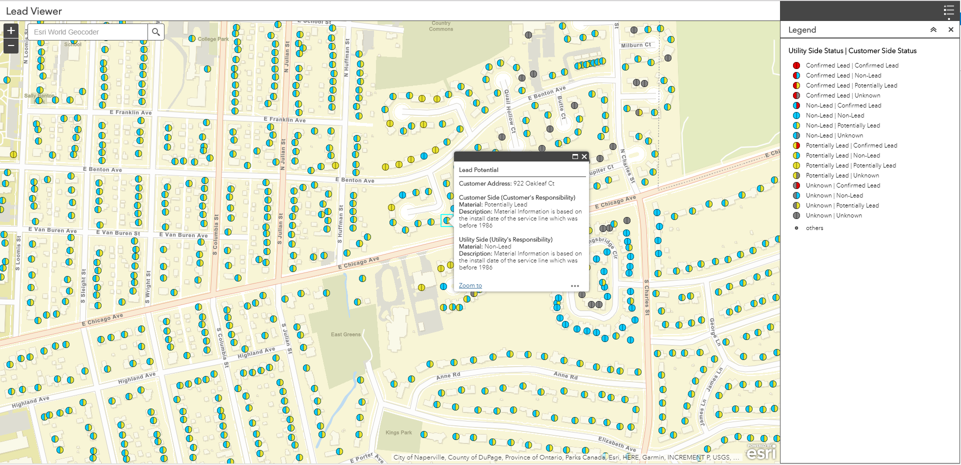
Lead Service Management communicates the location of potential and known lead water services in a water distribution network and helps water utilities manage information about service materials
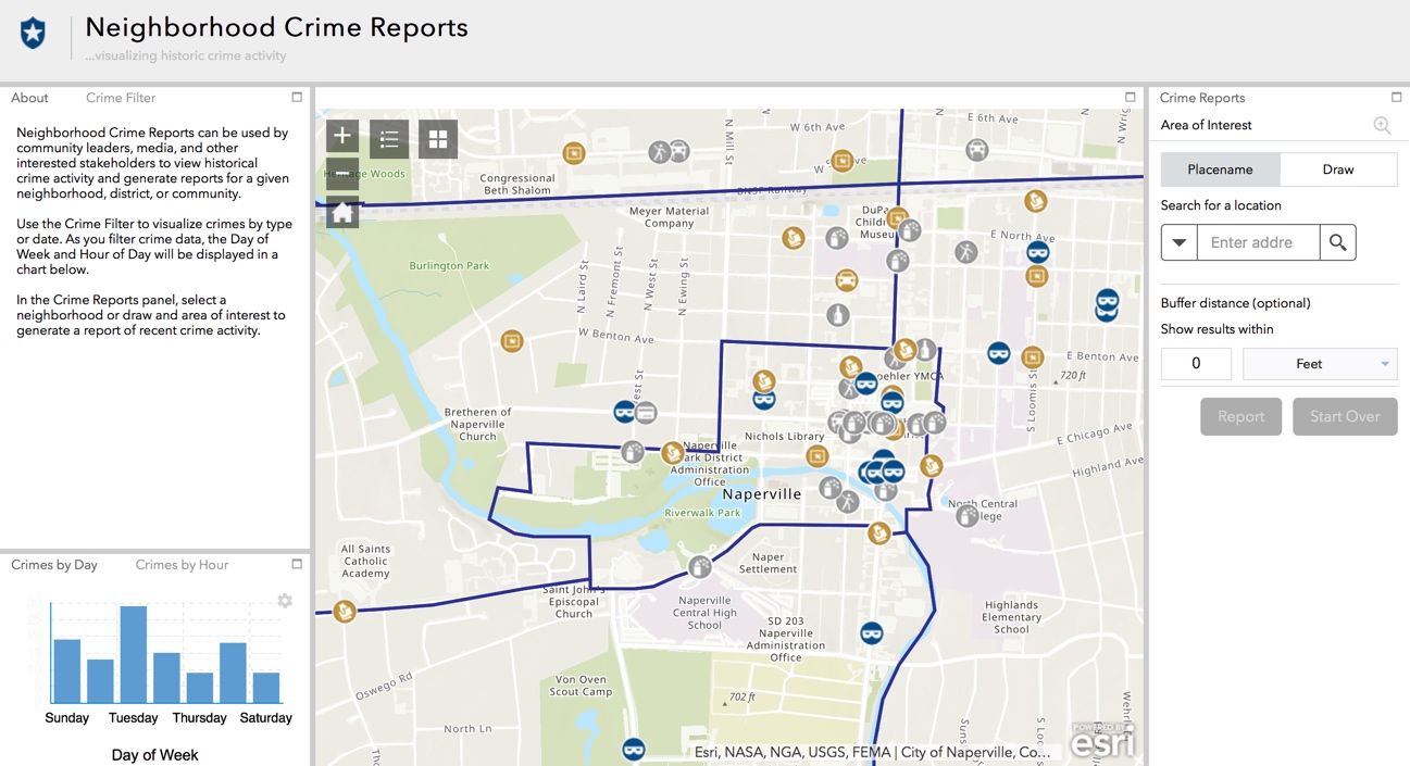
Neighborhood Crime Reports informs community leaders about past crime activity
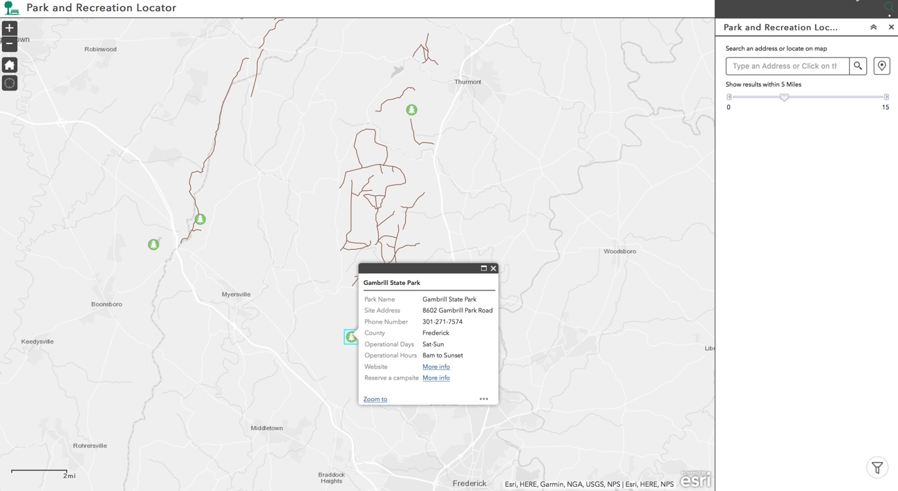
Park and Recreation Locator helps the public discover recreational activities
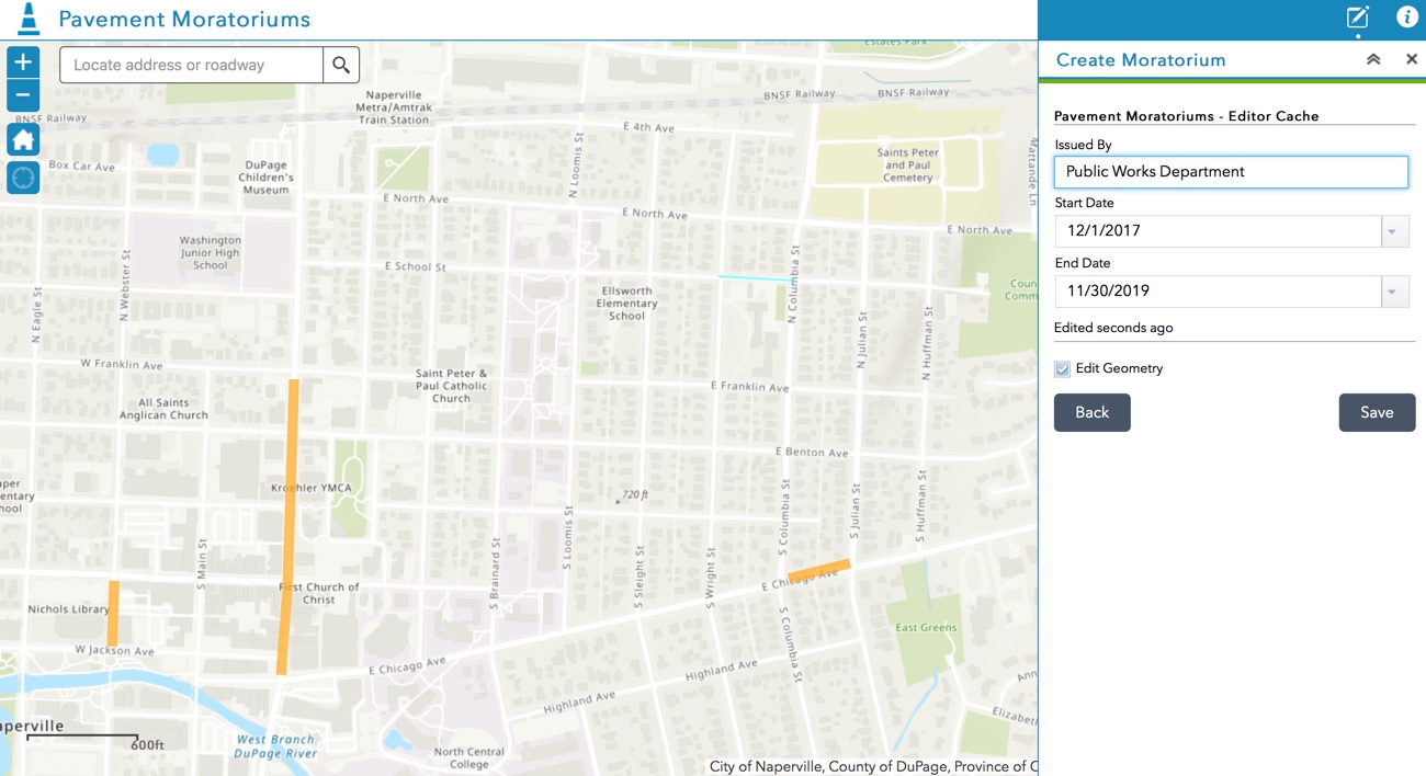
Pavement Moratoriums simplifies inventorying moratoriums that preclude or restrict work in recently paved streets
Public Crime Map informs the public about recent crime activity at or near a location

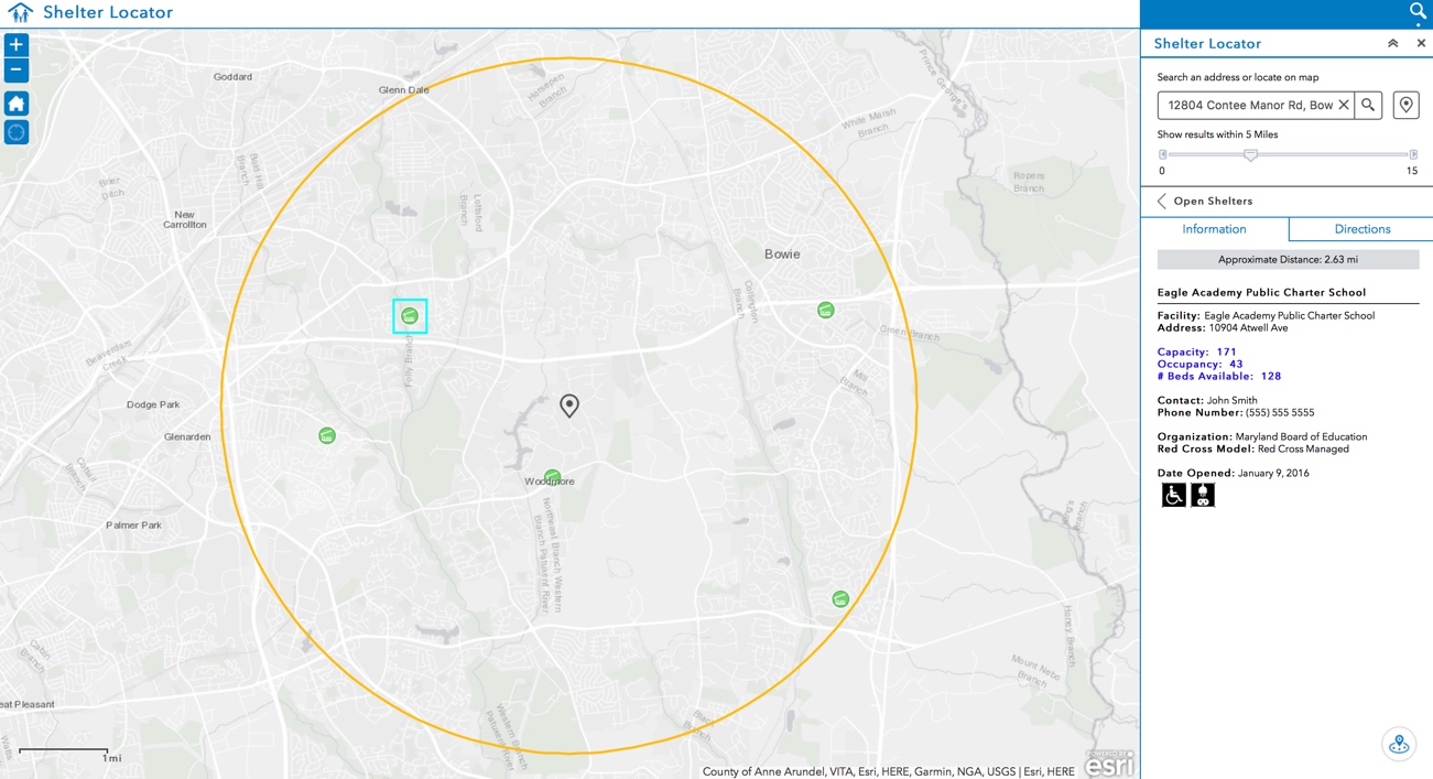
Shelter Locator helps people displaced by natural and man-made incidents find emergency shelters
Street Intersection Inventory supports inventory of street intersections and approach characteristics
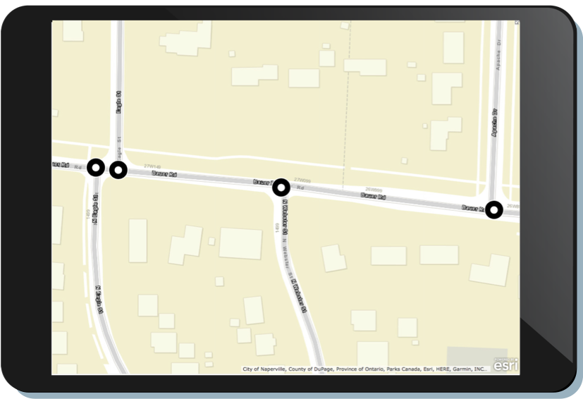
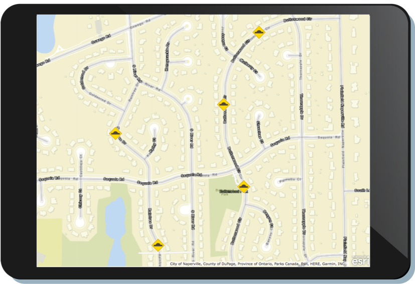
Traffic Calming Inventory supports inventory of devices designed to reduce traffic flow or encourage safe driving
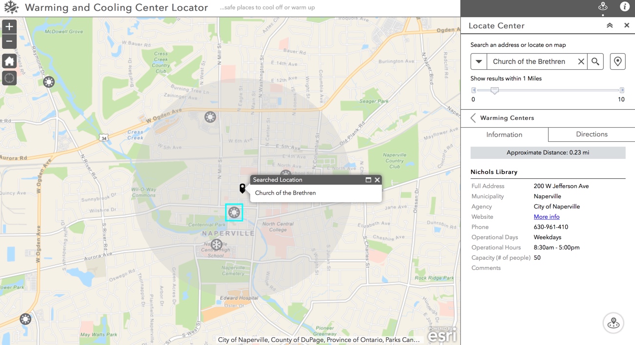
Warming and Cooling Center Locator helps the public locate warming and cooling centers
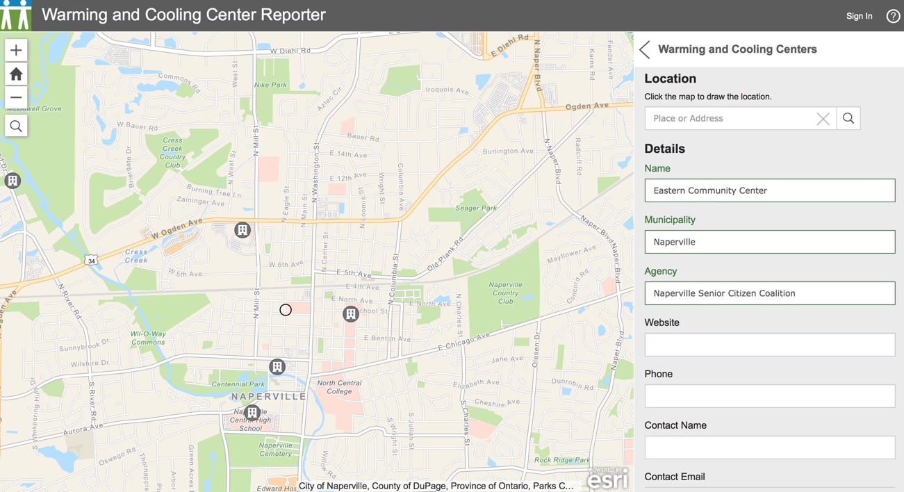
Warming and Cooling Center Reporter enables community members to record locations of warming and cooling centers
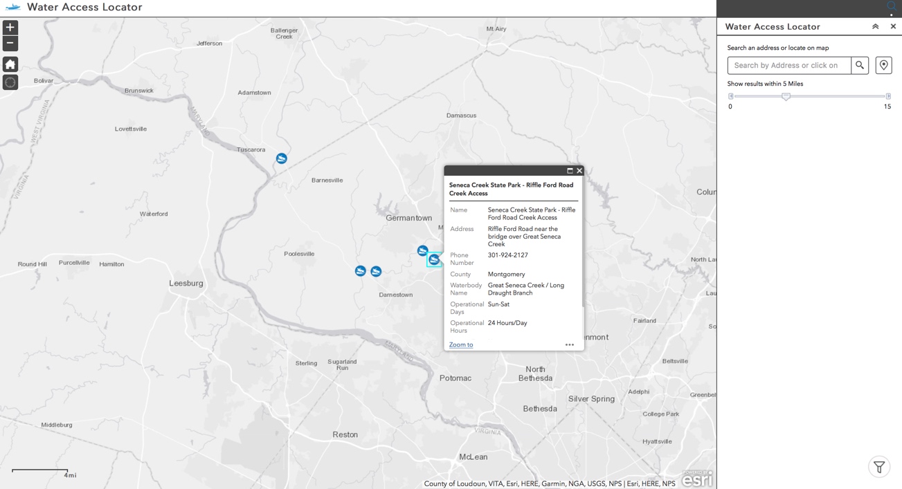
Water Access Locator enables the public to discover water access sites
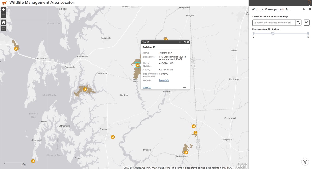
Wildlife Management Area Locator helps the public discover wildlife management areas and recreational activities
Updated Solution Products
- Crash Analysis
- Crowdsource Manager affecting Citizen Science Manager, Health and Safety Reports and Property Listing Reviewer
- Crowdsource Polling affecting Environmental Impact Public Comment and Events Permit Review
- Crowdsource Reporter affecting Citizen Science Reporter and Health and Safety Reports
- Environmental Screening
- Logistics Planning
- Maps and Apps Gallery affecting Common Operating Picture and Events Map Gallery
- Operations Response
- Parcel Drafter
- Photo Survey
- Property Lister
- Road Closures
- Situational Awareness Viewer
- Tactical Operations Dashboard
- Tactical Operation Planner
- Tactical Operation Surveillance
- Transportation 511
- Wildlife Photo Survey
Product Lifecycle Changes
Capital Project Planning moved to mature support. Replaced with a collection of public works configurations.
Capital Project Tracking moved to mature support. Replaced with a collection of public works configurations.
Events Calendar (JavaScript) moved to mature support. Replaced by Events Calendar (Web AppBuilder for ArcGIS).
Event Locator moved to mature lifecycle phase. Replaced by Events Calendar.
GeoEvent Server Components moved to mature lifecycle phase. Code available in Proofs of Concept repository.
Park Locator moved to mature lifecycle phase. Replaced by Park and Recreation Locator
Photo Survey (Version 1) moved to mature lifecycle phase. Replaced by Photo Survey (Version 2)
Shelter Locator (JavaScript) moved to mature lifecycle phase. Replaced by Shelter Locator (Web AppBuilder for ArcGIS).
Water Access Locator (JavaScript) moved the mature lifecycle phase. Replaced by Water Access Locator (Web AppBuilder for ArcGIS).
Wildlife Management Area moved to mature lifecycle phase. Replaced by Wildlife Management Area Locator.
Wildlife Photo Survey (Version 1) moved to Mature Support. Replaced by Wildlife Photo Survey (Version 2)


Article Discussion: