Online Mapping is Transforming GIS—and the World
Maps are important. Everyone understands and appreciates good maps. GIS users create and work with maps every day—they provide the basic experience and a practical interface for the application of GIS. Maps are also the primary way that GIS users share their work with others in their organizations and beyond. Maps provide a critical context because they are both analytical and artistic. They carry a universal appeal and offer a clarity and shape to the world. Maps enable you to explore your data and to discover and interpret patterns.
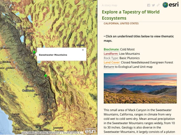 In 2015, the US Geological Survey published a new global ecosystem map of unprecedented detail. It is a mosaic of almost 4,000 unique types of ecological areas called ecological land units (ELUs) that are key to understanding the makeup of ecosystems.
Online GIS maps can be created by anyone using Web GIS—and can be shared with virtually everyone. These maps bring GIS to life and can travel with us on our smartphones and tablets. Online maps have forever transformed computing and the web.
Make no mistake, traditional printed maps are not going away. They continue to be important because they help you quickly grasp the broader context of a problem or situation. The best printed maps are true works of art that can stir your emotions and imagination. There’s no comparable large-format document that communicates and organizes such large amounts of information so effectively and so beautifully. Cartographers using GIS will continue their craft of making astounding printed maps that teach and amaze.
And this will always be the case. Large-format printed maps and their digital cousins (such as PDFs) will continue to significantly occupy the good work of many mapping professionals. The difference now is that GIS tools have come of age for spectacularly high levels of professional cartography.
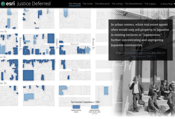 This series of narrative maps tells the story of Americans of Japanese ancestry during World War II, acknowledged finally in 1982 by the US government as “… the bitter history of an original mistake, a failure of America’s faith in its citizens’ devotion to their country’s cause and their right to liberty, when there was no evidence or proof of wrongdoing.”
Meanwhile, a major online mapping revolution is under way, and the implications of this are far-reaching. We all know that consumer maps are ubiquitous on smartphones and the web. Map-based applications regularly rank among the most used programs on smartphones and mobile devices. Online maps have familiarized millions of people with how to work with maps, and this massive worldwide audience is ready to apply maps to their work in ever more imaginative ways using Web GIS.
GIS Maps Engage an Audience for a Purpose
Any map that you make can be saved and shared online—intended for a specific audience and expected uses. Online maps have an interface, a user experience (UX) that comes with each map, called an app. With the ArcGIS platform, a user (which you are by reading this book and becoming a member of the Learn ArcGIS organization) now has a wide range of options for designing and implementing purposeful maps and apps. The possibilities for engaging the audience that matters to you are endless.
—–
This post is excerpted from The ArcGIS Book, Second Edition: 10 Big Ideas about Applying The Science of Where, by Christian Harder and Clint Brown. The twin goals of this book are to open your eyes to what is now possible with Web GIS, and then spur you into action by putting the technology and deep data resources in your hands. The book is available through Amazon.com and other booksellers, and is also available at TheArcGISBook.com for free.
Commenting is not enabled for this article.