The National River Recreation Database (NRRD) is a geodatabase of water trails, Wild & Scenic Rivers, whitewater segments and respective access points and campgrounds in the U.S. It was conceived to provide a way to:
- Offer a high-level view of rivers across the nation using attributes important to and familiar to fans of rivers and outdoor recreation.
- Direct visitors to the definitive, detailed resource for experiences that can help them plan a visit.
Project
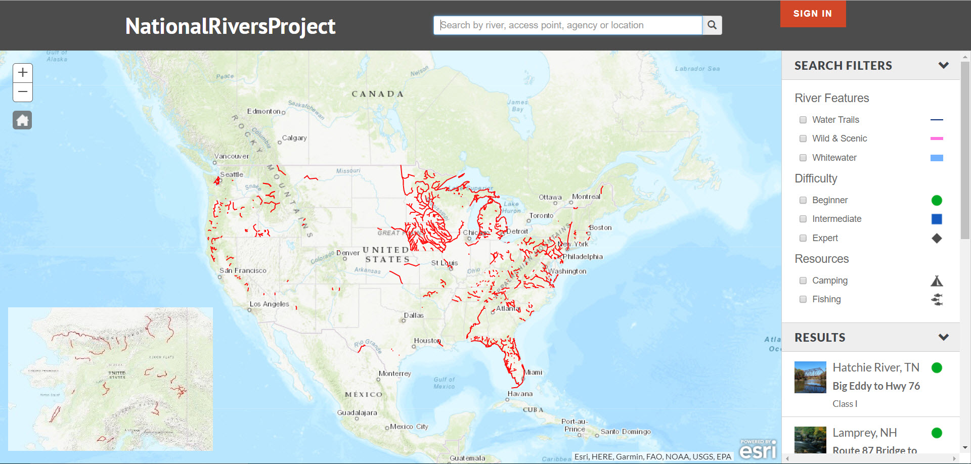
The extent is national, and the data consists of three feature classes. These feature classes are uploaded to ArcGIS Online as hosted feature layers. Using REST API endpoints, these layers fuel the map, search engine and database on the nationalriversproject.com website.
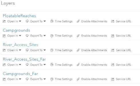
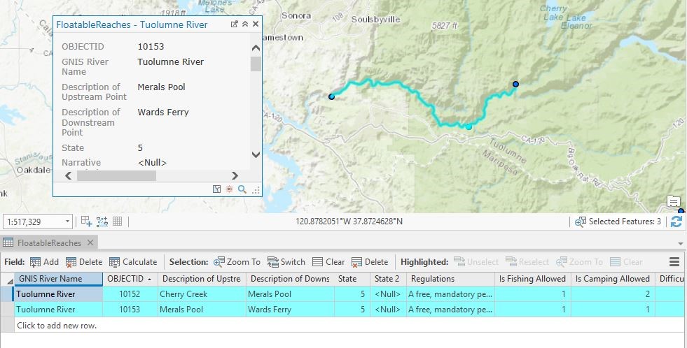
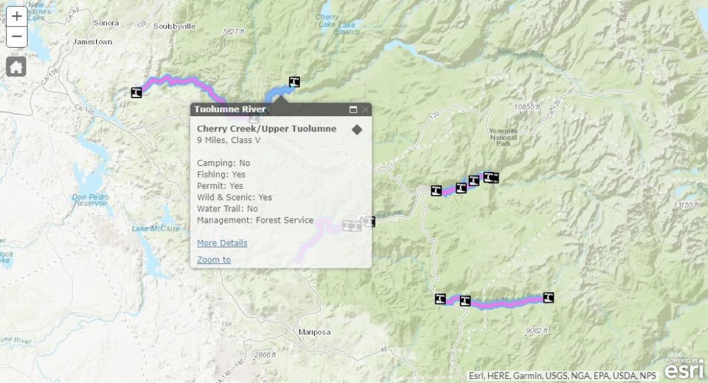
The three feature classes are: floatable reaches, access points and campsites. Floatable reaches are recreational river segment polylines that are referenced from the National Hydrography Dataset. Access points and campsites are point data showing locations where river segments can be accessed by boat, and where waterside camping exists.
Duplicated feature classes/feature layers are used to create visibility ranges in the nationalriversproject.com map.
Data
River Management Society is partnering with a variety of organizations to bring data into the NRRD. The project has creatively combined GIS and attribute data from: federal agencies, state agencies (departments of fish & game, departments of natural resources), municipal groups (planning groups, tourism & development organizations, regional authorities), non-profit organizations (water trail organizations, environmental non-profits, recreation and conservation groups) and local community organizations.
Methods for adding data:
Each partner’s data situation is different, so a variety of protocols have been utilized. We have created schemas and templates to ease the process of creating new NRRD data. For new data going into the database, partners without geospatial technology, staff or capacity can fill out pre-formatted Microsoft Excel spreadsheets with latitude and longitude coordinates for access points and campgrounds, along with the respective attribution. Partners will then also fill out the ‘floatable reach’ spreadsheet which details river sections between access points. These floatable reaches are created by referencing the access points to the National Hydrography Dataset.
Another method used to add data to the NRRD is retrofitting pre-existing data, and pointing attribute fields from the existing data into the NRRD template. This has been common and effective with state-level water trail programs whom often already track data on recreational rivers and access points. Creative field calculating and ArcMap’s Simple Data Loader tool is used to accomplish this.
Next Steps
River Management Society is currently working with the U.S. Forest Service to bring additional Wild & Scenic Rivers in the NRRD. Current partnerships exist with several state-level water trail programs to fill in the map for flatwater paddling opportunities in the southeast and mid-west United States. We are also working with the National Park Service to continue bringing National Recreation Areas and National Scenic Rivers into the NRRD. A long-term goal is to work with national whitewater paddling advocates to bring more whitewater river sections in.
For more information, contact Jack Henderson – jack@river-management.org


Article Discussion: