Esri and PubNub have joined forces to bring geospatial developer tools, global maps, and data capabilities to PubNub Functions, making it easy to harness the power of Esri’s mapping APIs and apply it to realtime data. With just a few lines of code that will execute within the PubNub Data Stream Network (DSN), developers can now build and deploy geospatially enabled and extended IoT, web, and mobile apps.
The Power of Esri’s Location and Mapping Analytics
Esri builds ArcGIS, the world’s most powerful mapping and spatial analytics software. ArcGIS applies The Science of Where™ to connect everyone, everywhere through a common visual language. It combines mapping and analytics to reveal deeper insights into data. Esri GIS technology is used by tens of thousands of government organizations around the world, and by 75% of Fortune 500 companies.
The ArcGIS Developer Subscription offers a cost-effective way to license ArcGIS products and access, build, test, deploy, and license developer API’s and SDK’s. Whether you’re building apps or extending the ArcGIS platform, the Developer Subscription has free and for-fee plans specifically tailored to best implement your solution.
Sign up for a free ArcGIS Developer Subscription: developers.arcgis.com.
Realtime Apps Made Simple with PubNub
People expect “always-on” online experiences these days, but building the underlying realtime infrastructure remains very challenging. There are unique security risks, reliability challenges and scalability concerns for realtime infrastructure, which can drastically slow down release schedules.
PubNub resolves all these concerns, by providing enterprise-grade security, 99.999% SLA-backed reliability, and global scalability to support the largest realtime deployments, all via simple APIs and over 75 SDKs. Additionally, the PubNub Data Stream Network offers value added features for application areas like chat/ collaboration, IoT device control, and realtime updates to further accelerate your build and release times. With PubNub, developers and businesses can add realtime functionality without having to build or maintain the backend infrastructure, so you can focus on innovation, not infrastructure.
Access the Functions Catalog: pubnub.com/functions-catalog.
What can you do with Esri Functions?
Esri’s ArcGIS APIs and SDKs allow you to create apps that include mapping, visualization, and analysis via PubNub Functions. ArcGIS for Developers has four ready to use functions; Geoenrichment, Directions, Geocoding, and Reverse Geocoding that you can use on PubNub to support your realtime applications (with more on the way!).
Esri Functions:
Geoenrichment: Add demographic, spending, business, and lifestyle data to maps and apps.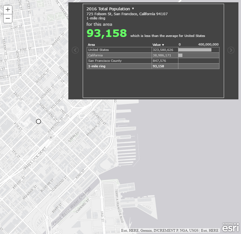
The Esri Geoenrichment Service can be used to query and display information from a large collection of enhanced demographic data sets including population, income, housing, consumer behavior, and the natural environment. To see the data sets available check out the data browser, pubnub.com/docs/blocks-catalog/esri-geoenrichment.
Directions: Create point-to-point routing, or build optimized routes that automatically consider traffic.
The Esri Routing Service for directions can be used to find the best way to get from one location to another or to visit several locations. The best route can be the quickest route for a given time of day taking traffic conditions into account, or it can be the shortest route that minimizes the travel distance, pubnub.com/docs/blocks-catalog/esri-directions.
Geocoding: Convert addresses to locations.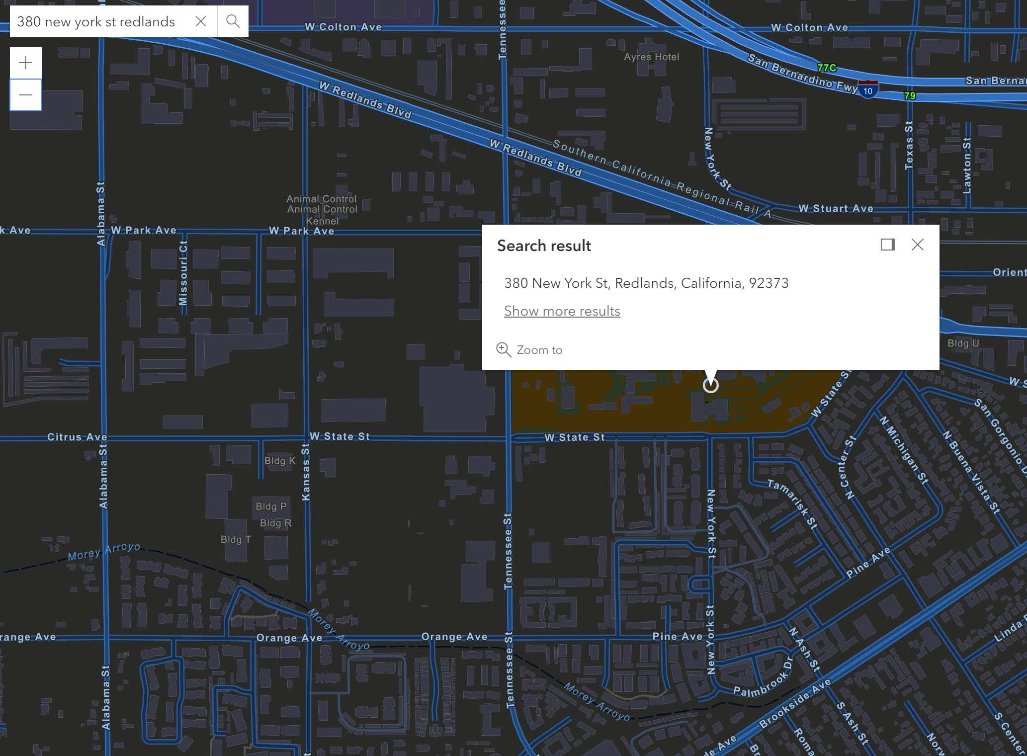
The Esri World Geocoding Service converts an address or place name to latitude and longitude. For example, if you know the address of a business and want to put it on a map, you can use geocoding to find the coordinates, pubnub.com/docs/blocks-catalog/esri-geocoding.
Reverse Geocoding: Convert geocoordinates to addresses.
Using the Esri World Geocoding Service, you can convert a latitude and longitude to an address. For example, if you are using realtime coordinates, you can use reverse geocoding to find the address for those coordinates, pubnub.com/docs/blocks-catalog/esri-reverse-geocoding.
Coming Soon – Esri Tracking:
Execute multipoint directions, realtime vehicle tracking, and drive-time based geofencing all with a simple but powerful JavaScript mapping API and a PubNub Function. Get started with the Github repo today. ![]()
Watch the webinar, “Mapping and Tracking Your Users Crave”, showing you the ins-and-outs of realtime mapping, including how to implement geo-tracking, route planning, and more using Esri Features.
Get started today!
Sign up for a free ArcGIS Developer Subscription: developers.arcgis.com.
Access the Functions Catalog: pubnub.com/functions-catalog.


Commenting is not enabled for this article.