
Remote telecom network engineering is all about reducing the number of engineering field visits by bringing the field to the engineer. This can reduce costs, improve designs, and accelerate time-to-market. One of the most crucial pieces to remote engineering is geographic data. In order to bring the field to the engineer, the engineer needs to have as much data and intelligence about the field as possible in order to make a calculated decision. This data might include existing or potential asset locations, like poles and power supplies, or it might be high quality aerial imagery and LiDAR data. All of these geographic datasets that help create a Digital Twin of the real world can be collected, stored, and made available to your engineers through ArcGIS.
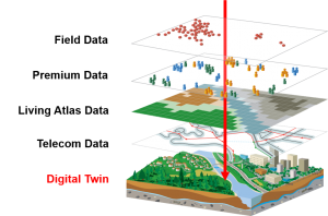
Creating the Digital Twin
In order to create the Digital Twin for your telecom network engineers follow the four U’s below to bring the field to them.
Use existing data
 I bet that somewhere in your organization, someone has access to geographic based data that would be of value to your engineers. More times than not, this data comes from previous field surveys where field engineers have collected pole locations and other easement information using high accuracy GPS devices. This data might be currently stored in a spreadsheet or KML/KMZ, but can be easily brought into, stored, and viewed in ArcGIS. As-builts are another great dataset that provides value to engineers and lets them understand where existing infrastructure is, and most construction projects produce as-builts in the form of CAD drawings or files that can be georeferenced or converted to a GIS format within ArcGIS. Building a solid GIS database foundation from geographic data that is available within your organization allows you to re-use the data you have, and then enables your engineers to layer on additional insightful GIS datasets.
Unlock the value of Esri’s Living Atlas data
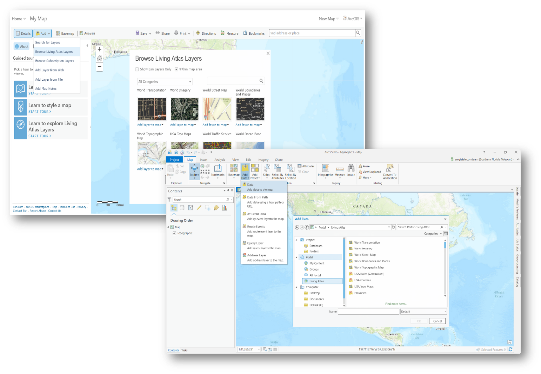
Esri offers a ton of ready to use maps and content from the Living Atlas. This content ranges from demographic information, to street data, to land use information, to high quality aerial imagery. All of this data is available through ArcGIS Online and is hosted by Esri, so you don’t have to host it and maintain it yourself. Accessing this rich content is as easy as opening up a new or existing map in ArcGIS Online, ArcGIS Enterprise, or ArcGIS Pro, clicking the Add Data button, browsing the Living Atlas layers, then adding the relevant layers to your map. This data can supplement your organization’s geographic data and provide to your engineers, greater detail about the real-world.
Pro tip: Living Atlas Map Layers & Enrichment Variables for Telecommunications
Utilize ArcGIS ready 3rd party premium data
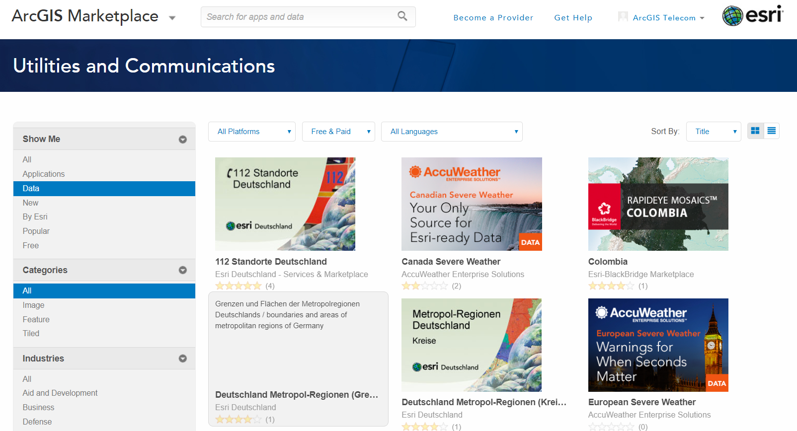
Esri has many partners that offer premium geographic datasets that plug and play directly with ArcGIS. A lot of these partners provide specific datasets for telecom organizations. For example, some of this data takes Esri demographics to the next level by adding specific telecom information, like spending on communication services and total bandwidth used. Leverage premium partner data, with Esri Living Atlas data, along with your organization’s authoritative data to build the complete GIS Digital Twin replica of the real-world.
Pro tip: ArcGIS Marketplace
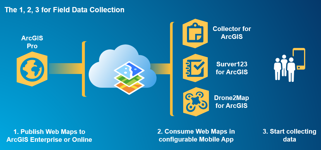
Update your GIS databases with data from the field
Once a GIS data foundation is in place, it’s time to take advantage of your many field personnel. Enable your field crews with the ability to view and collect data from the field. This will allow your organization to continually update and add to your GIS databases by internally crowdsourcing data from the field. As your GIS datasets become more complete and accurate, so will your engineering designs and cost estimates. Collector, Survey123, and Drone2Map are just a few of the ArcGIS apps that you can quickly take advantage of for field data collection, and start enhancing your GIS datasets today.
Pro tip: Apps for the Field
Remote Engineering
For more information on the suit of capabilities Remote Engineering with ArcGIS has to offer, check out this Story Map.

Article Discussion: