The latest releases of the ArcGIS API for JavaScript are packed with useful new enhancements and capabilities. Version 4.4 gives you more control over visualizing and interacting with 3D data, includes deeper web map support, and brings in OGC layer types (WMS and WTMS). Both 3.21 and 4.4 also enable vector tile layer printing and the ability to script pop-up content using Arcade (which is particularly useful if you need to calculate a new value to display using your attribute data). Here are some of the highlights of these two new releases. For a complete list, see the 4.4 and 3.21 release notes.
ArcGIS API 4.4 for JavaScript
Better web map support
In this release, we’re adding three new layer types: MapNotesLayer, WMSLayer and WMTSLayer. This means most web maps can now be read using the 4.x API. Not yet supported web map features include full label support, heatmap rendering, KML, Bing, WFS, and time support.
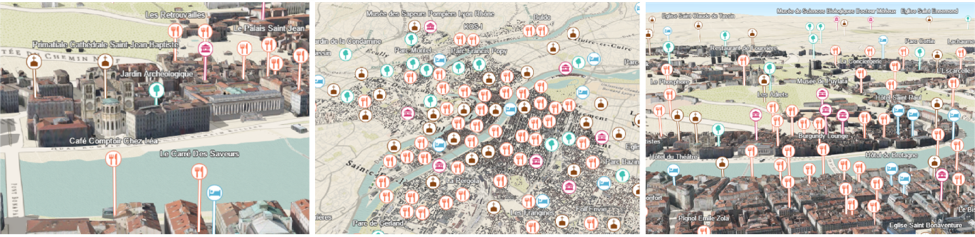
New styles for points in city landscapes:
Visualizing point data in city scenes has been improved, making icons more clearly visible with respect to their actual locations. Point graphics can be configured to display above buildings with the new relative-to-scene elevation mode. Callout lines (a callout is essentially extended from the top of the scene) can be used to better understand point locations.
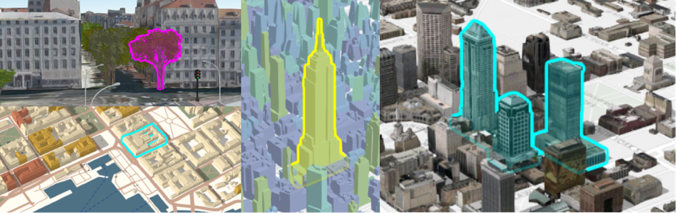
Highlight in 3D:
Highlight features in a 3D scene, with options to configure the color and opacity of the highlight effect.
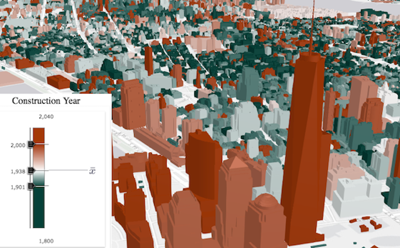
Styling building data:
We added options for removing building textures and modifying their color. This allows you to better emphasize thematic visualizations or draw attention away from specific buildings by making them appear to have grayscale textures.
Smart Mapping
You can now automatically generate renderers for SceneLayers using SmartMapping. Generating type renderers with smart mapping is new to both 2D and 3D views.
Note: When we reference smart mapping/generating renderers, we mean that the API creates smart defaults for your map/scene styles on the fly. This capability is typically used in data exploration type apps (as opposed to defining the styling explicitly in code).
PointCloudLayer enhancements
Add natural lighting conditions to a point cloud layer in order to better distinguish objects.
OGC support
Added support for WMS and WMTS layers.
VectorTileLayer printing
This release of the JavaScript API includes support for vector tile layer printing through client-side image.
Arcade support in popups
Arcade expressions can now be applied in the popup’s content. This is useful when you want to display data that isn’t present as an attribute value in your FeatureLayer instance. Web maps that have been created in Portal or ArcGIS Online that contain popups with Arcade expressions will be honored in apps built with the JavaScript API. Developers can also write Arcade expressions directly in their code.
Widget standardization
In this release, the following widgets have been updated to the widget framework, initially introduced at 4.2: Legend, Popup and Search widgets.
ArcGIS API 3.21 for JavaScript
Arcade support in popups
As described above.
VectorTileLayer printing
As described above.
(… plus minor enhancements and bug fixes)
Check out the latest samples
A great way to explore the new features and capabilities of each release is to check out the latest interactive samples:
Come see us at the Esri User Conference!
The Esri JavaScript development team will be showcasing the latest technology during the Esri User Conference in San Diego next week (July 10th-14th). A few sessions that might be of interest are:
See the agenda for a full list of tech sessions and demo theater presentations.


Commenting is not enabled for this article.