During the June 2017 ArcGIS Solutions Release 19 new Solution Products were added to ArcGIS, 26 Solution Products were updated and 22 changed lifecycle phase.
New Solution Products
Demolition Tracker enables the public to track building demolitions and understand associated costs.
![]()
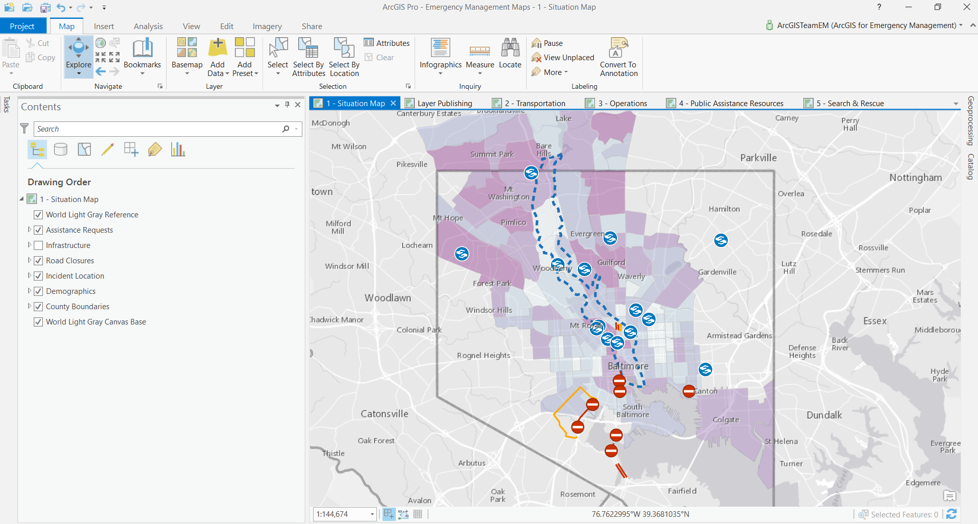
Emergency Management Maps creates a standard set of maps for emergency management response activities and briefings using ArcGIS Pro.
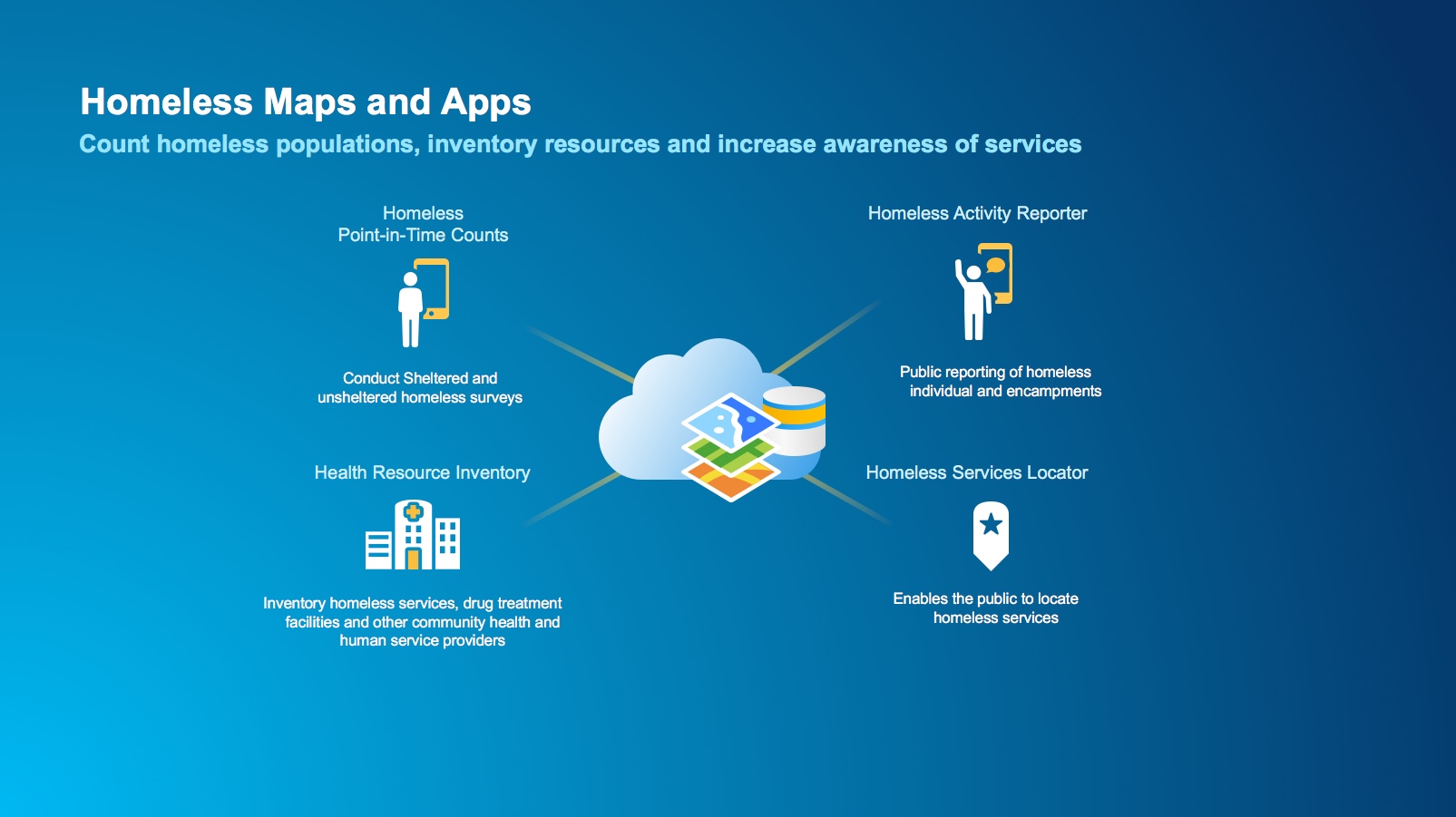
Homeless maps and apps supports community efforts to reduce homelessness. This collection includes 4 new Solution Products:
- Health Resource Inventory
- Homeless Activity Reporter
- Homeless Point-in-Time Counts
- Homeless Service Locator
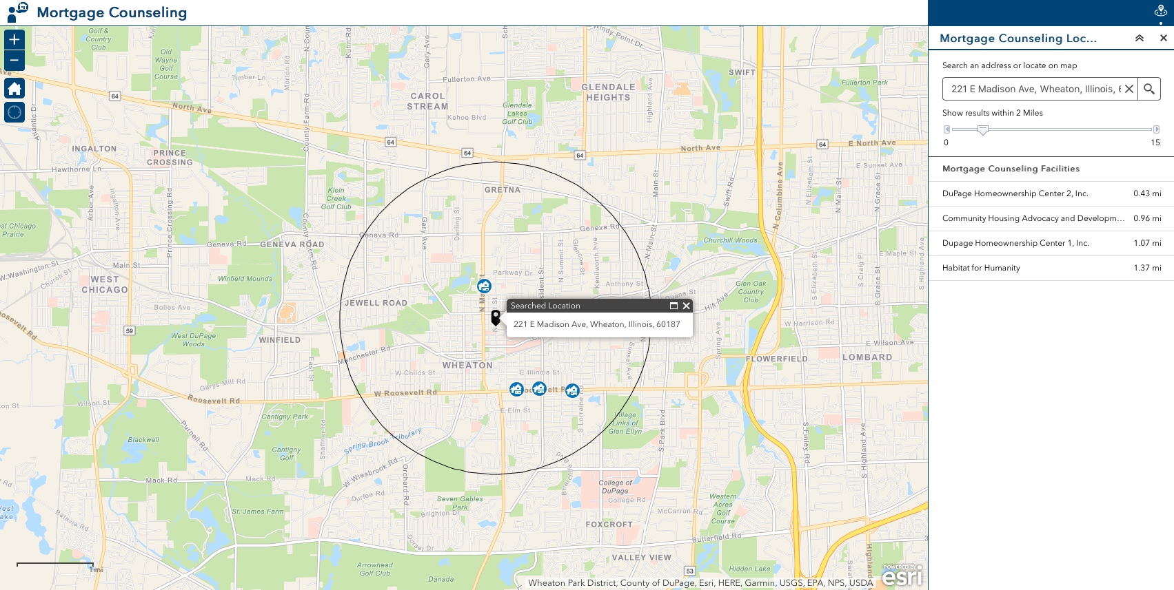
Mortgage Counseling Locator shows the public where to find mortgage and housing counselors in their community.
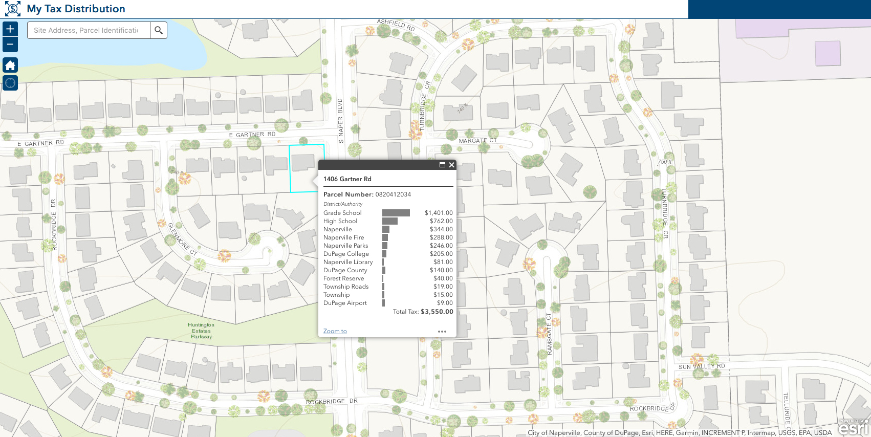
My Tax Distribution enables the public to view how property tax revenue is distributed for each parcel in a municipality.
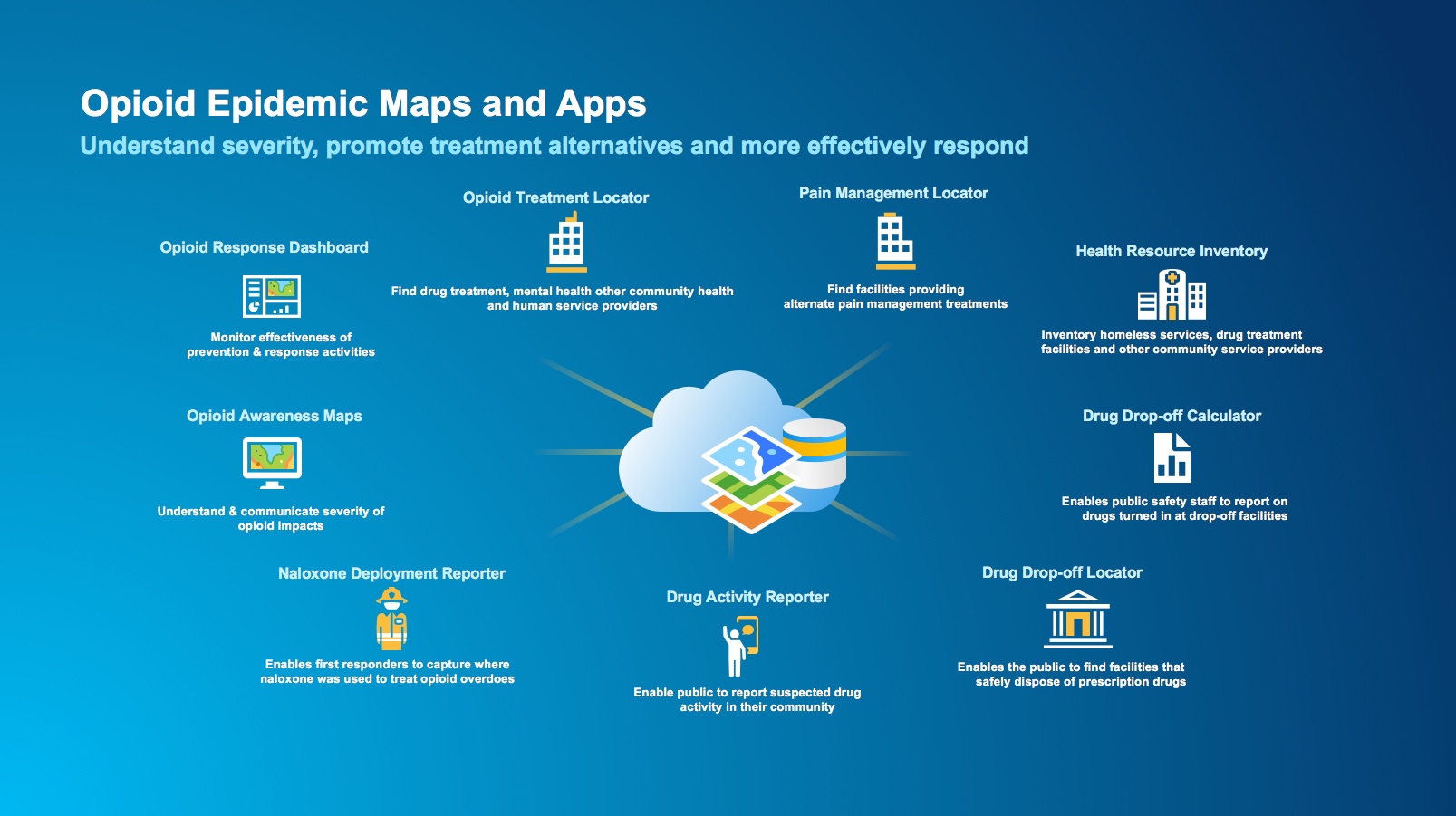
Opioid Epidemic maps and apps help communities combat opioid addiction. This collection includes 9 new Solution Products:
- Drug Activity Reporter
- Drug Drop-off Calculator
- Drug Drop-off Locator
- Health Resource Inventory
- Naloxone Deployment Reporter
- Opioid Awareness Maps
- Opioid Response Dashboard
- Opioid Treatment Locator
- Pain Management Locator
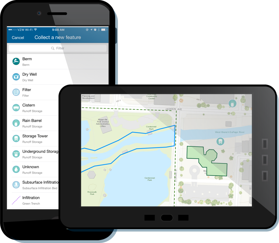
Stormwater Inventory and Inspection deploys a set of maps and apps that supports field inventory and inspection of stormwater assets and best management practices (BMPs).
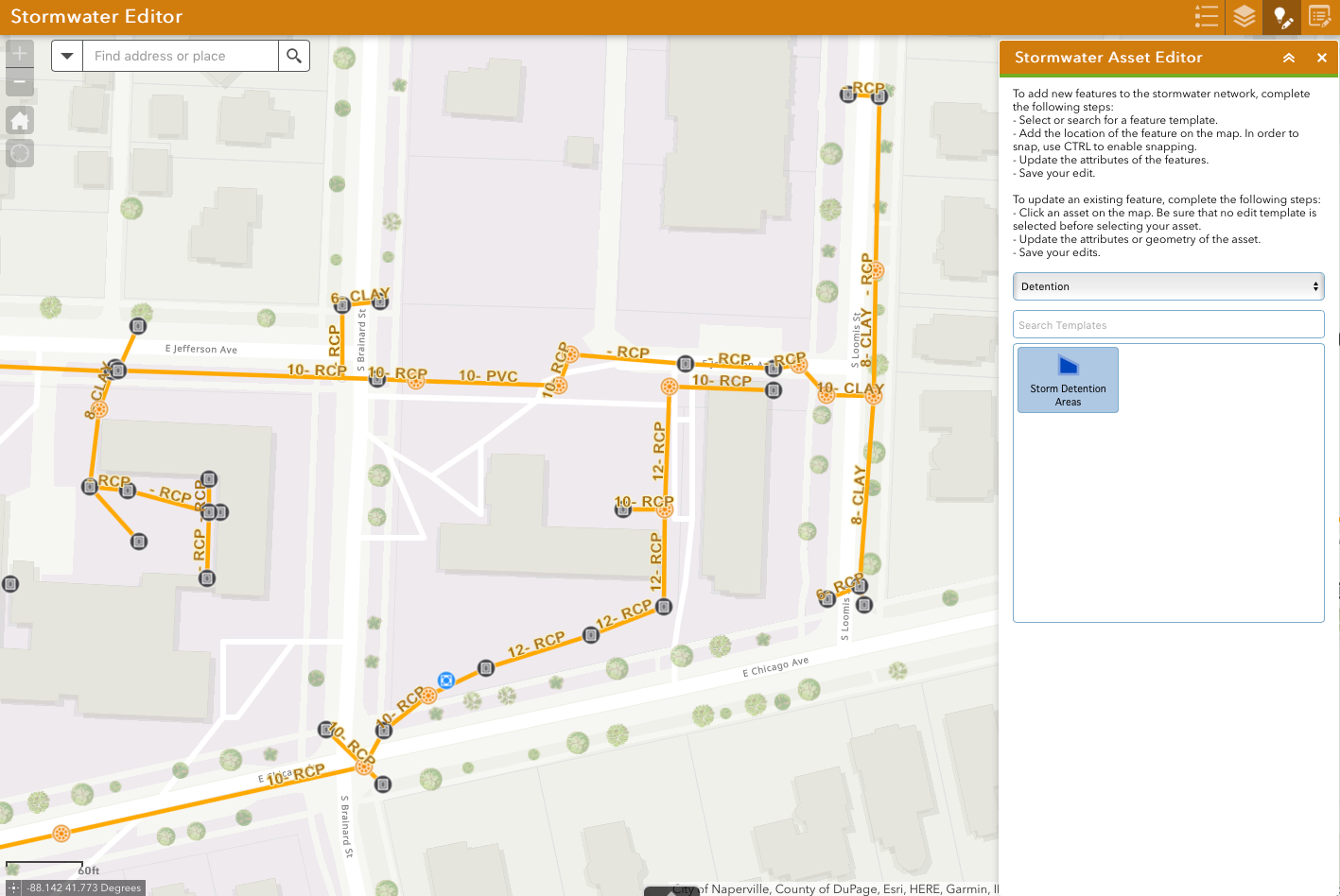
Stormwater Viewer and Editor deploys a set of maps and apps that supports viewing and editing stormwater assets and best management practices (BMPs) in a web browser or mobile web browser.
Tracking and Traceability enables gas utilities to accurately capture the location of pipes, fittings and other assets and scan their barcodes.
![]()
ArcGIS Solutions Deployment Tool Updates
31 Solutions were added to the ArcGIS Solutions Deployment Tool bringing the total number of Solutions that can be automatically deployed using ArcGIS Pro to 228.
Updated Solution Products
Capital Improvement Planning modified the wAbandonedPoint and wAbandonedLine layers in WaterUtilities.gdb.
Citizen Science Reporter and Property Lister added the option during application load on a smartphone to display the map view of existing reports before the list view. User experience was improved when viewing ‘My Submissions’ on layers containing filters. Removed the map from submissions form in desktop/tablet layout. The order of Details, Attachments, & Location in the main form section is now configurable. Sign in page help content can be different from in-app help content and in-app help content can be displayed as a splash screen. Updated to use version 3.2 of the ArcGIS API for JavaScript
Citizen Science Manager and Property Listing Reviewer added support for layers that have capabilities to Update but not Add. Fixed bugs and now uses version 3.21 of the ArcGIS API for JavaScript.
Data Reviewer for Basemaps retired a series of checks from the Basemaps batch job.
Environmental Impact Public Comment and Events Permit Review added the option during application load on a smartphone to display the map view of existing reports before the list view and the option to set default status of the toggle to filter list of features in the visible map extent. Search widget is now at top of feature list in smartphone view. Updated UI for help and sign in panels. Now uses version 3.21 of the ArcGIS API for JavaScript.
Environmental Screening can now print reports when no impacts are found, includes more options to configure printed reports, analysis locations can now be defined with a point or a line, selectable layers can be defined when setting analysis location, URLs in analytical results are now clickable and the Screening widget has been incorporated into Web AppBuilder for ArcGIS.
Facility Reports for Gas Distribution and Facility Reports for Gas Gathering added ReportAreasOverLap and ReclassType parameters to the reclass report configuration and fixed bugs.
Facility Reports for Gas Transmission updated Data Summarization of Onshore Transmission Pipe by DOT Class and Data Summarization of Offshore Transmission Pipe by DOT Class to use the PipeDOTClass Layer and Filter SQL updated to summarize only active features with a system type of offshore transmission. Added ReportAreasOverLap and ReclassType parameters to the reclass report configuration and fixed bugs.
Joint Use Survey added workflow documentation for providing real time notifications.
Leak Survey Manager map document updated to symbolize areas with no overdue surveys and removed database specific data frames. Added ReportAreasOverLap and ReclassType parameters to the reclass report configuration and fixed bugs.
Logistics Planning , Operations Response and Situational Awareness Viewer added options to create printable reports and to disable layer management. Snapshots are now shared with an ArcGIS Online Group.
Parcel Drafter is now deployed with Web AppBuilder for ArcGIS
Pole Reports added ReportAreasOverLap and ReclassType parameters to the reclass report configuration and fixed bugs.
Shadow Impact Analysis added a Quick Shadow Check task with the ability to export to popular movie formats.
Transportation 511 now returns results in an alphabetized list and can be resized to fit list content. The Info Summary widget supports showing all features instead of filtering by extent.
Utility Isolation Trace simplified configuration and publishing with a redesigned Isolation Trace process. Modified the wAbandonedPoint and wAbandonedLine layers in WaterUtilities.gdb.
Visibility Assessment enhanced performance of the Visibility Analysis tool.
Water Conservation Dashboard now supports stormwater best management practices services.
Water Utility Network Editing and Analysis migrated the Water Utility Network Editing toolbox from a geoprocessing toolbox to a Python toolbox. Refactored Abandon and Un-Abandon Tools and enhanced them to better support multiple geodatabase formats. Fixed bugs.
Product Lifecycle Changes
Customer Complaints moved to the mature lifecycle phase.
CSO Notification moved to the mature lifecycle phase.
Electric Asset Locator moved to the retired lifecycle phase.
Emergency Management Maps (previous ArcMap version) moved to the retired lifecycle phase. Replaced with new ArcGIS Pro version of Emergency Management Maps.
Gas Asset Locator moved to the retired lifecycle phase.
Green Infrastructure moved to the retired lifecycle phase. Functionality replaced with Stormwater Inventory and Inspection.
Hazard Notification moved to the retired lifecycle phase. Functionality replaced with documented workflow included with Hazard Reporting Collector.
High/Low Water Consumption moved to the mature lifecycle phase.
Inlet Inspection moved to the retired lifecycle phase. Functionality replaced with Stormwater Inventory and Inspection.
Leak Survey Mobile Map moved to the retired lifecycle phase.
MS4 Inventory Recorder moved to the retired lifecycle phase. Functionality replaced with Stormwater Inventory and Inspection.
Pressure Zone Analysis moved to the mature lifecycle phase.
Public Information Map moved to the retired lifecycle phase.
Social Media Sentiment Viewer moved to the mature lifecycle phase.
Stormwater Network moved to the retired lifecycle phase. Functionality replaced with Stormwater Inventory and Inspection.
Upsell Analysis moved to the retired lifecycle phase.
Utility Mobile Map moved to the retired lifecycle phase.
Social Media Sentiment Viewer moved to the mature lifecycle phase.
Violations Notification moved to the retired lifecycle phase
Water Asset Locator moved to the retired lifecycle phase.
Water Inventory Reports moved to the mature lifecycle phase.
Water SCADA Processor moved to the mature lifecycle phase.


Article Discussion: