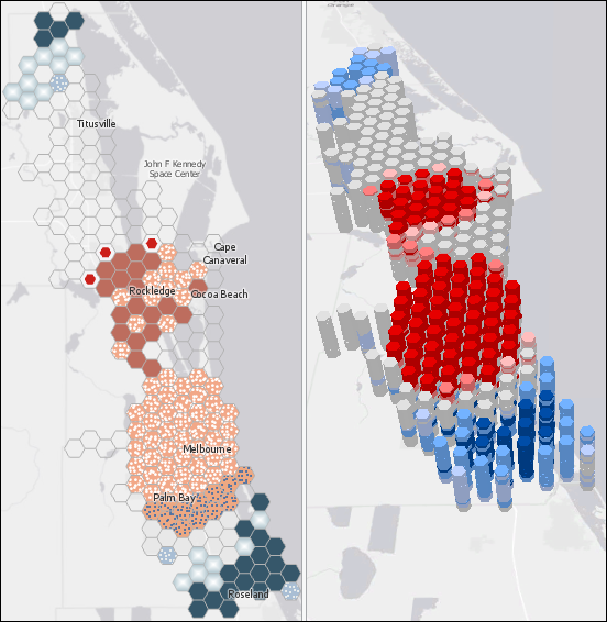
Check out this case study Story Map showing spatial and temporal analyses of crash data in Brevard County, Florida. It begins with a simple space-time trend analysis, displaying the results in 3D. The workflow is then refined to analyze traffic accidents using the underlying road network. Finally, the analysis considers temporal cycles such as the work week afternoon commute. You may download the data and follow the complete workflow from start to finish. References and resources for learning more are also available.


Commenting is not enabled for this article.