Offering your web app in multiple languages can increase your audience and the overall impact of the information. In this blog, we will show two examples of configuring apps to support a bilingual audience.
Example 1: Configuring two apps
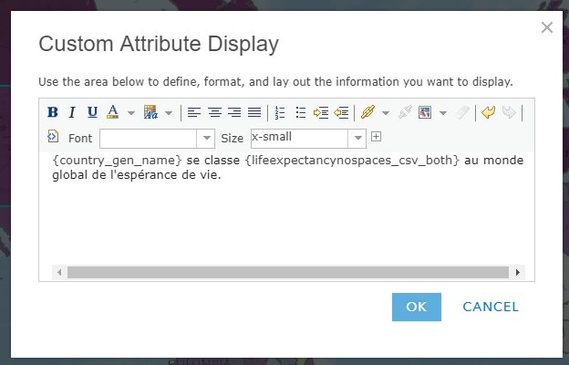
In the first example, we will be using the Basic Viewer template to showcase a map. For this project, our audience is both French and English speakers. The map’s pop-up is configured with a custom attribute display explaining the data. These steps start after your initial map and app have been created.
1. Identify data to translate.
First, let’s start by identifying which data Esri translates as part of the localization process and what you will need to handle. Esri will display all application elements such as search, element labels, and tooltips in the browser or ArcGIS Organization locale. Green boxes show what Esri translates and red boxes highlight what is driven by web map content. In this example, the web map and data is in English and the browser locale was set to French.
![]() 2. Translate data and create the second map.
2. Translate data and create the second map.
The pop-up, app title and layer titles need to be updated in the French version. Create a second map and update all required data to fully translate your map and app into the language you need. Since I am using a custom attribute pop-up I needed to translate it.
3. Configure the second application
Configure and publish your app. While configuring your app you will be able to change the title, subtitles and additional information to your language of choice.
Optional tips:
- To enable users to easily choose the appropriate language I have added a splash screen to both apps. The splash contains a link to an application that has a web map configured in French.
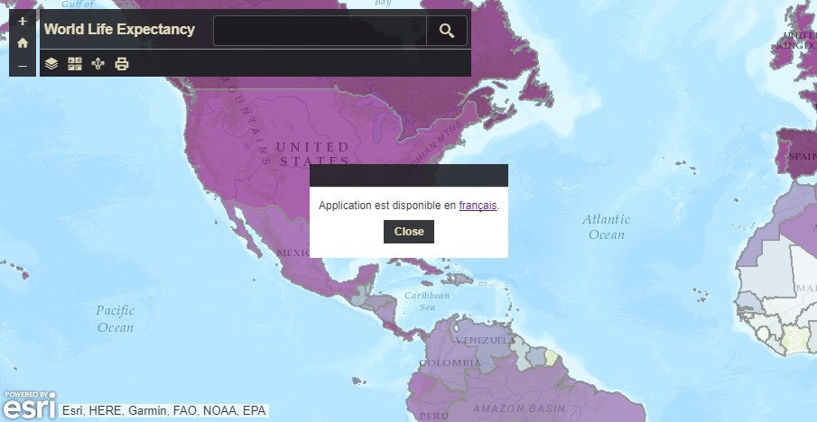
- In addition to the splash screen, URL parameters can be set to force the locale to be in French. In the splash screen hyperlink a URL parameter can be added to the application URL to force the locale to be set. In this example, “&locale=fr” was added to the end of the French application. For more information on URL Parameters visit the help topic.
4. Share your app
Review and test your app in both languages. Verify everything is correctly translated. I generated the translations from Google Translate for this example. You may want to have a fluent speaker verify your translations. Make any configuration or data adjustment. Then share your app with your audience.
Example 2: Configuring one app to support two languages
This example will illustrate how to configure one app to support two languages. For this project, I want to collect data from the community. The community I’m targeting contains both English and Spanish speakers. I’d like to collect all the information in one application. This example will use the GeoForm template.
1. Configure data to support two languages
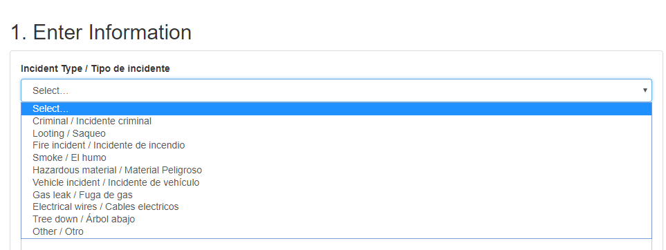
In the GeoForm application, I have four fields I will use to collect data. One field contains a domain to drive the drop-down options in the GeoForm app. I created the domain values to appear in both Spanish and English. A bit of planning or updating may be necessary to update your data to contain both Spanish and English values. These domains were created and published from ArcGIS Pro.  2. Configure the application
During the configuration process, you can assign a title and short instructions in both languages.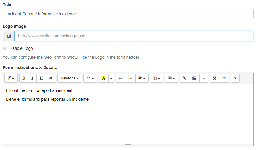
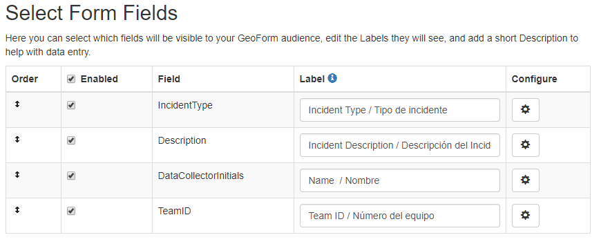
In most cases you should adjust the layer names in the web map, but the GeoForm allows you to change the field name labels in the builder. This is a simple way to add a second language to the field name.
3. Share your app
Test your app in both languages to ensure everything thing which needs to be offered in two languages by the author is and the rest is localized. An easy way to test is to use the URL parameter discussed earlier. Refine any details as needed. Then share your app. If you are going to provide links to this app from a website it would also be a good idea to utilize the locale parameter to ensure that the app UI is in the correct language for your target audience. Here is English version of the GeoForm example and here is the Spanish.

Article Discussion: