With the largest release of data to date, the Polar Geospatial Center (PGC) has significantly expanded the high-resolution coverage of the Arctic Elevation dataset. The new data is available to ArcGIS users as a part of Esri’s ready-to-use Arctic Elevation layers, as well as Esri’s ArcticDEM Explorer and ArcticDEM Change web apps.
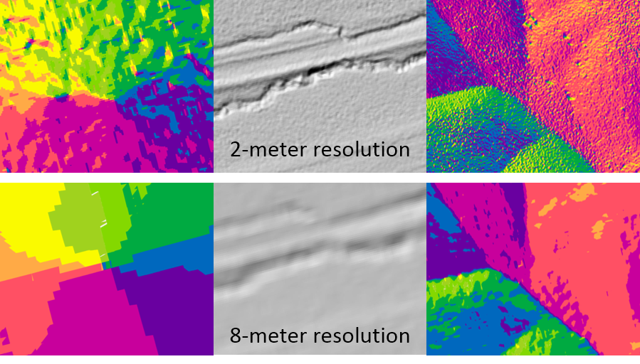
The Arctic Elevation dataset provides two-, five-, and eight-meter elevation for land north of 60°N. To date, 65% of the Arctic is covered—over 51 million square kilometers. As the PGC releases new digital elevation models (DEMs) throughout 2017, high-resolution, two-meter DEMs will gradually expand and replace the coverage of older, eight-meter data. This release alone expands Esri’s Arctic Elevation dataset by an additional six terabytes of two-meter data and one terabyte of five-meter data covering Canada, Greenland, Alaska, and more. The result is more detail than ever—see the improvement for New Siberian Islands (left), Ellesmere Island (center), and Wrangel Island (right).
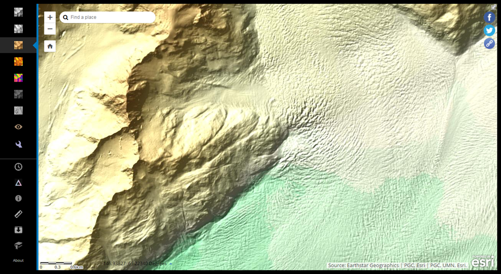
Arctic Elevation, offered as easy-to-access layers, maps, and apps, has numerous applications. Users can deploy these elevation layers in ArcGIS Pro, ArcMap, and custom web apps, viewing and analyzing them on-the-fly using dynamic functions like slope, aspect, hillshade, multi-dimensional hillshade, and others. Check out the Columbia Glacier below, for example, visualized with the ArcticDEM Explorer web app using an elevation tinted hillshade.
 Users can also explore Arctic elevation by acquisition date to analyze how Arctic topography changes in different seasons or years. Ever wonder how quickly a particular glacier is receding? Now you can find out for yourself.
Interested in learning more? Dive in to Esri’s ArcticDEM Explorer web app to interactively explore the latest high-resolution elevation data. Or, if you’re ready to start using Esri’s Arctic Elevation in your own applications, get started today with the Arctic DEM or with a free 60-day trial of ArcGIS Desktop Advanced.


Article Discussion: