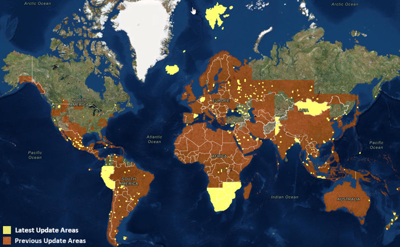
In our tireless quest to enhance our World Imagery map, we have released several more updates to our imagery this month. This includes another large batch of updates with DigitalGlobe imagery for parts of Africa, Asia, Europe, South America and well over 100 metro areas around the world. This also includes updates for several other areas with imagery acquired through our Community Maps program. The map below highlights (in yellow) the areas updated this month, and the areas (in orange) that were updated in the previous 7 months.
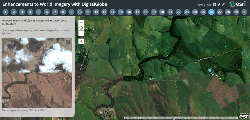
This is the latest in a series of updates to our World Imagery basemap with imagery provided by DigitalGlobe. This update includes Basemap +Vivid imagery for the areas in Southern Africa, Central Asia, South America, and Iceland shown above. The latest DigitalGlobe imagery significantly improves upon the image currency and quality in these countries and cities, as you can see for a few sample areas (tabs 25-30) in the story map below.
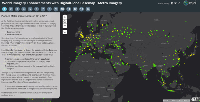
This update also includes Basemap +Metro sub-meter resolution (down to Level 19) imagery for many metropolitan areas around the world. We have now updated over 430 of a planned 750 metro areas with the latest DigitalGlobe Basemap +Metro imagery. The story map below enables you to see the areas that are planned for update, current status with our latest releases, and ‘before’ and ‘after’ examples for several metro areas. In the Current Status tab, you can click on individual metro areas to see the current deployment status and an estimated release date.
Over the next few months, Esri will continue to release regular updates to the World Imagery basemap with latest available imagery from both Basemap +Vivid and Basemap +Metro products.
Community Maps Imagery
In addition to this, we have also published new or updated imagery for the communities below:
- City of Rocklin, California
- City of SeaTac, Washington
- Douglas and Sarpy Counties, Nebraska
- City of New Westminster, BC, Canada (courtesy of Surrey, BC)
- City of Chestermere, AB, Canada
- City of Rimouski, QC, Canada
- State of Burgenland, Austria
- State of Nordrhein-Westfalen, Germany
- Country of New Zealand (several communities)
- Country of Spain (several communities)
The Living Atlas Curator’s Choice for our Community Maps imagery contributions in April is the City of Invercargill, New Zealand, which shared 5cm resolution (20cm accuracy) imagery of the City captured in January 2016. Check out the beautiful imagery for Queens Park below, and explore other parts of the City. This is currently the highest resolution imagery in the World Imagery map, and the first contribution cached to Level 22. We look forward to publishing other super high-res imagery from contributors in the future.
[iframe width=”100%” height=”400″ frameborder=”0″ scrolling=”no” marginheight=”0″ marginwidth=”0″ title=”Community Maps Imagery for Invercargill, New Zealand” src=”//arcgis-content.maps.arcgis.com/apps/Embed/index.html?webmap=3402aa36ef684735b8f9d88591c6b64c&extent=168.3542,-46.4044,168.3553,-46.404&zoom=true&scale=false&disable_scroll=true&theme=light”]
We would like to thank these contributors for sharing their imagery so it can be made available as part of our World Imagery map. If you have imagery that you’d like to share, please visit our Esri Community Maps for Imagery site to get started!


Article Discussion: