GIS isn’t just about the earth. From Mars Global Surveyor to Cassini to New Horizon, if there’s a probe snapping pictures of extraterrestrial bodies, GIS can and is being used to interpret much of their remotely sensed data. GIS and heavenly bodies go hand in hand.
With that astronomical pedigree, Esri is pleased to announce a recent enhancement to our 3.20 Javascript API has ushered web GIS into the hands of planetary scientists as a new tool in the ArcGIS platform at their disposal. Our hope is this enhancement will provide planetary scientists with the tools necessary to continue our exploration of our nearest neighbors and planetary systems.
Because terrestrial planets and moons are spatially investigable, ArcGIS has traditionally supported extraterrestrial coordinate systems and projections in core ArcGIS Desktop and ArcGIS Enterprise products since the version 9.x days. As GIS continued to democratize, grow, and expand into web GIS, support for extraterrestrial coordinate systems (projections) was never migrated over to ArcGIS Online.
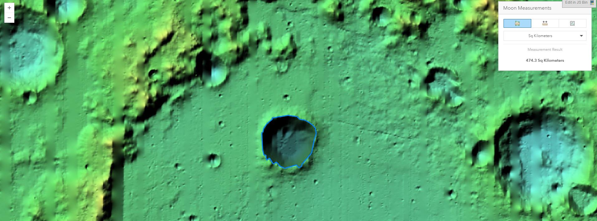
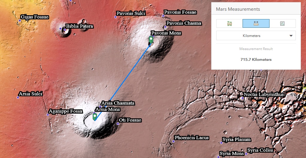
In early 2016, our planetary scientist customers began requesting this functionality, which set the wheels in motion to enhance our Javascript APIs. This enhancement ensures accurate distance referencing on the Scalebar Widget, as well as accurate distance and area measurements in the Measurement Widget when using the 2D ArcGIS Online Map Viewer, Web AppBuilder, and the Web App Templates. Seen above is an example of a crater area measurement on the Moon and below is an example of the distance measurement on Mars.
As many of you are familiar, ArcGIS Online’s Map Viewer runs natively off Esri’s 3.x Javascript API. With the March release of 3.20, ArcGIS Online now natively references the correct spheroids for the following bodies, listed below with their Well-Known IDs (WKIDs):
4326 (GCS_WGS_1984)
104900 (GCS_Mercury_2000)
104901 (GCS_Venus_1985)
104902 (GCS_Venus_2000)
104903 (GCS_Moon_2000)
104904 (GCS_Mars_1979)
104905 (GCS_Mars_2000)
104906 (GCS_Deimos_2000)
104907 (GCS_Phobos_2000)
104912 (GCS_Callisto_2000)
104915 (GCS_Europa_2000)
104916 (GCS_Ganymede_2000)
104918 (GCS_Io_2000)
104929 (GCS_Enceladus_2000)
104943 (GCS_Titan_2000)
Additionally, expect support in this Summer’s ArcGIS Desktop and Enterprise 10.5.1 and Pro 2.0 release for (Online and API support will follow in the next releases):
104971 (Mars 2000 [Sphere])
104972 (1 Ceres 2015)
104973 (4 Vesta 2015)
104974 (Mercury 2015)
We’re continuing to enhance support in the 4.x Javascript API to extend the same functionality in 3D.
<<2021 Update: Support for global 3D visualizations for Moon and Mars, when instantiated using the ArcGIS API for JavaScript directly, has been added in our 4.18 JS release. This means that accurate measurement works for those two planets in global mode. Note that saving to a web scene is not currently supported>>.
To leverage the above 2D functionality, make sure you’re publishing a service in the native coordinate system of your planetary body to your ArcGIS Server. When you register that service REST endpoint with ArcGIS Online, the Javascript API will do the rest!
NASA’s announcement last month of the 7 planets in the Trappist-I system showed the underlying excitement to study our neighboring solar systems by the general populace. We’ll leave the “getting there” part to NASA and its private partners. However, we’ll avidly be standing by to spatially orient the data collected from their missions.
Our hope is that we can continually assist scientists with the tools to determine the best landing sites and their proximity to resources, expected topographical and geologic challenges upon arrival, and strategies for inhabitation moving forward. (Internally, we’re still trying to convince Jack that GIS could also stand for Galactic Information System; we’ll see how far we get!).
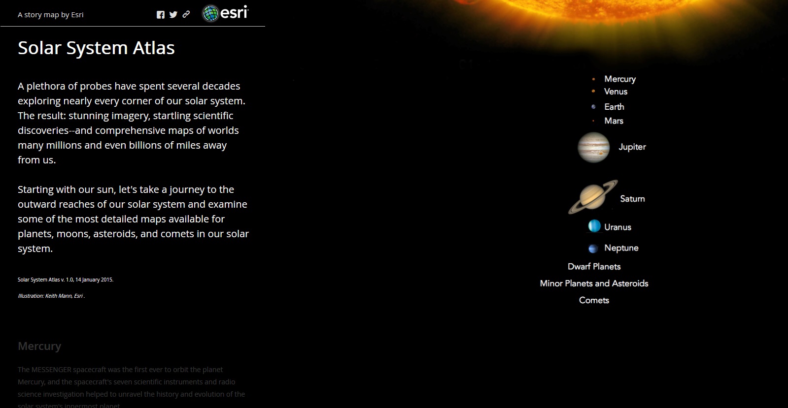
Finally, if you’re curious to know more on how GIS can help to educate others on Planetary Science, you can learn more about our home solar system in the meantime by browsing the interactive maps in the Solar System Atlas by clicking here.
Before you go, Esri would like to recognize and extend a special thanks to Dr. Fred Calef of NASA JPL, Emily Law of NASA JPL, Trent Hare of USGS, Dr. Kara Latorella of NASA Langley, and Matt Tisdale of Booz Allen Hamilton at NASA Langley, for their requirements gathering, dedicated commentary, and testing assistance to make this functionality a reality for the entire Planetary Sciences community. Please give these folks a pat on the back if you see them!
About the author


Article Discussion: