In this latest release for ArcGIS Online we have added in a few new features to the Scene Viewer that can help you create interesting web scenes.
Enhancements to Point Layer Styles
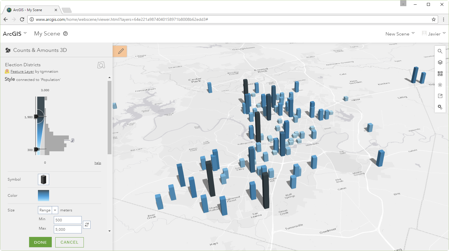
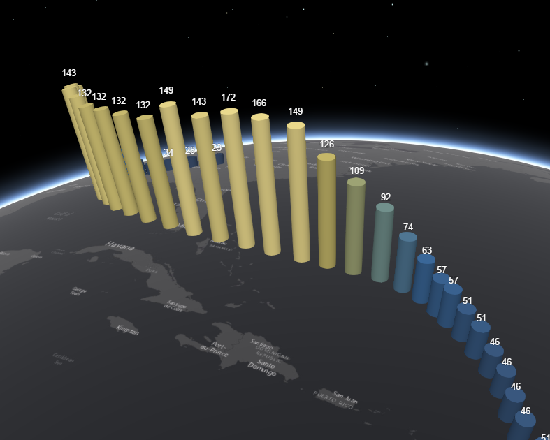
In the December release of the Scene Viewer we added in support for smart mapping and rich new 3D layer styles for point features. In this release we continue adding new features and improving the user experience.
New 3D Symbols
You can now use 3 new symbols to style your points: ”Tall Cylinder”, “Tall Cone” and “Tall Cube”. They are very well suited for thematically display attribute data. We call them “tall” symbols because the attribute you chose to visualize the point style will drive the height of the symbol, while keeping a constant width and depth. See as an example:
Another enhancement we have made for using 3D point symbols when you are configuring your layer is that you can now choose size units when entering a symbol size.
Label Support
We’re very excited also to announce a powerful addition to the Point layer style: configuring labels. You can now easily choose the attribute to use for your labels as well as 9 placement positions, which work both on 2D and 3D symbols.
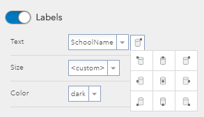
You can also configure properties like size and color. Ah, and it is also important to note that labels are automatically deconflicted in 3D space, so that they don’t overlap.
Touch Navigation
Another great feature we have added to the scene viewer is full touch navigation. On touch screen laptops and monitors you can pan, zoom, rotate and tilt the scene with simple touch gestures. If you can zoom by pinching with two fingers and pan using one or multiple fingers. You can also double-tap the scene to zoom in a step towards the tapped location. To rotate the scene, move two fingers in a clockwise or counterclockwise direction. In 3D you can tilt the scene by dragging two fingers up or down the screen.
New Layers Supported in the Scene Viewer
In the last release of the Scene Viewer we added support for Vector Tile Layers, Point Cloud Scene Layers and Dynamic Renderers on Map Services. In this release of the Scene Viewer we added support for OGC Web Map Tile Service (WMTS) layers.
These WMTS layers can be added into the scene viewer through ArcGIS Online by clicking on the Open in Scene Viewer option displayed with the item or you can search for the item in the Scene Viewer which will add the item from your Organization or ArcGIS Online. Currently custom parameters are not supported at this release.
Please post any feedback or questions you have on the latest features below.
Cheers,
Russ


Commenting is not enabled for this article.