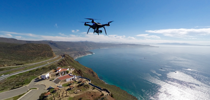
Have a drone? Not sure the best way to manage and process your data? Esri can help! Both ortho mapping in ArcGIS Pro and Drone2Map for ArcGIS are powerful tools to unlock the full potential of your drone imagery (and more).
What’s the difference? Which you choose will probably depend on how much photogrammetric functionality your organization requires. The ortho mapping tools built into ArcGIS Pro support the camera models found on most drones, plus those found on many commercially available aerial and satellite sensors. If you want a targeted application that focuses solely on drone imagery, on the other hand, Drone2Map for ArcGIS may be the place to start.
Ortho mapping tools can be used to process a range of 2D imagery into terrain and orthorectified image products. Ortho mapping tools are included with ArcGIS Pro (Advanced license), and provide a familiar experience for practiced imagery users. For example, use ortho mapping tools to create digital terrain models and orthophotos within your GIS, or to increase the accuracy of imagery managed in mosaic datasets.
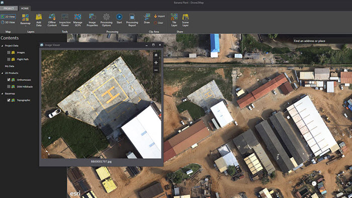
Drone2Map for ArcGIS, on the other hand, offers streamlined workflows that quickly convert drone images into useable products. In addition to 2D imagery, Drone2Map also supports 3D workflows. Drone2Map ArcGIS is a standalone product that doesn’t require ArcGIS Desktop, and may be more approachable for a GIS user with less imagery experience. You might use Drone2Map to do rapid quality control with your drone imagery in the field, for example, or to create a 3D textured mesh of terrain and buildings. Whatever the application, Drone2Map is highly efficient, dedicated software built specifically for drone imagery.
For some organizations, both Drone2Map for ArcGIS and ArcGIS Pro ortho mapping may offer valuable solutions. Need to process drone data quickly in the field, but also manage large orthophoto production projects? Leverage both Drone2Map and ArcGIS Pro ortho mapping tools to get the most from your drone imagery. Plus, get expanded Drone2Map analytical capabilities when you pair it with ArcGIS Pro.
So next time you’re staring at file after file of images from your last drone flight, wondering where to get started, try out Drone2Map for ArcGIS or try a free 60-day trial of ArcGIS Pro. And if your drone is capturing video, check out the Full Motion Video capability of ArcGIS Image Analyst extension for ArcGIS Pro.
Have questions? Want to tell us about the awesome things you’re doing with ortho mapping tools or Drone2Map? Email Esri at ImageManagementWorkflows@esri.com.

Commenting is not enabled for this article.