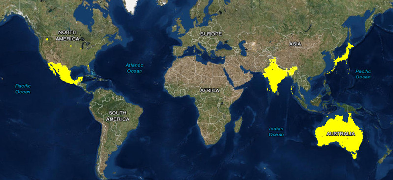
As part of the September updates to ArcGIS Online, we have updated large parts (over 13 million km2) of our World Imagery basemap with imagery from DigitalGlobe and the GIS user community. The update features new and improved high-resolution imagery for most of Australia, India, Mexico, and Japan as shown below.
This is the first in a series of planned updates to our World Imagery basemap with imagery provided by DigitalGlobe. As announced in late June at the Esri International User Conference, Esri has partnered with DigitalGlobe to update our World Imagery basemap with the latest available DigitalGlobe basemap imagery content. This includes imagery from DigitalGlobe’s Basemap +Vivid and Basemap +Metro products.
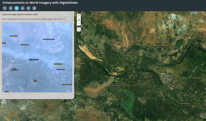
This is the first of several updates with Basemap +Vivid imagery, which is now available at 1m resolution (down to Level 17) for Australia, India, Mexico, and Japan. The Basemap +Vivid imagery significantly improves upon the image currency and quality in these countries, as you can see for a few sample areas in the story map below.
Over the next few months, Esri will continue to release regular updates to the World Imagery basemap with latest available imagery from both Basemap +Vivid and Basemap +Metro products. The next +Vivid updates will include 1m resolution imagery for Brazil as well sub-meter resolution imagery for large parts of Western Europe. In addition, we will soon release the first set of +Metro updates with sub-meter resolution imagery for hundreds of large metro areas around the world.
The World Imagery basemap, and the Living Atlas of the World as a whole, continues to get better as we release more recent and detailed imagery from DigitalGlobe and others in the GIS user community!


Article Discussion: