You may have noticed the new look and functionality added to ArcGIS Online in the latest release. Did you know that some of this added functionality was supported by the ideas from customers like you? With this release, twenty-two Ideas were marked as implemented and partially implemented, that were logged on the ideas site. As the ideas span across many features, here is a brief Ideas Tour of the new release!
Items Pages
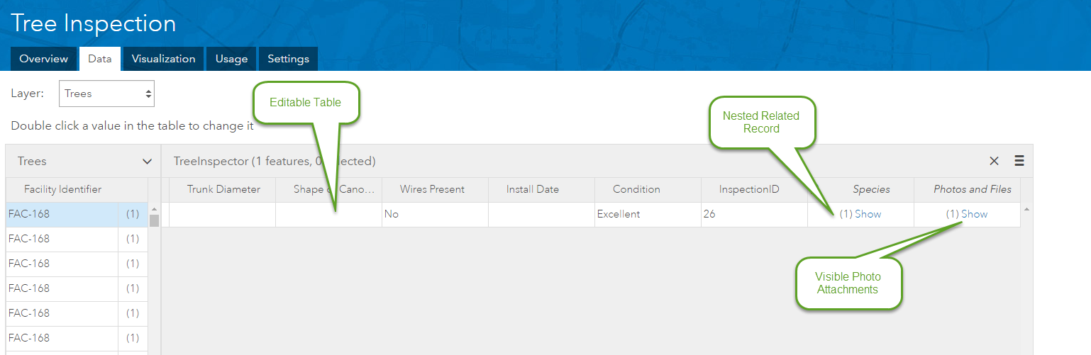
Viewing and working with attribute data has been integrated into the improved items page, exposing new ways to view and interact with your data with the data tab. New functionality includes the ability to edit data in the table as well as the ability to edit and display related records. This includes images that have been attached to a related record and nested related records.
The usage tab provides a clean dashboard view to get insight into usage patterns on your items, including your apps. The new visualization tab provides some excellent functionality to style, label and create pop ups on your layer. This will allow you to configure a pop up on the layer and choose if the pop up should be displayed in your web map or app, while maintaining the configuration.
Map Viewer
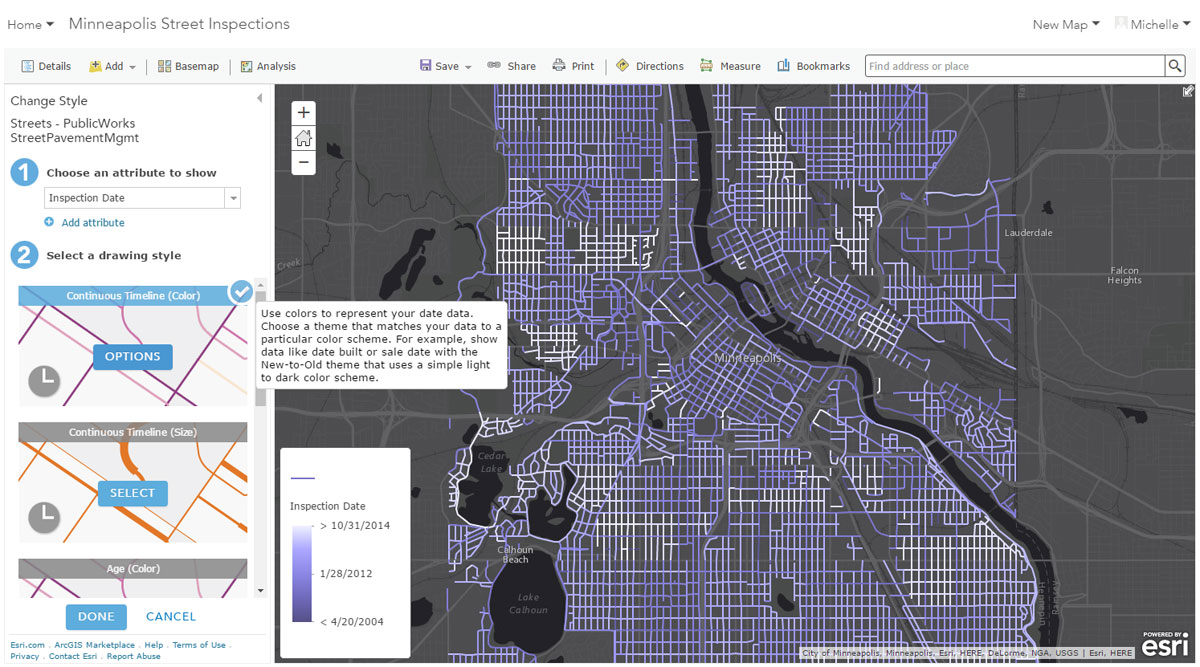
Some great functionality has been added to the mapviewer to help in the authouring of web maps. The ability to filter data based on date fields using dynamic date ranges and between dates has been added. A combination of date filtering and new Smart Mapping styles have also been added to better symbolize date/time data.
Improvements have been made to the supported features with OGC layers. You can now view a legend and configure a pop-up for WMS and WFS layers with the capabilities enabled on the layers. Adding a WFS as an item is also supported. There are example services available on the help site for testing.
Speaking of pop ups and related records, you can now format pop-ups to include fields from your related records! Is it hard to remember what the order is for inputting coordinates when searching in the map viewer? You can now reverse some coordinates order from Lat/Long to Long/Lat when searching for locations when the geocoding service supports the combination. This will be fully implemented later this summer.
Configurable Apps
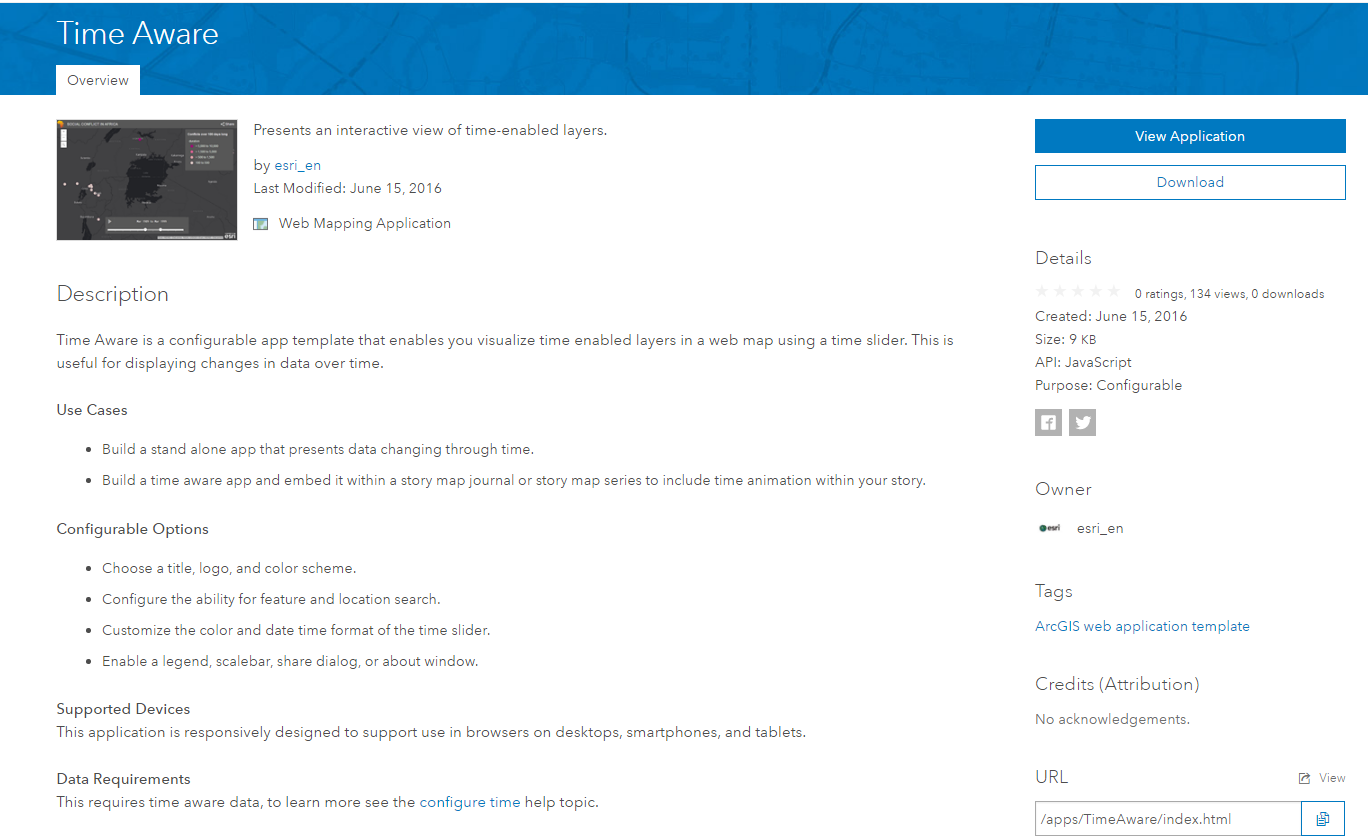
The Configurable Application Templates item descriptions have been refreshed, including an added data requirements section! The Crowdsource Manager app and Web AppBuilder have added functionality for selecting features.
Administration
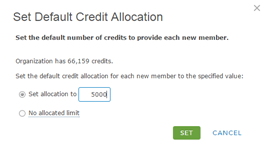
Last but not least, some improvements have been made to the credit allocation process. You can now set credit budgets during the invitation process as well as set an org specific default limit!
Thank you for submitting and voting on these great ideas! Keep submitting and discussing your ideas about what problems you would like to see solved in future versions of the software!
For a complete list of implemented ideas, see the following link.

Article Discussion: