Recently, an extensive collection of Lidar data of England and Wales was made available by Environment agency of England and Natural Resources Wales respectively. At 2 meters resolution (cell size), the lidar derived DTM (bare earth) covers nearly three quarters (~70%) of England and Wales. The data mainly covers flood plains, coastal zones and urban areas and will aid in improving the quality of flood risk modeling.
We are excited to make this high-resolution collection available in Esri World Elevation services. With this update, there is now 25 times more detail in these countries.
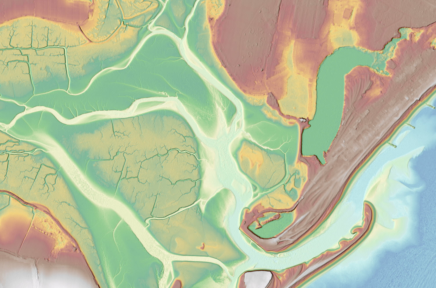
Pagham coastal area in South East England depicted with 2 meter Lidar derived digital terrain model
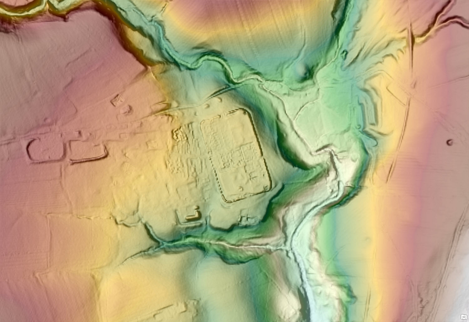 Vindolanda Roman fort depicted with 2 meter Lidar derived digital terrain model
The world elevation image services (Terrain and TopoBathy), which provide online access to a global collection of multi-resolution and multisource elevation data, can be used for visualization (such as multi-directional hillshade, tinted hillshade) and analysis. In ArcGIS for Desktop, a temporary layer can be generated using Make Image Server Layer tool to use as an input in GP tools to perform the analysis. The parameters such as the extent, cell size, query and output coordinate system can be defined using Make Image Server Layer tool to produce the output layer. A query will select a subset of items within the image service thus restricting the analysis to a particular data source available in these services. For example, a definition query of “ProductName” = ‘England_DTM2m’ will filter data pertaining to England 2m DTM only.
These global layers are available free of cost to every ArcGIS Organizational account user. The updates will also be rolled out to world elevation derivative products – Terrain 3D and World Hillshade.
For more information about the coverage of the World Elevation services check our Elevation coverage map. Additionally, to contribute high-resolution elevation data to Living Atlas of the World, check Esri Community Maps for Elevation program.


Article Discussion: