ArcGIS Open Data was renamed to ArcGIS Hub on June 28, 2017.
ArcGIS Open Data just released a bunch of new features and functionality to augment the citizen experience of finding and collecting open data and information. Read on to learn more about what’s new and explore the umbrella site, opendata.arcgis.com, to see them in action. These features are coming soon to customer sites.
Connected Content
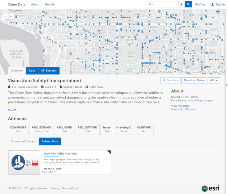
Having data points on the map and in the table is a first step in helping to create a more informed community. However, it’s the information that is created with this data that speeds up this process and makes the data more accessible to many more people. A dataset’s connected content will provide users with more information and context about the dataset they are viewing. For the first iteration, when viewing a dataset page, citizens will see any web maps that contain that dataset and can explore the dataset in a new way. These web maps must be shared with an open data group to appear. Future releases will highlight connected apps, reports, GitHub repos and more, as well as citizen-submitted content.
API Explorer
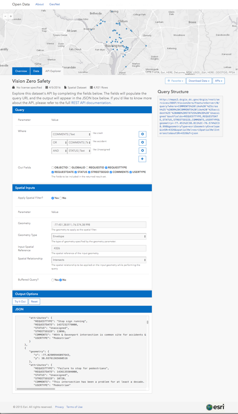
Every dataset found on an ArcGIS Open Data site (both spatial and non-spatial!) is backed by the Geoservices REST API. This powerful API is the programatic gateway to the data, which now has a new intuitive interface embedded within ArcGIS Open Data to allow developers easily access and use authoritative datasets. This explorer is unique for each dataset and guides citizens and developers by offering the dataset’s attributes in the general query, and it allows the user to pan and zoom the map to establish their spatial query — a big improvement over typing coordinates for a bounding box! The query structure is modified as the parameter values change (this is used to call for the data) and the data is returned in the JSON box below as well as visualized on the map.
Social Logins
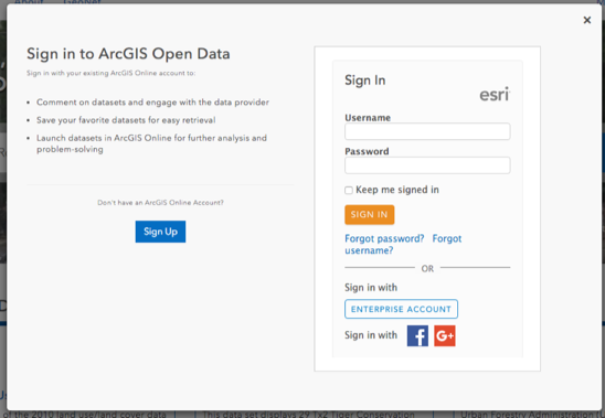
Following the release of social logins in ArcGIS Online, ArcGIS Open Data now supports user sign in from Facebook and Google+. Signing in with these accounts will associate the social media account with a free ArcGIS Online public account. This account is used to take advantage of features like favorites and other upcoming citizen functionality.
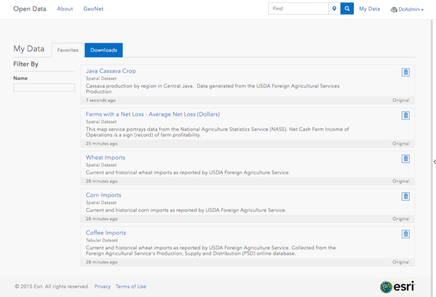
My Data
Signed in citizens now have a new page to keep track of their download history and favorited datasets. This is helpful for citizens working on long term projects that find themselves coming back to datasets over and over again. My Data will be the starting point for future capabilities, like launching a group of datasets into Story Maps and building out other web apps and dashboards.
Downloads
We slightly modified the way we process downloads on all sites, both on opendata.arcgis.com and customer sites. We now generate download caches in the background and all downloads should be served immediately.
How it worked before: Every dataset download generates a cache the first time a user downloads it. The next time a user requests a download, if that cache is out of date (either more than 24 hours has passed since the cache was generated for on premises services, or the data has been updated for hosted services) the user waits for a new cache to be generated. This can take a while depending on the dataset.
How it works now: Every dataset download generates a cache the first time a user downloads it. The next time a user requests a download, if that cache is out of date (either more than 24 hours has passed since the cache was generated, or the data has been updated), the user receives the last generated download and a new download is generated in the background for each subsequent request. Effectively, besides the first request, the user will never have to wait for a download to be generated and served. All downloads will have a last-modified header that indicates when the data was retrieved from the underlying service.
—
That’s all for now! We encourage you to poke around, try these new features in action, and let us know what you think or what you’d like to see next. We’re always listening on GeoNet.
Article Discussion: