Throughout 2016, we will be presenting a series of ArcGIS Scene Viewer tips and tricks. We hope these posts will help you work more efficiently, produce better 3D visualizations, and really harness the power of your 2D and 3D data with the scene viewer. In the previous post, we offered some tips about the basemap gallery and your scene title and icon. This post focuses on local scenes with scene layers.
Local scene
With a local scene in the scene viewer, you can project local data on a planar surface in a different spatial reference than Web Mercator. It is best to use local scenes when you already have data in a local spatial reference or your project requires that all your data be in a specific local spatial reference.
It is now possible to create a local scene with scene layers in the scene viewer. With the release of the Portal for ArcGIS 10.4 and ArcGIS Pro 1.2, scene layers can be published from Pro to Portal and added to a local scene. This means that if you have a multipatch dataset in a local spatial reference of downtown buildings in your city, for example, you can now add them to a scene in the scene viewer and share with your organization or the public.
Layers and basemap
When working with local scenes in the scene viewer consider the following:
- You need to provide all layers including elevation.
- All layers and basemap must be in the same spatial reference.
In local scenes, basemaps with a local spatial reference don’t include elevation as they do in global scenes. Therefore, you need to add an elevation layer to be able to show terrain with elevation (see publish and elevation image service for more information). The basemap and elevation layer must be in the same spatial reference and have the same tiling scheme which satisfies the scene viewer tiling scheme requirements. You can configure the basemap gallery and add this custom basemap to the scene viewer which matches the elevation layer.
Publish a scene layer
Once you have the base layers in the same spatial reference, you can create your building scene layer. Use ArcGIS Pro 1.2 and Portal for ArcGIS 10.4, to publish your buildings as a scene layer with the same spatial reference as the basemap and elevation. Here’s how:
- Create a local scene in Pro (see author a web scene for more information).
- Add your building multipatch dataset to the scene.
- Set the local scene coordinate system to match the spatial reference of the basemap and elevation. (Note: This is an important step. When you publish a scene layer from a local scene in Pro, during the caching process the scene layer will reproject to the coordinate system you set in the local scene.)
- Publish your buildings layer as a scene layer. A scene layer service is created in Portal for ArcGIS 10.4 (see sharing a web scene layer for more information).
Create a local scene with your buildings
Now that you have all your layers in the same spatial reference you can create a local scene in the scene viewer to show your buildings with elevation.
- Open the scene viewer.
- Click
 New Local Scene.
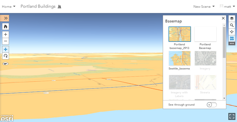
 - Click the Basemap button
 in the viewer tools on the right.
 - Choose the custom basemap from the gallery that matches the elevation layer:
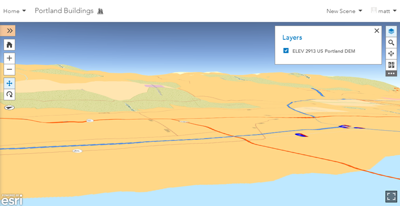
- Add the elevation layer
 from Portal to show elevation with the basemap:
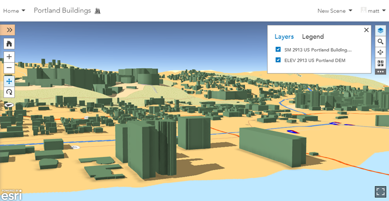
- Add your building scene layer
 :
:
- Save the scene.
You have created a dynamic 3D local scene of your buildings that you can share with your organization and the public.
Stay tuned here for more exciting scene viewer tips and tricks to come! Also, take a look at scene help in ArcGIS Online to learn even more about scenes.


Commenting is not enabled for this article.