Navigator for ArcGIS is an app that gets you or your workforce where it needs to be, improving efficiency and reliability. Like many consumer grade navigation products, Navigator calculates directions, searches for addresses and places, and guides you to your destination with voice and turn-by-turn directions. Unlike these offerings, Navigator connects with other apps and devices, calculates custom travel routes, creates multi-stop routes, and gets directions even in disconnected areas.
For these reasons, Navigator is a commercial rather than a consumer grade solution. Whether you are a manager looking to improve your organization’s performance and bottom line, or a field worker figuring out how to do your job better, you can benefit from Navigator for ArcGIS.
Connect with other apps and devices
Navigator seamlessly integrates with your organization’s apps. Whether data about stops is stored in Collector for ArcGIS, or another business app, this information can be sent directly to Navigator. For field workers, this means that all of the data that you need is available on one device and managed within the ArcGIS platform. For managers, Navigator will reduce driving times, while increasing customer confidence and earnings.
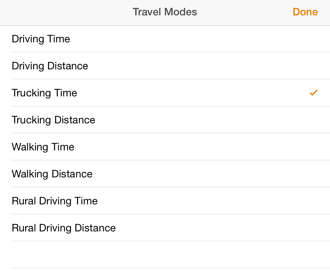
Calculate custom travel routes
Navigator also calculates highly precise routes. As a field worker, you can receive travel routes based on whether you drive a truck or car. These travel modes are based on road capabilities and curb approach guidelines. In short, you are guaranteed the best route, honoring the rules of the road that apply to you.
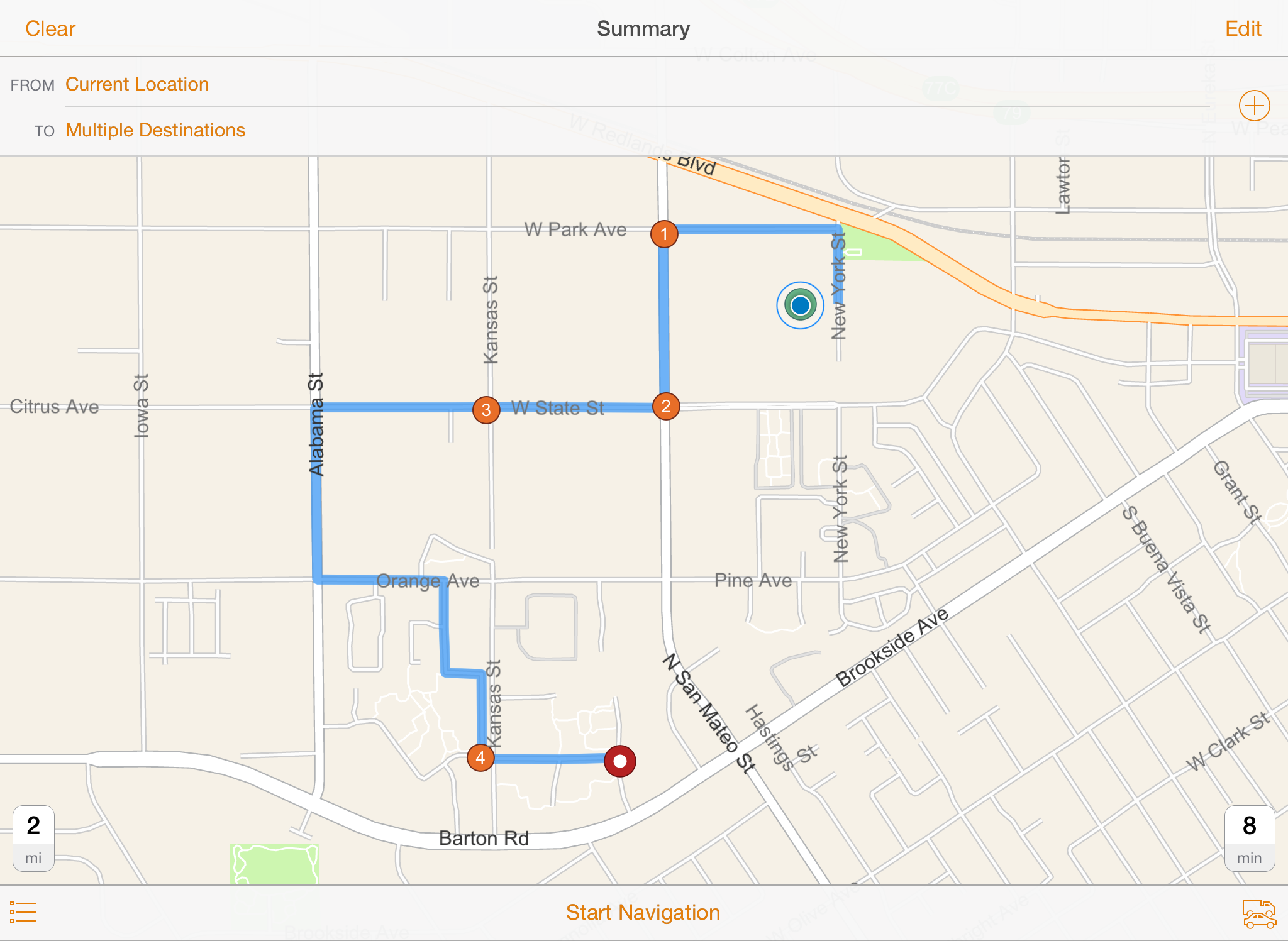
Create multi-stop routes
You can also calculate multi-stop routes with Navigator. As a field worker, you can create a work list of all your stops at the beginning of the day, saving you time and 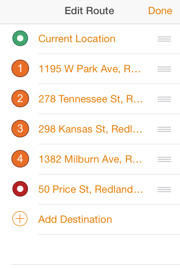 energy. You can also search for additional stops or information within your data. As a manager, you will appreciate that Navigator allows your workforce to do its job more quickly and efficiently.
Get directions anytime, anywhere
Users can complete all of these tasks while they are disconnected. So even if you need to travel off the beaten path, you will still receive accurate and up-to-date directions and tasks. As a manager, you will know that your team is always able to do its job and avoid duplication.
What’s next?
Today, ready-to-use maps and commercial street data for Navigator are available for download to your device through ArcGIS Online. Future releases of ArcGIS Pro will support the use of your organization’s own custom maps and data in the app. This means support for routing on custom roads, searching against custom geocoding locators, and customizing the map display. You will also be able to create your own custom travel mode for say, an emergency vehicle. We are also working to provide navigation maps for areas outside of North America and Europe. And of course, we are developing Android and Windows versions of the app. Click here for more details about what’s being planned for Navigator.
How do I start using Navigator?
See for yourself how your organization can benefit from Navigator for ArcGIS and download it today from the Apple App Store. To use the app you must have an ArcGIS Online account that has been configured with a Navigator for ArcGIS license. For more information, click here.

Article Discussion: