Organizations around the world are discovering the benefits of sharing their imagery with ArcGIS Online and the Living Atlas of the World. Communities both large and small are applying their hosted imagery to solve problems and tackle projects.
The City of Fargo, ND has been routinely contributing to Esri’s Online Basemaps for over 5 years. “The relationship we have formed with the Esri Community Maps team definitely made it an easy decision for us and our area contributors to begin sharing imagery. The City of Fargo uses an ArcGIS Online Organization Account. We have several maps and apps that we host in our organization’s account for our staff. We like using Esri’s services because it is convenient and reduces the amount of onsite resource we would need if we hosted all of our own Basemaps”, Daryl Masten, GIS Manager for the City of Fargo.
Fargo worked closely with Cass County and West Fargo on the North Dakota side and Clay County, City of Dilworth and City of Moorhead on the Minnesota side, along with Metro Council of Governments on the latest aerial photo acquisition project.
[iframe width=”800″ height=”400″ frameborder=”0″ scrolling=”no” marginheight=”0″ marginwidth=”0″ src=”http://arcgis-content.maps.arcgis.com/apps/Embed/index.html?webmap=61b8d71e093e4c45a606acd719e918b4&extent=-96.7949,46.8781,-96.7912,46.8796&zoom=true&scale=true&theme=light”][/iframe]
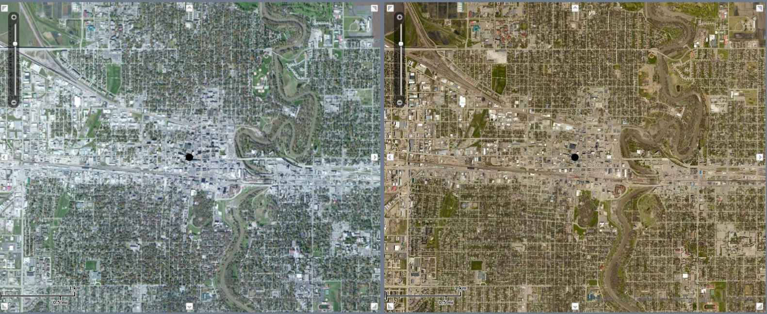
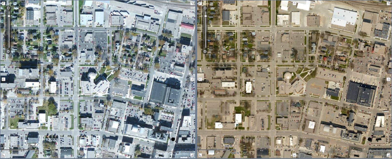
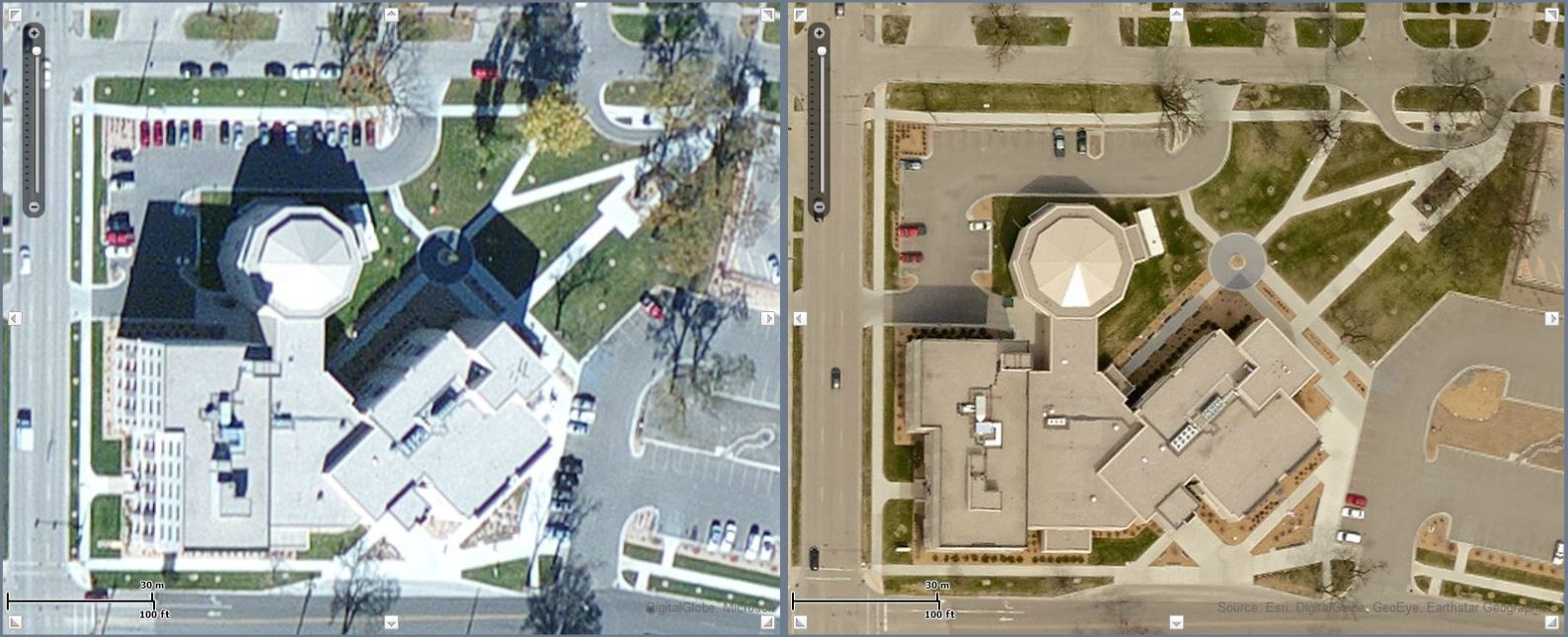
During a recent exchange with Daryl, he told me that the organizations working on this aerial acquisition project understand the value in using Esri’s secure cloud services. When they recognized that their recent acquisition exceeded the resolution of the imagery currently being hosted on ArcGIS Online, they decided to contribute their imagery. “Having the services off site and mashed together to make a larger coverage area than what we maintain has been beneficial and convenient. We wanted to make the imagery service more valuable to us by updating it with our newer, high-resolution imagery”, Daryl Masten.
Updated imagery shown in right pane
The Fargo-Moorhead metropolitan area has been working with the Corps of Engineers on a Red River of the North diversion around the area. It is a large project estimated at 1.5 billion dollars. The project will impact areas inside (protected by the diversion) and areas outside (not protected) of the diversion channel. In order to get a better feel and understanding of the impacts of the division many studies have been conducted and continue to be conducted in the region. The area is growing quickly, particularly the cities of Fargo and West Fargo. The Corps of Engineers wants to keep track of the growth and how it impacts the areas protected and not protected by the diversion. High resolution, routinely updated aerials are a valuable tool for tracking this growth and analyzing the impact it has.
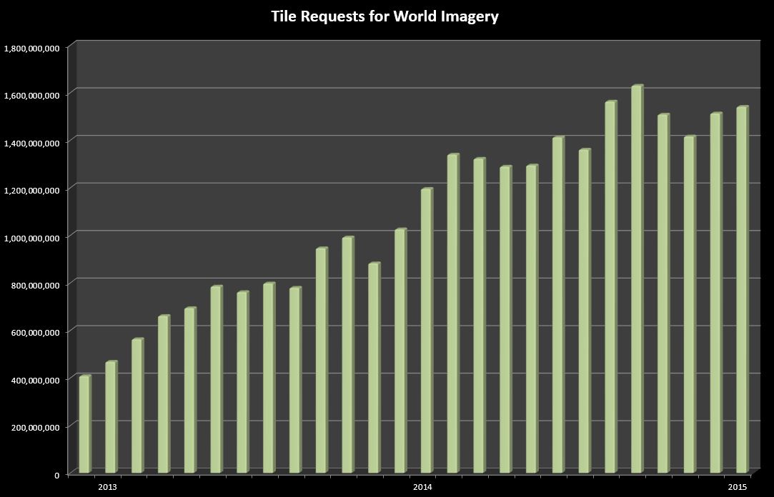
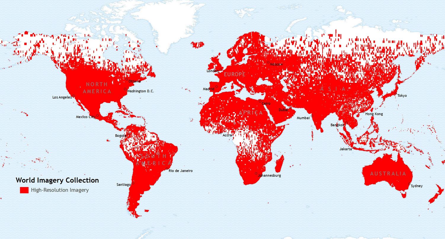
The City of Fargo understands that modern GIS requires information sharing and participation. There are thousands of organizations around the world who also understand this and are discovering how sharing their high-resolution imagery can benefit their communities. Esri’s World Imagery Service is one of the most popularly requested basemaps and continues to grow with user community contributions.
There are three ready to use web maps that use the World Imagery service as their basemap, Imagery, in which both reference layers are turned off, Imagery with Labels, which has World Boundaries and Places turned on but World Transportation turned off, and Imagery with Labels and Transportation, which has both reference layers turned on.
World Imagery Collection
Have you ever seen a problem in the Esri World Imagery Map that you wanted to see fixed? You can use the Imagery Map Feedback web map to provide feedback on issues or errors that you see. The feedback will be reviewed by the ArcGIS Online team and considered for one of our updates.
The ArcGIS Content team is actively seeking high-resolution imagery. If your organization has questions about imagery criteria and are interested in sharing imagery, please email us at communitymaps@esri.com.


Article Discussion: