 The Hydrology Analysis tools, Watershed and Trace Downstream, have been available in ArcGIS for Desktop for over a year now, and many water resources users are utilizing these fast and accurate Geoprocessing services. We’re happy to announce that these two tools are now available out-of-the-box in the ArcGIS Online web map viewer.
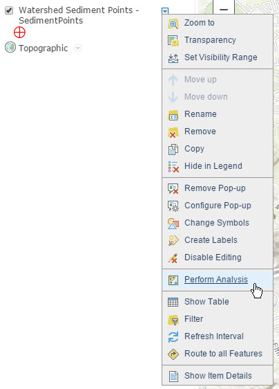
To use the Create Watersheds and Trace Downstream analysis tools, add your point layer to a web map then click the drop down arrow to reveal the Perform Analysis menu.
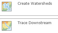
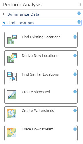
In this menu, select Find Locations. The Find Locations list includes Create Watersheds and Trace Downstream.
Create Watersheds and Trace Downstream in ArcGIS Online are driven by the Watershed and Trace Downstream Geoprocessing services. These tools are built on authoritative datasets from the USGS and World Wildlife Fund and produce fast and accurate upstream drainage basins and downstream flow paths. For more information on the data behind these tools, please read our Official Release blog.
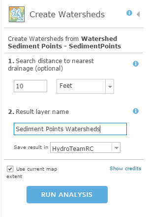
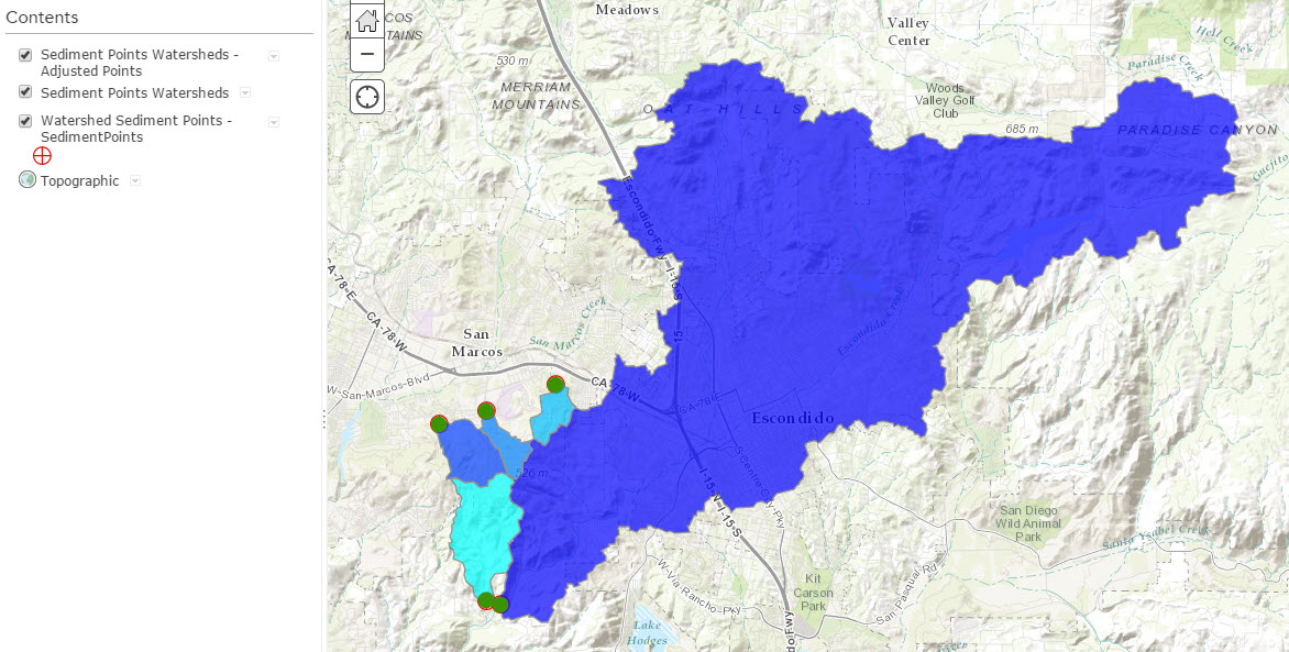
To use the Watershed tool in ArcGIS Online, select Create Watersheds. The first input is Search distance to nearest drainage. This is similar to the Snap Distance parameter in the Desktop tool. This parameter will snap you to the closest stream within a certain distance (in the example below I use 10 Feet). You can leave this blank, and the tool will automatically snap you to the closest stream within a default distance of 5 cells. The second input is the result layer name, and then you can save your result in your ArcGIS Online Organization Account. This tool runs against the finest resolution data available in your area of interest. In the US, the finest resolution is 30m data from the USGS, and in the rest of the world, the finest resolution is 90m data from the HydroSHEDS project–a product by the World Wildlife Fund and the USGS.
The resulting layers are added to your web map: Watershed polygons from the 30m or 90m data and the Adjusted Points, which are the snapped points used to calculate the watersheds.
The Trace Downstream tool is just as easy to use, and is based upon the same datasets as Create Watersheds. However, this ArcGIS Online tool was built with some additional functionality. Trace Downstream in ArcGIS Online allows you to split the resulting downstream flow path into line segments, and also clip the line at a designated distance (1,000 Miles in the example below).
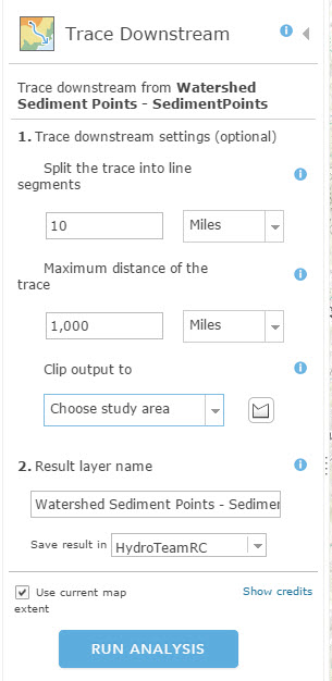
The resulting downstream trace line shows the downstream flow path that water would take if it were dropped at each input point location, all the way out to the ocean, and also gives you measurements of how far that water actually went.
We hope you find these two new additions to ArcGIS Online’s analytic capabilities exciting and useful!
Please send any and all feedback to HydroTeamRC@esri.com


Commenting is not enabled for this article.