by Nahm Lee, Santa Clara Valley Water District
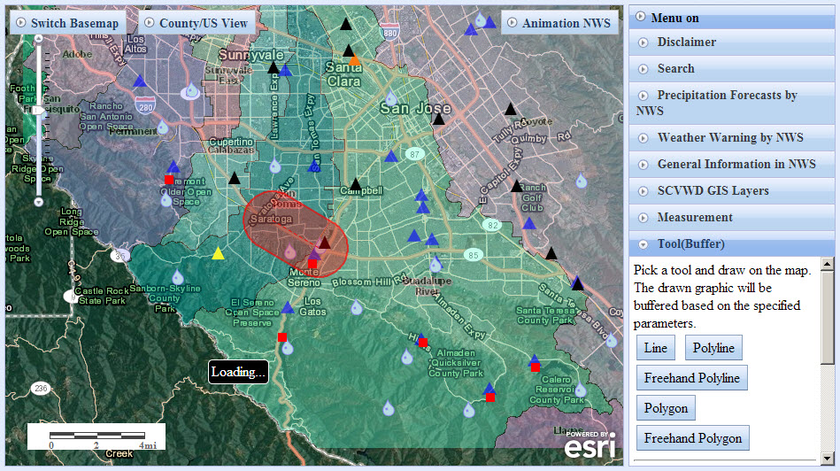
The Santa Clara Valley Water District Alert web map was designed using the ESRI javascript API. Santa Clara Valley Water District provides real time rainfall, stream flow/stage and reservoir storage/elevation data for Santa Clara County. The Alert web map uses overlay techniques to deliver National Weather Service (NWS) forecasted rainfall up to 72hrs and NWS issued weather warnings for the county. NWS radar animation lasts up to 3 hours and provides the latest rainfall information. Residents in the county can use the Alert map to get real time and advanced flood related information.
The Alert web map also provides District GIS layers, creek and 2006 Lidar data and more. Managers and Engineers who are not familiar with Desktop GIS software can use the Alert map to view District GIS layers and some basic GIS tools (distance, area, location measurement and buffering) all in an online environment.
Please explore Santa Clara Counties’ Alert web map, and consider creating a similar online experience for your county.


Article Discussion: