by Gil Strassberg, Aquaveo
 A new release (3.2.0) of the Arc Hydro Groundwater (AHGW) tools is now available. You can download the new version from the Aquaveo website, or read about the new features on the AHGW Wiki.
Some of the new tools available are:
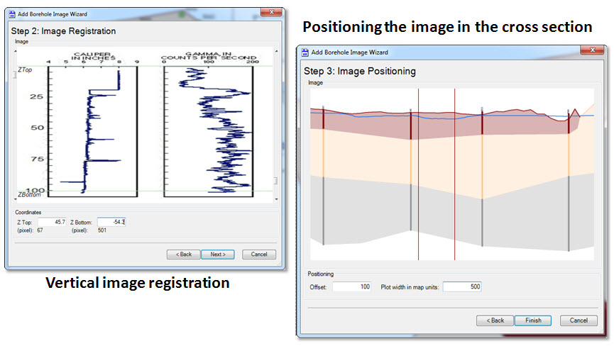
- Wizard for adding borehole images to cross sections.
- GP tool for modifying existing geodatabases for use with AHGW. It creates empty tables and feature classes that conform to the Arc Hydro Groundwater data model.
- GP tools to transform lines/points intersecting a cross section (e.g. spring, river, fault, county boundary) to points on the cross section.
- GP tool to transform cross section lines to 3D points.
One of interesting new features is a new wizard for adding borehole images (e.g. geophysical plots) to cross sections. In a previous post we discussed the ability to create 2D cross sections describing the subsurface using the Subsurface Analyst tools.
With the new wizard you will be able to add existing borehole images to cross sections in ArcMap.
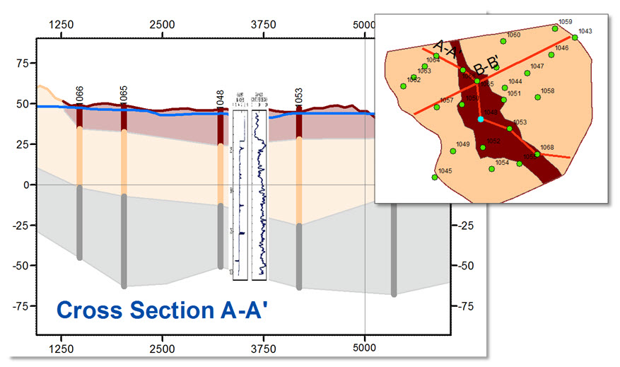
The process of adding a borehole image to a cross section includes identifying the borehole to which the image is related, selecting a cross section on which the image will be projected, and referencing the image vertically. The new Add Borehole Image Wizard makes it easy to perform the registration and to view the geophysical data on top of other information shown in the cross section.
Special thanks to Gil Strassberg (gstrassberg@aquaveo.com) for contributing this post. Additional information can be found on the Aquaveo website (www.aquaveo.com/archydro).


Article Discussion: