 Imagine being able to have an idea of where flooding issues are at the outset of a project. What if we could squeeze government dollars a bit harder and quickly map flood risk for a whole nation?
Making good use of available GIS data and new tools in the armory of our profession are rapid flood inundation models like Halcrow’s ISIS-FAST. The tool provides a quick assessment of flooding using simplified hydraulic principles to provide results up to 1000 times quicker when compared to other tools and methods available for flood inundation simulations – i.e. providing results in minutes as opposed to hours or days.
ISIS-FAST works by first identifying depressions on the floodplain before routing water through these depressions. Water depths in the depressions are determined by: volume of water flowing into that depression; level at which water can spill into neighboring depressions; and water level in neighboring depressions. ISIS FAST represents connectivity and volume filling effects on the floodplain, without having to represent detailed hydraulics.
A model is very quickly constructed using ArcGIS to develop the input components:
- a digital terrain model (DTM);
- model area of interest polygon feature class;
- rainfall/runoff extent polygon feature class;
- boundary condition location feature classes;
- feature classes to modify the DTM – polylines to define levees etc
Hydrologic inputs can be entered directly; by copying from Excel or developing input data files. ISIS-FAST’s output is provided in raster and shapefile format that can be easily brought in to ArcMap to facilitate discussions in the team or to develop mapping products for clients.
Applications to date:
The ease of setup coupled with the availability of robust GIS input data available to our industry mean that rapid flood inundation modeling and mapping tools can be used at all scales of projects.
The ability also to batch run models drawing on these GIS datasets means that high-level strategic flood mapping from pluvial/storm sewer related sources could be undertaken swiftly at a County scale for the Fingal East Meath Flood Risk Assessment and Management Study in Ireland. The same tools were also used to develop a National Pluvial Flood Map of Scotland (some 30,400 square miles) in only 3 months. These maps of flood risk are being used to plan and target flood management solutions and work programs.
In Florida, at the watershed level, ISIS-FAST rapid flood mapping is being used to help identify areas with issues early on in watershed management planning projects for South West Florida Water Management District (SWFWMD) and their co-operating partner governments.
The image below shows the good match between a flood depth raster grid output from ISIS compared to the red and green dots of known issue areas.
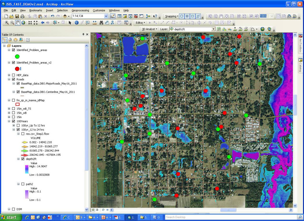
Figure 1
ISIS-FAST will also provide shapefile output for the probable flow paths over the DTM, providing us with a good idea of the likely flood flow mechanisms (the arrows on Figure 2 below are scaled in proportion to the flood flow volume moving through the area).
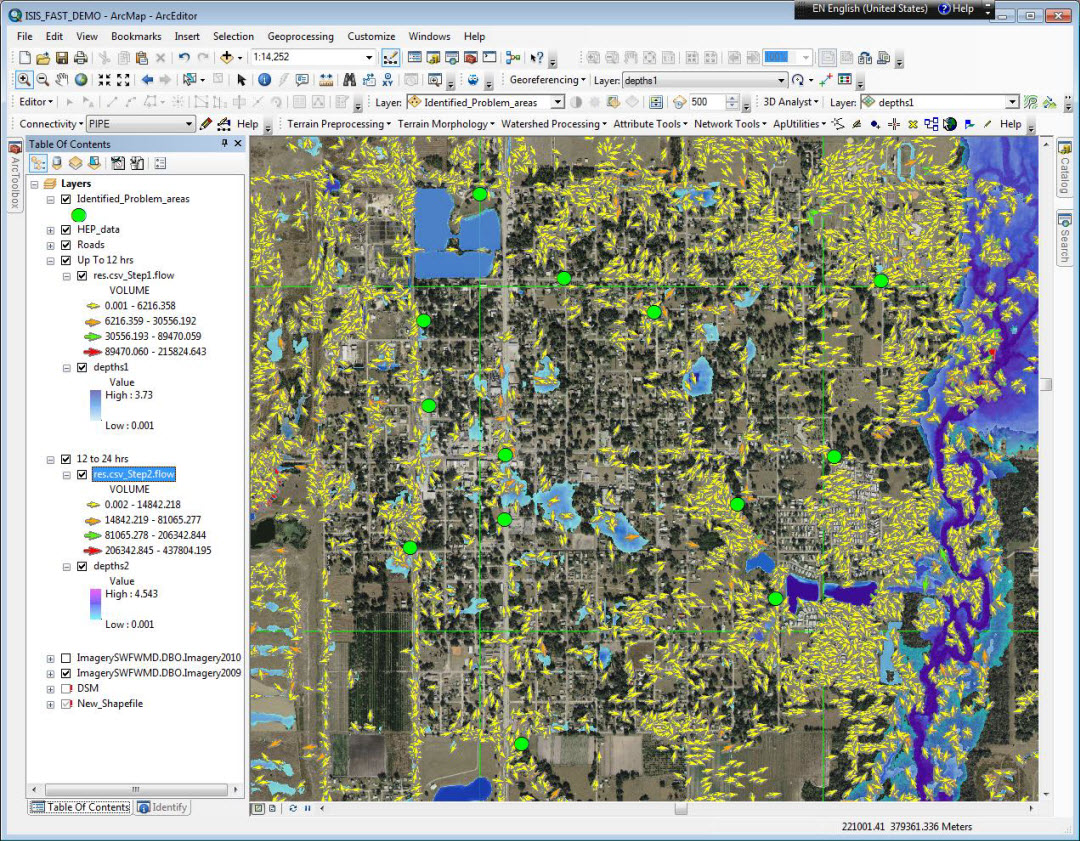
Figure 2: Probable flow paths
Having preliminary flood maps, like these, means that we can better target field data collection to areas of concern. We can more easily discuss and understand flooding issues with government staff who know the area and can better leverage their institutional knowledge. Also, these maps will provide an additional tool in back-stopping or peer reviewing detailed modeling and mapping work in support of FEMA objectives.
Special thanks to Paul Robinson for providing this post. Questions for Paul: PaulM.Robinson@ch2m.com

Commenting is not enabled for this article.