Prepared by: Fernando Salas, Graduate Research Assistant, University of Texas at Austin
Special thanks to Dr. David Maidment (CRWR), Dr. Stefan Fuest and Matt Ables (KISTERS), and Dan Siegel (Esri) for their individual contributions to the design and implementation of the Central Texas HUB.
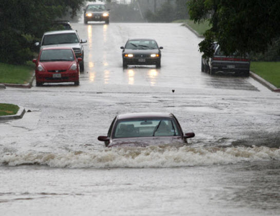
The central Texas corridor, better known as “Flash Flood Alley,” is one of the most flood prone regions in the United States. In fact, Texas regularly leads the nation in flood fatalities and flood related property damage each year. During a flash flood, rapidly changing water levels can trap both emergency responders and citizens with little to no warning. In order to mitigate risk to residents and infrastructure, citizens and emergency responders need to exhibit “real-time” situational awareness to respond proactively instead of reactively. With the emergence of the internet, mobile communication networks and social media, it is now possible to quickly disseminate information to a vast audience in “real-time.” Furthermore, the emergence of GIS technology and web services has facilitated the creation of easily understandable map applications that readily convert data into actionable intelligence.
In central Texas, precipitation, streamflow and water elevation data are collected by numerous local, regional and national agencies (e.g. USGS, LCRA, City of Austin etc.). During an extreme precipitation event, these data in conjunction with information from news and media outlets are utilized by the federal government to assess “real-time” hydrologic conditions and issue warnings to residents in the area. Until recently, these sets of data have been stored in disparate systems and communicated via individual websites and data streams without a common interface from which to synthesize information.
Over the past year, the Center for Research in Water Resources (CRWR) at the University of Texas at Austin has partnered with KISTERS, a water data management group headquartered in Aachen, Germany, and Esri to build the Central Texas HUB, an information system that seamlessly integrates vital water data and maps available through both public and private sectors.
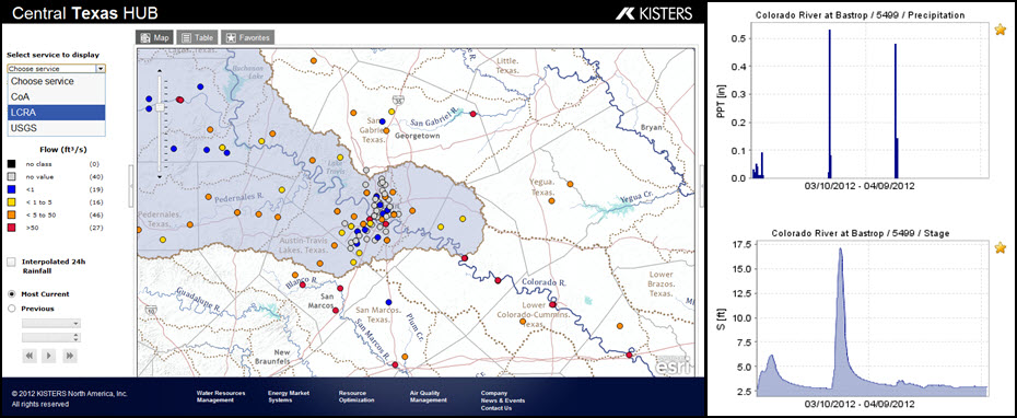
The Central Texas Hub operates as a network of networks. Currently, it continuously ingests water observations data from the USGS, LCRA and the City of Austin into a central database maintained at CRWR. The KISTERS WISKI database is used as the primary engine for storing raw water observations data and calculating value added products on the fly such as “3 hour moving precipitation totals.” In addition to providing the user with “real-time” data, historical statistics are calculated and displayed within the system to provide context and a base for comparisons.
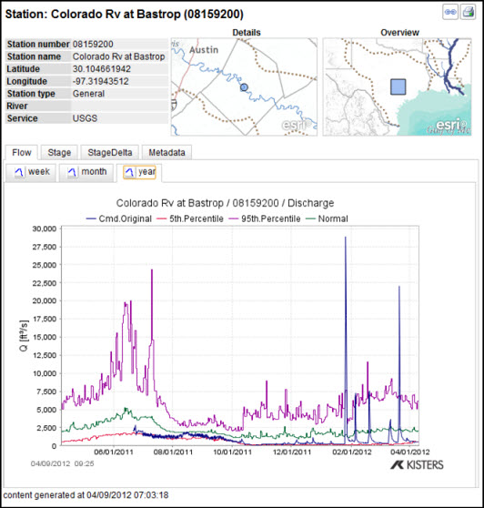
The data within the system are mapped thematically as streamflow, precipitation and water level layers, while charts are provided for viewing temporal data over multiple time scales (e.g. week, month or year). Furthermore, users can choose to view the data coming from a specific data provider instead of mashing all of them together.
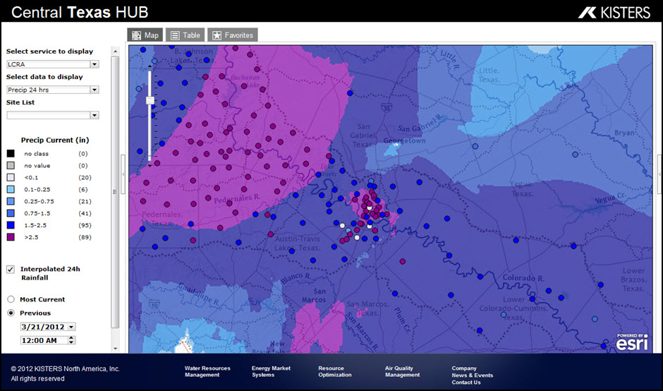
One of the strengths of the HUB is its ability to provide spatial and temporal context within a common geographic interface. Along with providing the user with basic water observations data, the HUB also allows a user to view the watershed in which they are located. Geospatial information services provided by Esri are used to delineate the drainage area for each stream gauge, and to construct interpolated precipitation maps derived from observed precipitation data. Behind the scenes, multiple web services are seamlessly working together to provide these useful and informative products to the user.
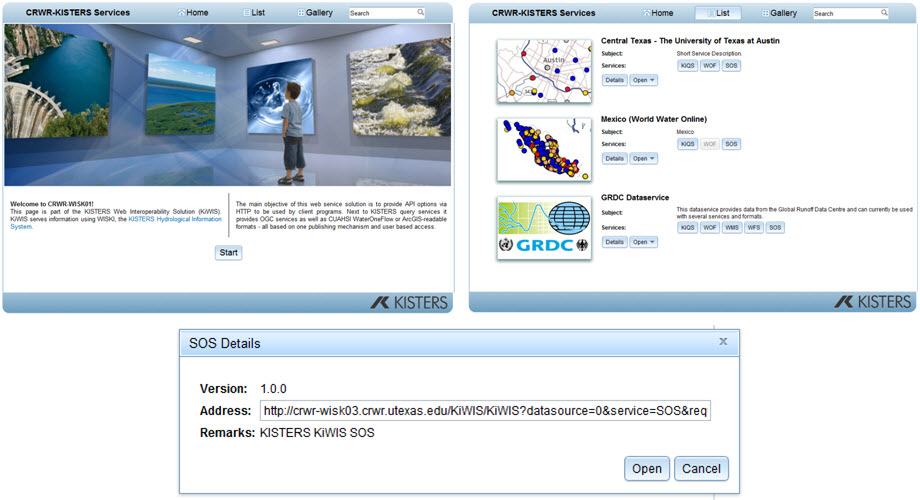
Although the Central Texas HUB provides a web map solution for viewing and interpreting “real-time” water information, others users can utilize data from the HUB to build their own map applications. All the data within the HUB is available through a suite of proven industry and open standard web services and encodings (e.g. OGC Web Services, Esri Map Services, JSON, WaterML etc.). These services are all made available through the KISTERS Web Interoperability Solution (KiWIS).
The Central Texas HUB has built a framework through which water observations data can be leveraged and utilized within a common information system. Water information is critical to understanding our world and the way water and people interact. The Central Texas HUB is a system for bringing together geospatial and temporal water information at regional and local scales. It describes the characteristics of the landscape through which water flows, and the properties of the water itself. The HUB aims to link water observations data with models to simulate and forecast water movement through a river network. All this will be done on the web to make the information universally accessible.
For more information please visit www.centraltexashub.org or contact Fernando Salas at fernando.r.salas@utexas.edu.
Disclaimer: This is a research and development project. The service is provided without warranty of any kind. In no event shall the authors be liable for any claim, damages or other liability, whether in an action of contract, tort or otherwise, arising from, out of or in connection with the software or the use or other dealings in the software.
Special thanks to Fernando Salas for providing this blog. Questions for Fernando: fernando.r.salas@utexas.edu


Article Discussion: