As we have written about previously in this blog after the earthquake in Haiti (here and here), OpenStreetMap is a great source of data for you to support disaster and/or humanitarian operations. Esri has created a specific tool to empower the GIS Community to contribute and use OpenStreetMap data within ArcGIS. The ArcGIS Editor for OpenStreetMap is a free tool you can download for ArcGIS Desktop from CodePlex. It allows people to do two key things from a disaster management / humanitarian relief perspective:
- Contribute data to OpenStreetMap using familiar tools
- Enable the conversion of OpenStreetMap (*.osm) files to a feature dataset for editing in ArcGIS
To get started with the ArcGIS Editor for OpenStreetMap you’ll need ArcGIS for Desktop 10 and the ArcGIS Editor for OpenStreetMap. Note that the ArcGIS for Home Use Program or the Esri Nonprofit Organization Program are great ways to get Esri software if you don’t have it available to you already and do not intend to use it for commercial gain. You should also be familiar with the basics of editing in ArcGIS for Desktop and with OpenStreetMap. There is an excellent wiki here to help you understand OpenStreetMap. If you want to contribute edits to OpenStreetMap you’ll need OpenStreetMap login credentials.
Making your first edits
Once you have you tools loaded and your environment prepared, you’re ready to make your first edits. The first step is to find an area that you are familiar with that needs editing. Perhaps this is a new neighborhood near where you live.

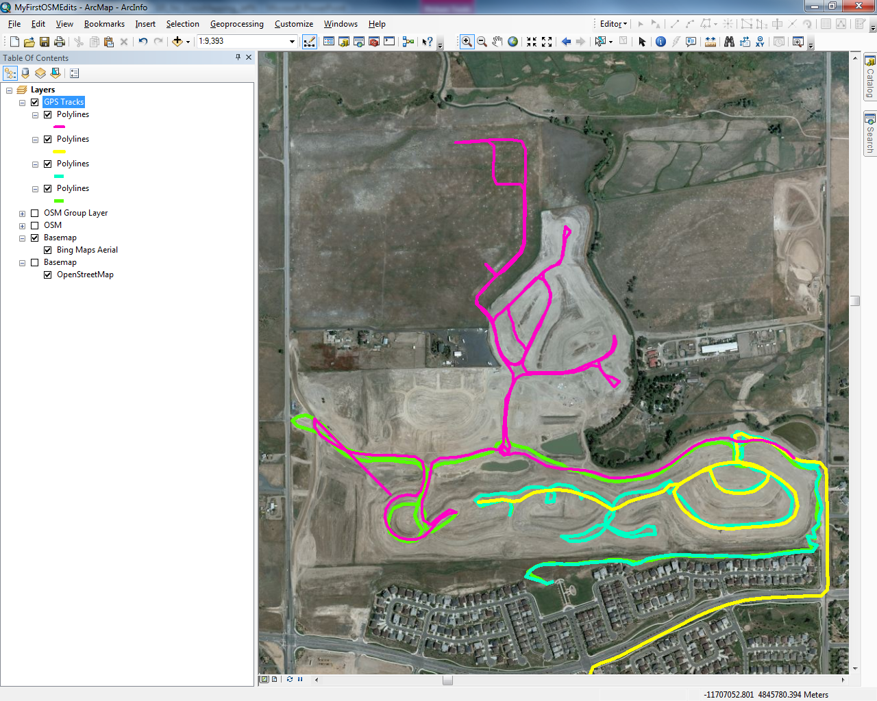
The next step is to find some base layer information to put your edits in context. You can use one of the Basemaps available from the ‘Add Data > Add Basemap’ button. In the image below, we’ve added Imagery upon which we will add data collected from GPS tracks.

GPS tracking is a common way of collecting data for OpenStreetMap as you are collecting the raw geometry of your movement. In the image below, we’ve added GPS tracks to the map.
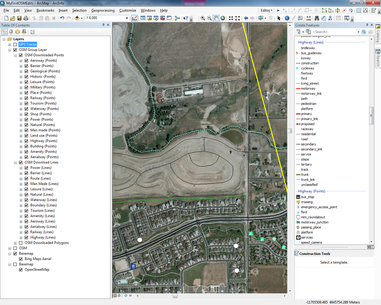
Next, use the Download and Symbolize OSM Data tool to download data to a local geodatabase for editing. Note that the larger the area the longer it will take to download the data. Once you have the data downloaded you can go ahead and start editing data just like any other feature. In the image below, the downloaded data from OSM has been added to the map. The GPS tracks have been turned off; however, we will turn them back on again so we can integrate the GPS track data into the downloaded OSM dataset.
When you are done editing you can upload your changes to OpenStreetMap. It is important that any data contributed back to OpenStreetMap is free from licensing restrictions, as data contributed becomes subject to the Open Database License (see http://www.osmfoundation.org/wiki/License/Contributor_Terms). OSM users are responsible for ensuring their edits comply with this license. Using the Upload OSM Data tool you can point to the revision table within your geodatabase where you made your edits, enter your OpenStreetMap login information, and upload your edits to OpenStreetMap.

After a few moments (or up to an hour or so) your new edits will be visible!
Loading OpenStreetMap data
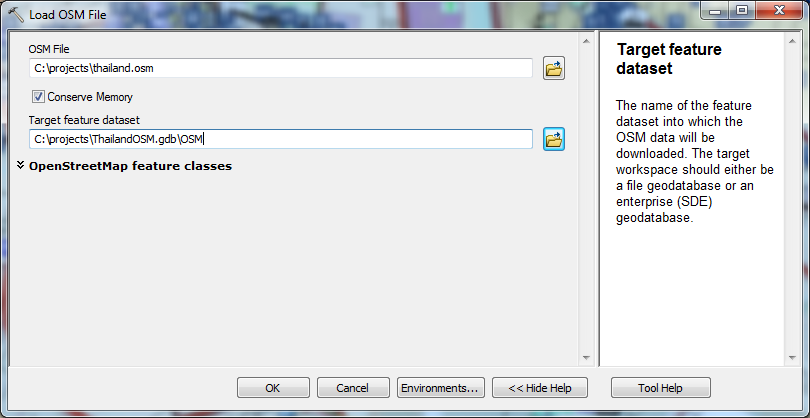
Another very useful tool with the ArcGIS Editor for OpenStreetMap is the Load OSM File tool. Often times from a response perspective we’re working in environments that are either completely disconnected or have very little bandwidth. During the response in Haiti it was helpful to have OSM data locally to support operations. Having up-to-date basemap data is really important to support response and recovery activities. OpenStreetMap data is available in Planet files or OSM XML format for the world, region, or country downloads.
Once you have an *.OSM file downloaded for a country or region of interest, you can load the data into a geodatabase using the Load OSM File tool. Note that the larger the file the longer it will take to process.
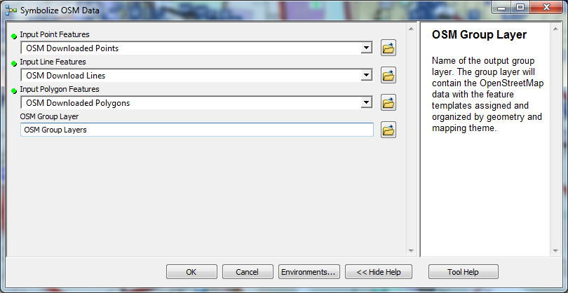
After the data is loaded into the geodatabase you can symbolize the data using the Symbolize OSM Data tool. Simply point the tool to the appropriate point, line, and polygon features.
After this tool completes, you’ll have a rich collection of basemap features that are available whether you’re connected to the internet or not. This is perfect for forward deployed GIS operations where there may not be good internet connectivity.

Look for more updates on version 2.0 of the tool coming soon! Beta 4 of the ArcGIS Editor for OpenStreetMap 2.0 is available now – http://esriosmeditor.codeplex.com/releases/view/83110. In the upcoming version 2.0 of ArcGIS Editor for OSM, you’ll also be able to generate and consume ArcGIS Server feature services based on OSM data for use in multiple clients, including mobile devices.


Commenting is not enabled for this article.