By Alex Tait, Chief Cartographer and Vice President, International Mapping
At the North American Cartographic Information Society (nacis.org) conference in October, I presented a list of 10 quick references for mapmakers. These are the scraps of paper on my bulletin board next to my computer. Some are photocopies of key pages out of books, others are screen captures from useful web pages, and some things I’ve jotted down freehand as I’ve worked with maps over the years.
I thought that if I were going to organize this information for myself, I would put them together in the spirit of collegial sharing that runs through the NACIS group. I shared them at Practical Cartography Day at NACIS, and I am happy to share the references with you in this blog post.
You can download the high-resolution Practical Cartographer’s Reference in PDF format from my website at http://www.taitmaps.com/pcref.pdf. Here is what you’ll find:
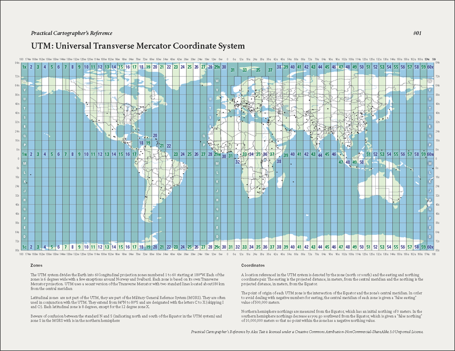
1. UTM Zones: A map of the 60 UTM zones so that you can tell which zone the area you are mapping falls within.
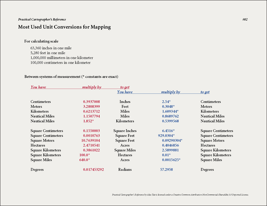
2. Conversion Constants: The most often used constants to convert from one measurement system to another.
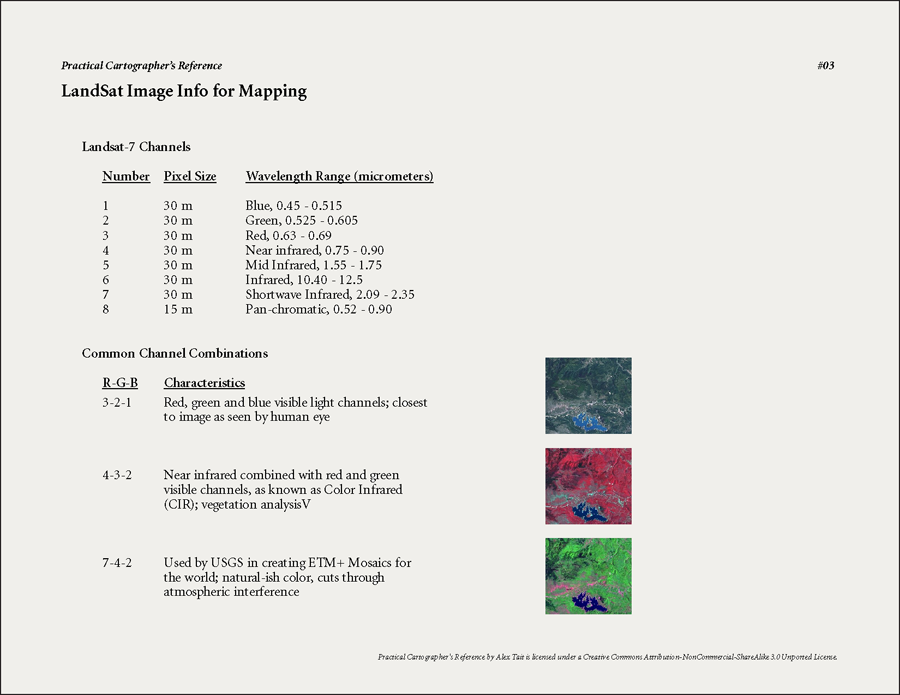
3. Landsat Image Information: A list of the channels in the data, their wavelength ranges, and some common band combinations (for true color, color infrared, and ETM+ mosaics).
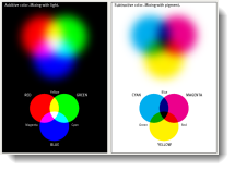
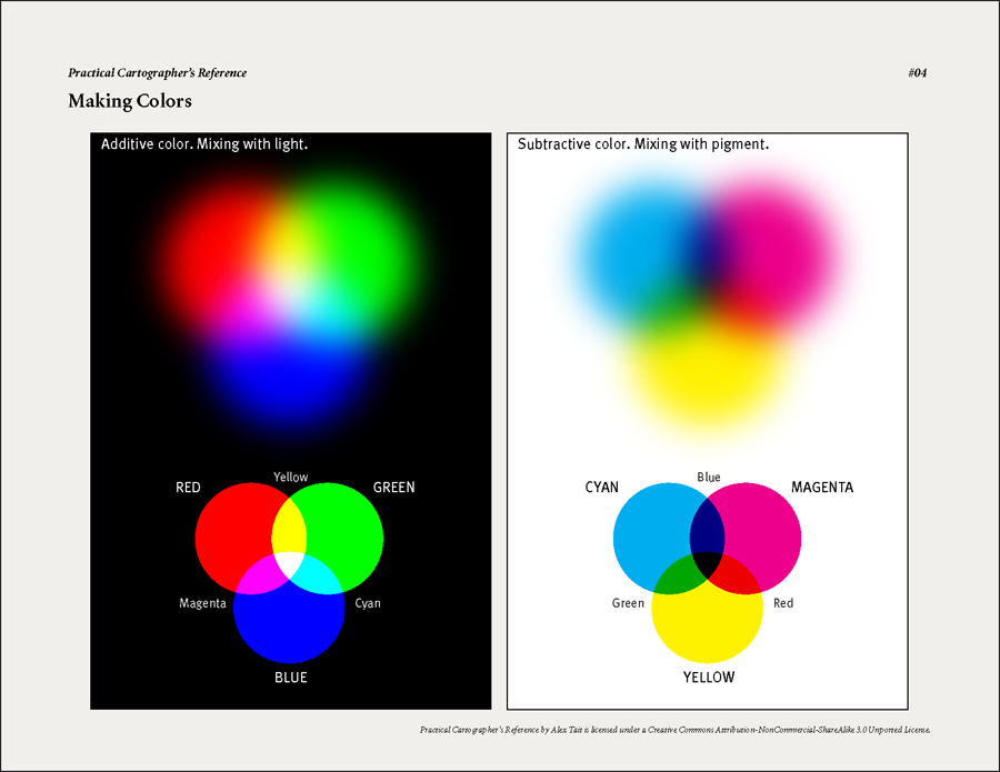
4. Additive and Subtractive Color Models: A graphic of each of the color models that also show how mixtures of the primary hues can be used to produce additional colors.
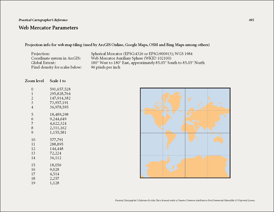
5. Web Mercator Projection Parameters: Information about the projection used for the Bing Maps/Google Maps/ArcGIS Online maps tiling scheme (Web Mercator Auxiliary Sphere), including the global extent and the map scales associated with each zoom level.
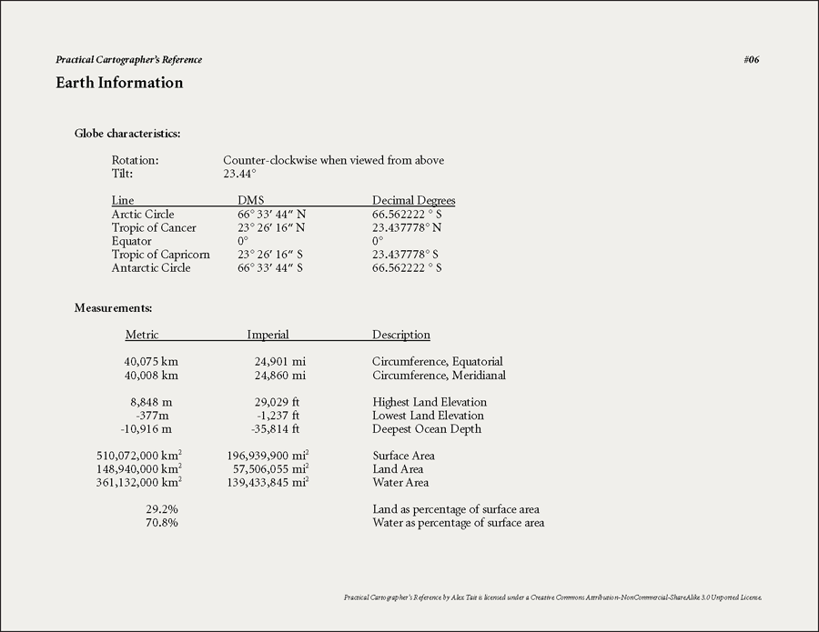
6. Basic Earth Information: Basic geodetic information about the earth including the direction of rotation, angle of tilt, definitions for specific named latitudes (equator, Tropic of Cancer, etc…), measurements of various earth characteristics (circumference, highest and lowest points, etc…) and more.
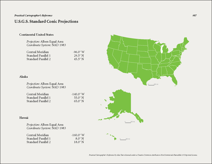
7. USGS Standard Projection Parameters: A summary of the major projection parameters for the Albers equal area projection that the USGS uses for the conterminous US, Alaska and Hawaii.
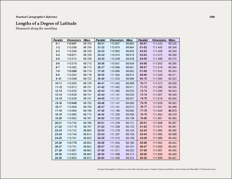
8a. Variation in the Length of a Degree of Latitude: A table with the measurements in of a degree of latitude measured along the meridian.
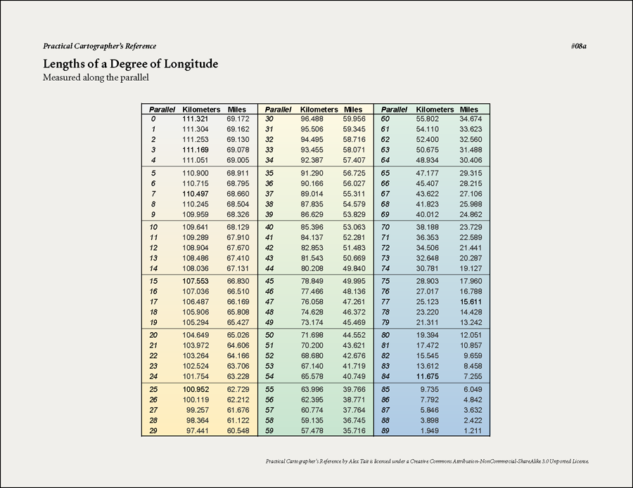
8b. Variation in the Length of a Degree of Latitude: A table with the measurements in of a degree of longitude measured along the parallel.
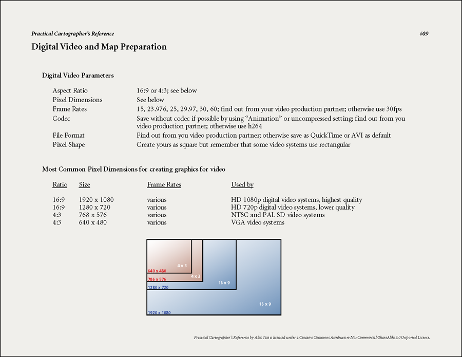
9. Digital Video and Map Production Parameters: A compilation of the aspect ratio, pixel dimensions, pixel shapes and more that are useful for creating graphics for video.
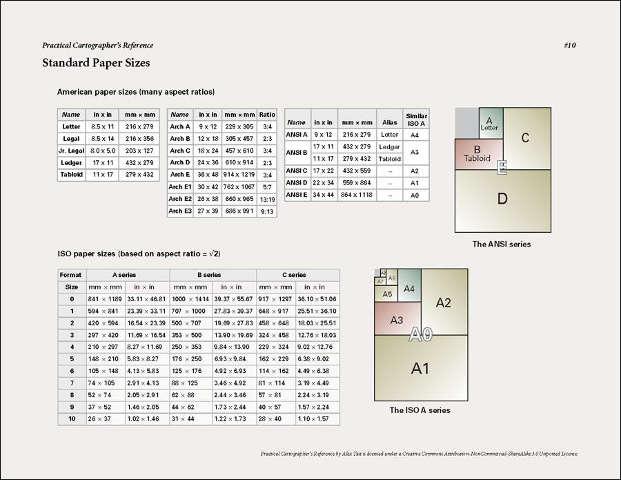
10. Standard Paper Sizes: The names and dimensions of paper sizes for both American and ISO standards.
I hope you will find something useful in this set of quick references. And if you have a suggestion for something to add to this list, you can get in touch with me at alex@internationalmapping.com.
Thanks to Aileen Buckley, Mapping Center Lead, for her help with this blog entry.

Article Discussion: