We all know managing spatial data, map products, and documents are critical to the success of any GIS work being performed. When producing many versions of your map documents and outputs, current databases and file systems are not well equipped to simultaneously manage these. And it can be a daunting task to manage changes to these files, including knowing which version is the latest and being able to access historical versions if necessary. Also, conflicts may arise when files are not centrally managed which can compromise a schedule or budget, introduce unnecessary risks, and jeopardize the success of your work. Typically, you would use the geodatabase for spatial data storage and management, SharePoint for document management, and maybe a file server for your map product management. If you’re looking for one tool that could do all of these and more, you are reading the right blog post!
Product library
Product library is a tool within Esri Production Mapping that allows you to store and manage files associated with your GIS work, including documents, business rules, map products, and data and cartographic specifications. It’s a geodatabase that helps you organize and interact with the various parts of your work. You can maintain file versions, manage permissions, and enable locking when configuring, retrieving, and sharing products. In essence, product library can be considered a spatially enabled document management system. By storing all your information in a central location you ensure consistency and improve overall efficiency of GIS tasks within your organization.
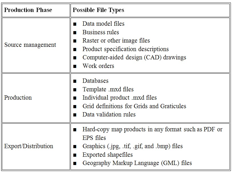
Files that can be stored and managed in a product library can include, but are not limited to, the following:
Permissions
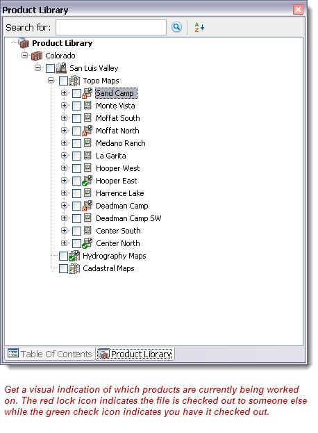
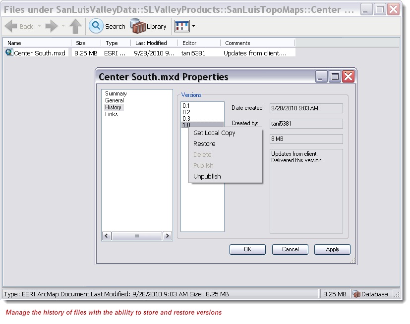
Product library allows you to set permissions and maintain file versions. You can assign user permissions to restrict who can check out files for editing and who can just view them. When someone has checked out a file others are prevented from making edits which prevents critical changes from being overwritten. When files are checked in a new version of the file is created to maintain a history of changes. You can also restore a previous version of a file if an inappropriate change was made.
Managing business rules
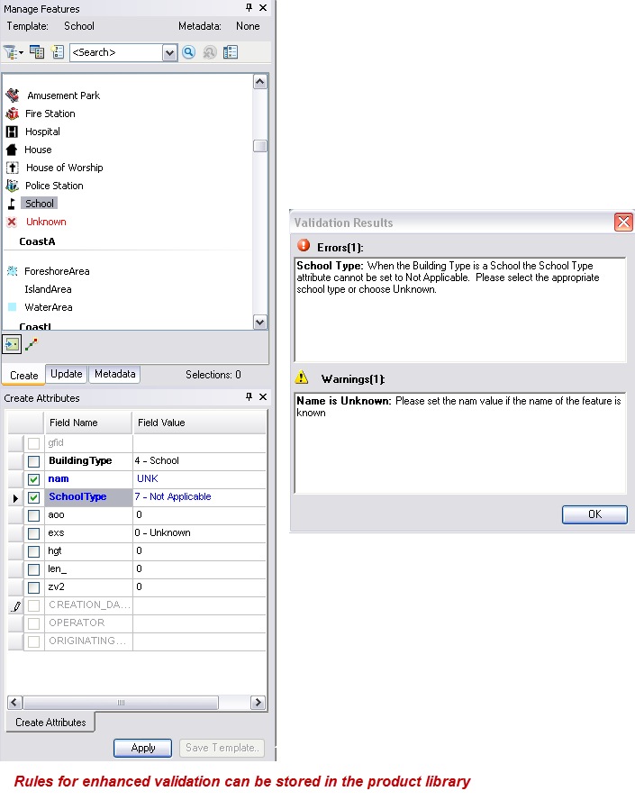
Depending on your work, you may configure various types of business rules to ensure consistency and accuracy of the data and/or products being created. These can include rules for the geodatabase such as the schema of the geodatabase, validation rules, and attribute display rules. One key reason to store these rules in product library is to ensure that all users have access to up-to-date versions.
Editing tools within Production Mapping, such as the Feature Manager, recognize when you’re using product library and as you create or update features they’re validated against the stored business rules.
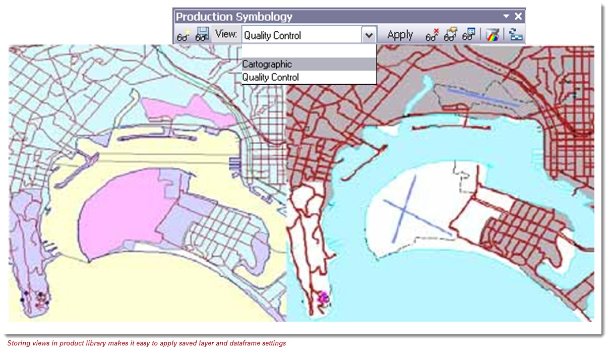
Managing cartography
Product library can also be used to manage your cartographic production. Products with standardized layouts as well as ones that have custom layouts per product can be modeled and managed inside product library. In addition product library provides the ability to import and manage your data driven pages map documents. Versions of the map documents are created by default in the product library, allowing you to track version history and go back to a previous version of a product if necessary.
Cartographic specifications, including symbology, can be managed in product library. Production Mapping’s cartographic tools such as viewsand visual specifications use rules that can be stored and managed in product library.
Product library can also act as the central repository for storing and managing your map layout elements such as your organization’s logo, north arrows, legends, tables, and notes. Production Mapping’s element library allows you to save map layout elements to the product library where they can be easily accessed and added to an ArcMap layout at any time.
As you can see, the benefits of using product library as a spatially enabled document management system are enormous. I encourge you to begin exploring and take advantage of the tool’s capabilities.
Contributed by Amber Bethell

Commenting is not enabled for this article.