Currently, there are three authoritative sources of global hydro data out there, all available free to the public for non-commercial use: HydroSHEDS, HYDRO1K, and the GRDC’s Major River Basins of the World. The HydroSHEDS dataset was derived from SRTM elevation data, while the HYDRO1K and GRDC datasets were derived from the GTOPO30 elevation dataset. Here’s some additional information on each dataset:
HydroSHEDS
The Conservation Science Program of World Wildlife Fund (WWF) took high-resolution elevation data collected during NASA’s Shuttle Radar Topography Mission (SRTM) and developed HydroSHEDS (Hydrological data and maps based on SHuttle Elevation Derivatives at multiple Scales). HydroSHEDS is a set of hydro information mapping products at regional and global scales. The suite of data includes river networks, watershed boundaries, drainage directions, and flow accumulations. HydroSHEDS makes it possible to produce quality watershed analyses, hydrologic modeling, and water conservation and planning at regional and global levels for parts of the world that are largely unmapped. The data products were derived from hydrologically conditioned SRTM data, and the resolution ranges from 90 meters to 10 km, with a seamless near-global extent (www.worldwildlife.org).
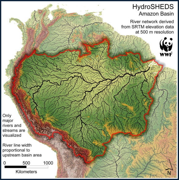
Amazon Basin HydroSHEDS map.
HYDRO1K
The HYDRO1K database was developed by USGS’s Earth Resources Observations and Science (EROS) Data Center from the Global 30 Arc-Second Elevation Data Set (GTOPO30). HYDRO1K data covers every continent, and includes a hydrologically corrected DEM, streams and drainage basins, and other ancillary data sets like flow direction.
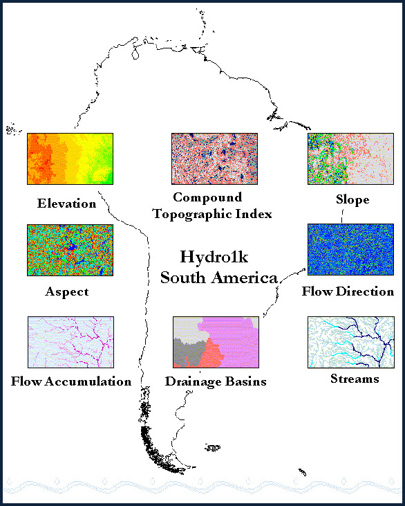
HYDRO1K data products for South America.
GRDC: Major River Basins of the World
The Global Runoff Data Centre (GRDC), part of the World Meteorological Organization (WMO), operates to support integrated water resources management on the global scale through the exchange of hydrologic data and information. They used the flow direction grid from HYDRO1K to generate their own data product: Major River Basins of the World. This dataset contains river basins and associated rivers with slightly different geometries than the HYDRO1K data, AND each river in the dataset contains mean annual discharge values calculated with the WaterGAP 2.1 methodology. Additionally, all basins and rivers are attributed with names (Global Runoff Data Centre (2007): Major River Basins of the World / Global Runoff Data Centre. Koblenz, Germany: Federal Institute of Hydrology (BfG)).
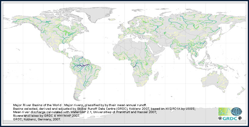
Major river basins of the World: Major rivers classified by their mean annual runoff.
Global Hydro datasets are invaluable to the people of planet earth because they make it possible to map, track, and model our water resources—abilities necessary to plan for and sustain life as we know it. But, these datasets need to be moved a step further than where they are now. They need to reach a broader audience than just scientists and academics. To do this we need to take these global mapping products and actually make useful maps and applications with them that will help people all over the world understand water. We need to use these invaluable resources to their full potential, and help save the world!
In the coming months, check back to the Hydro Resource Center Blog for announcements of new maps and applications, made by Mapping Center’s Hydro Team, that utilize our global hydro datasets, AND please use these invaluable resources yourselves—HydroSHEDS Layer Packages are on ArcGIS Online!
Special thanks for Caitlin Scopel for providing this post. Questions for Caitlin: cscopel@esri.com

Commenting is not enabled for this article.