What is DRA?
DRA stands for dynamic range adjustment. Dynamic range adjustment is a contrast stretch that is only stretches the pixel values within the display extent – not using all the pixels in the raster dataset. This allows you to focus on a
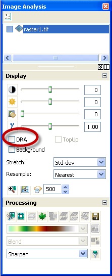
Is DRA New?
DRA is not new to ArcGIS 10, but it is now easily accessible via the Image Analysis window. In previous version of ArcGIS, DRA was known as statistics from current display extent, within the Symbology tab.
To learn more about Enhancing rasters based on the values in the display.
About the author


Commenting is not enabled for this article.