ArcGIS for Local Government provides a simple, harmonized local government information model that supports a series of maps and apps used by local governments. The information model reflects specific application requirements and the cartographic requirements necessary to produce rich, multi-scale base maps and operational layers. You can download the information model from ArcGIS.com and migrate your content into this geodatabase design. When you do, you can quickly take advantage of the maps and apps published on the ArcGIS for Local Government Resource Center.
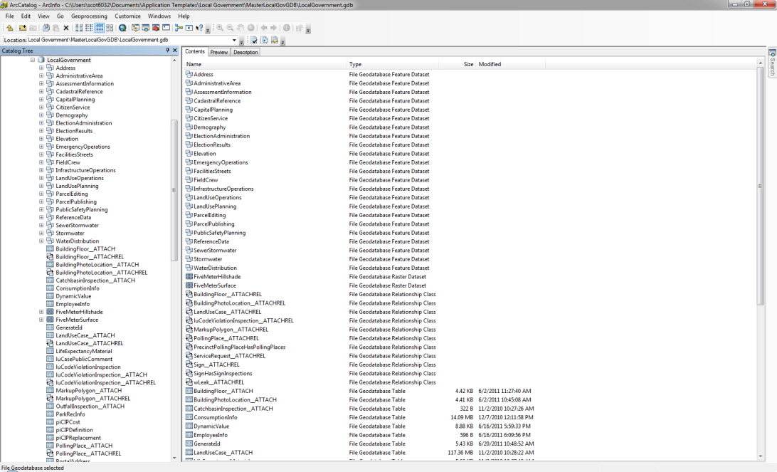
The Local Government Information Model in ArcCatalog
This release of the local government information model includes a series of major updates.
Major Updates:
The Address feature dataset was updated to support the active management of site addresses. The SiteAddress feature class was retired and three new feature classes were added to the local government information model. This update supports a series of Address Editing apps currently under development. The new feature classes and a PostalAddress table in the local government information model are a physical implementation of the FGDC United States Thoroughfare, Landmark, and Postal Address Data Standard and were adapted to support site address maintenance in local government.
The FacilitiesStreets feature dataset was updated to support the active management of facilities and campuses.This update supports a series of Facility/Campus management apps currently under development. For many who have already begun to use the features in this dataset, you’ll find we’ve done some pretty extensive work on the data model for features like, signs, streetlights, and signals. In addition, we’ve incorporated portions of the Building Interior Space Data Model (BISDM) to support building/interior space management and extended it to support exterior features found on government grounds, parks, and even campuses. Much of this work will also support Public Works apps that require information about paved areas, pavement markings, poles, signs, signals, etc.
This update to the information model also supports a new campus basemap we will release later this summer. When you begin to use this information model, you will be able to produce a great basemap for your government facilities, downtowns, and campuses.
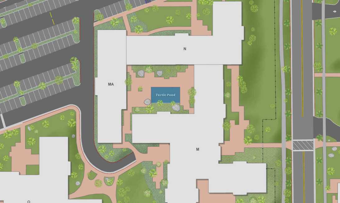
The new campus basemap with sample data from the Esri Campus
This release of the local government information model also includes a series of more minor updates.
Minor Updates:
The Parcel Fabric, contained in the ParcelEditing feature dataset now supports the active management of PLSS Sixteenth Sections. A new parcel type was added to the ParcelType domain to accommodate this requirement.
The ParkRecInfo table was added to the local government information model to support the Parks and Recreation Finder application currently under development.
The ServiceRequest feature class in the CitizenService feature dataset now supports the creation of service requests within buildings. The building floor and interior space attributes were added to the feature class to support Facilities Management applications currently under development.
Known Issues:
There are a few known issues we’re working to resolve in future releases.
Your imagery and surface models must be added to this schema manually.
Layer Packages (LPKs) do not currently support standalone tables in the geodatabase. After you’ve created your schema, please copy the ten stand alone geodatabase tables from the sample dataset in a recent application download. Refer to the Data Dictionary for a complete list of the standalone tables you’ll need to complete the Local Government Information Model.
If you are using ArcGIS Desktop SP1, the ParcelType domain will have to be applied to the Type field in the Parcel fabric class manually after you create your schema.
Quick Summary:
We continue to evolve the local government information model as we add new maps and apps to the ArcGIS for Local Government system. Your feedback is vital. So don’t hesitate to let us know what you think about the information model and what maps and apps will help you in your local government.
We’ve got some exciting things coming this summer and early fall so keep a close eye on the Local Government Blog or follow us on Twitter if you’d like to learn more about how ArcGIS for Local Government can help you effectively deploy GIS.


Commenting is not enabled for this article.