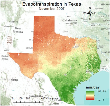
Evapotranspiration (ET), a combination of evaporation and plant transpiration from the Earth’s surface to the atmosphere, is an important and substantial component of the hydrologic cycle, and should not be overlooked. Scientists at the Numerical Terradynamic Simulation Group at The University of Montana are keeping ET in the forefront, making it possible to access actual levels of ET across the globe, using imagery collected by the Moderate Resolution Imaging Spectoradiometer (MODIS) instrument aboard the NASA satellite Terra. Dr. Qiaozhen Mu and Dr. Steve Running created monthly-averaged estimates with 1 km resolution for the entire globe – MOD16 Project – and are the first to provide such a resource.
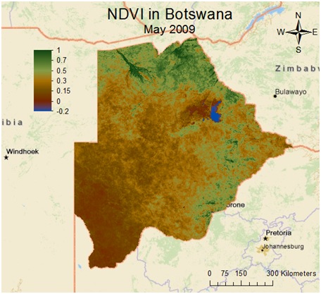
Lucky for us, researchers at the Center for Research in Water Resources at the University of Texas – Austin have gone one step further, and created a toobox – MODIS Toolbox – that imports the MODIS images directly into ArcGIS, and produces four data products: evapotranspiration, land surface temperature, normalized difference vegetation index (NDVI), and enhanced vegetation index (EVI).
The MODIS toolbox is found in the Geoprocessing Model and Script Tool Gallery in the Geoprocessing Resource Center, and is currently available for use with ArcGIS 10.
For additional information about the MODIS Toolbox check out the DATA.CRWR BLOG entry Accessing Historical Evapotranspiration Data in ArcGIS.
Special thanks to Daniel Siegel for assisting with this blog entry. Questions for Daniel: dsiegel@mail.utexas.edu


Article Discussion: