If you were using the ImageConnect toolbar in Business Analyst Desktop, you’ve probably noticed it’s no longer included in the product at version 10. DigitalGlobe is discontinuing that service so we had to remove it…a bummer, I know. One of its great features was that you could download an image and view the exact source, date, resolution, accuracy, etc. Fortunately, this feature is STILL AVAILABLE through the tiled ArcGIS Online layers. You simply use the Identify tool and click on the map and that’s it. All the source data appears in the dockable Identify window.
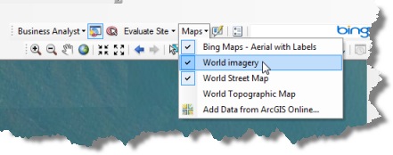
To do this you need to add a layer from ArcGIS Online. On the Business Analyst toolbar, we’ve conveniently provided some default map service layers in the Maps drop-down menu. As in the example below, you’ll select World imagery.
Once the layer is added to the ArcMap table of contents, you simply
1. Click the Identify button.
2. Click the area of interest on the imagery.
3. Check the available source data in the Identify window. If there is more than one level of imagery, the sources appear stacked in the top pane.
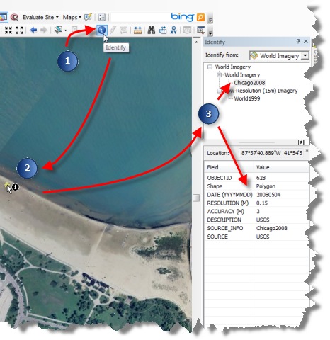
As you pan around the map and identify other areas, you’ll see that the source data changes even though you are using the same layer. This is because the aerial images are “mosiacked” together from a series of the best available sources.
Cheers,
Kyle


Commenting is not enabled for this article.