Featured Article
Multiple Authors | Nov 07, 2023
From oriented imagery to engaging thematic map series, there is something for everyone in this release of ArcGIS Pro 3.2.
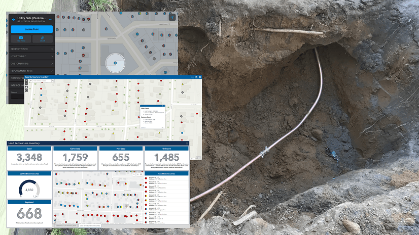
Christa Campbell | April 26, 2024
Water utilities with authoritative data, analytics, and technology solutions are going to successfully navigate improvements to the LCRR.

Multiple Authors | April 24, 2024
A Developer approach to imagery.

Shree Rajagopalan | April 24, 2024
Learn how to dynamically produce output data and information products at any scale from a single best-scale data source.

Lisa Berry | April 23, 2024
Do you have questions about how to access, use, or nominate content within ArcGIS Living Atlas of the World? Check out this blog for answers.

Greg Lehner | April 22, 2024
If you receive a notification saying there's a drawing alert: don't panic! Let's solve it together.

Jeff Liedtke | April 16, 2024
Format your metadata for the video multiplexer tool to geoenable video data for the Full Motion Video player.

John Nelson | April 12, 2024
How to configure scale-appropriate contour lines and their labels.
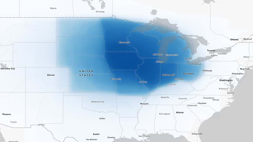
Multiple Authors | April 11, 2024
Answering regional geographers' favorite question: Where is the Midwest to you?
Rajinder Nagi | April 11, 2024
In April 2024, elevation layers have been updated with high-res datasets of Wales, New Zealand & German states of Bavaria, Saxony and Brandenburg
Multiple Authors | April 10, 2024
With ArcGIS Pro 3.2 or later, you can export all symbols in your project to a custom style.
Greg Lehner | April 8, 2024
In ArcGIS Pro 3.2, you can copy and paste the layer properties of one layer to another layer.
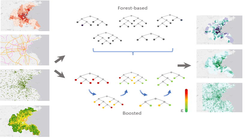
Cheng-Chia Huang | March 29, 2024
This article shows how to build a Gradient boosted model (XGBoost) with the Forest-based and Boosted Classification and Regression tool.

Multiple Authors | March 21, 2024
A highly anticipated event for transportation professionals. Read about Esri's presence at the conference.

Multiple Authors | March 13, 2024
The ArcGIS Well-Architected Framework and Architecture Center provides guidance for implementing systems with ArcGIS.

John Nelson | March 12, 2024
It's a map! It's a chart! It's a chart-map!

Multiple Authors | March 11, 2024
A new R package created by the R-ArcGIS Bridge team enables integration with ArcGIS location services.
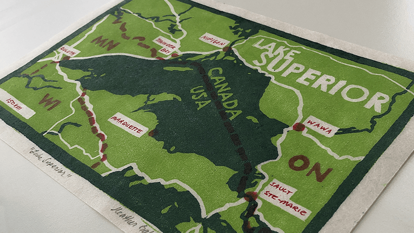
Heather Smith | March 7, 2024
How I used ArcGIS Pro to help me design a woodcut print.

Multiple Authors | March 6, 2024
Learn about events and workshops featuring R at the 2024 Esri Developer Summit.

Christie Roland | March 5, 2024
Must-attend technical sessions featuring ArcGIS Pro at the 2024 Esri DevSummit.
Ivonne Seler | February 29, 2024
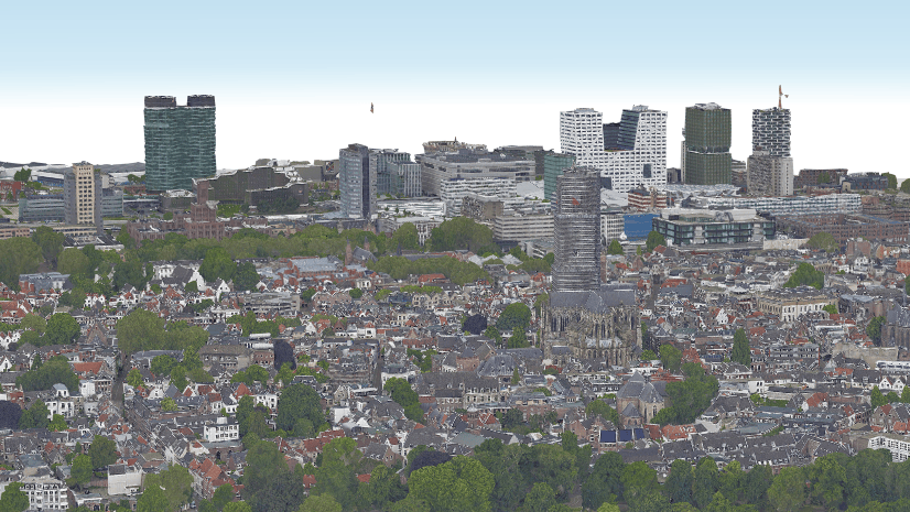
You can work with many 3D formats in ArcGIS like i3s and 3D tiles. What is best for your workflow depends on on the 3D capabilities required.

Multiple Authors | February 22, 2024
Join us for an exciting Partner Conference and Developer Summit! Discover the latest in Location Referencing and connect with experts.

Sophia Giebeler | February 22, 2024
ArcGIS Aviation Airports and ArcGIS Aviation Charting are extensions to ArcGIS Pro that allow users to do their best aviation work.

Kory Kramer | February 21, 2024
ArcGIS Pro 3.3 is planned to be available in May 2024. Install .NET 8 before attempting to install ArcGIS Pro 3.3 for the best user experience!

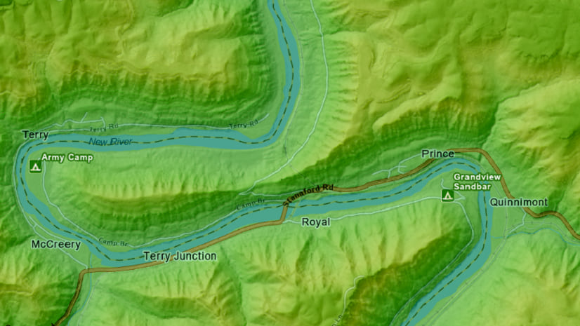
John Nelson | February 20, 2024
Create a cool looking landscape map, in record time. Start the clock!
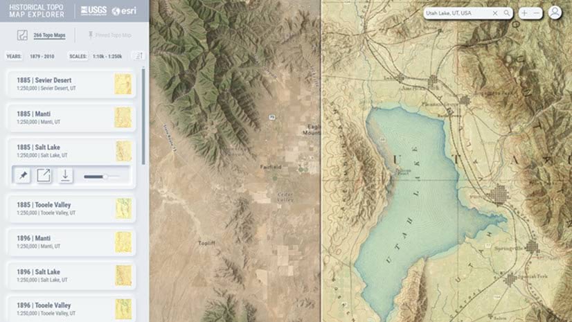
Aileen Buckley | February 16, 2024
We recently updated our online USGS historical topographic map collection with over 1,745 new maps for a new total of over 181,000 maps.