Version 4.0 is the next generation ArcGIS API for JavaScript and it supports both 2D and 3D. Today we are announcing the first beta version – 4.0 beta 1.
Discover 4.0
With version 4.0, the API continues to be a modern, top-of-the-line web mapping API with new cutting edge features, improved developer experience, and cleaner implementation. It provides a clean and simple interface, which includes support for 3D. For more information, see the Discover 4.x topic in the Guide.
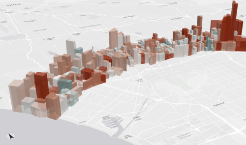
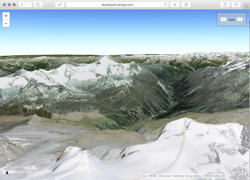
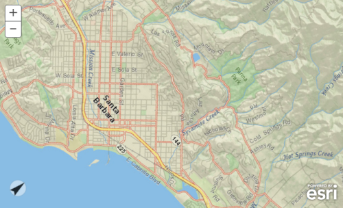
Mapping components in 4.0 cleanly separate map and layers from their display logic. This separation allows map and layers to be the representation of your data, which enables the display engine (map views and layer views) to use traditional HTML/SVG DOM or Canvas or WebGL depending on the type of data you want to visualize and the type of applications you want to build. As a developer, you will be able to write both 2D and 3D applications, consume and author Web Maps and Web Scenes – all using the same concepts, programming patterns and a consistent API.
Simple and consistent API
The API provides structured, streamlined methods for developing JavaScript-based mapping applications. Class names have been modified to be shorter and clearer with consistent casing. Confusing concepts such as accessing properties and multiple constructor signatures have been enhanced, modified or removed. For example, now an instance of a class may be created by providing properties in an object inside the constructor. No more having to remember the order of constructor parameters! For more information see the Working with the API section in the Guide.
Getting started
The API documentation is available at developers.arcgis.com/javascript/beta, complete with guides, tutorials, samples, and API reference. Check it out and let us know what you think. For the impatient, be sure to read the system requirements, known limitations, and migrating topics.
Status
Version 4.0 is in the initial beta phase. We are planning multiple betas before the 4.0 release next year. It is important to note that the first beta is primarily a developer preview with limited functionality and that the existing 3.x API is still supported and being developed.
Community
For beta 1, Esri will not provide support via the standard Technical Support channels. For feedback and questions, please post in the ArcGIS API for JavaScript forum and make sure to tag with “4.0beta”.
To see forum posts by others, go to posts tagged as “4.0beta”.
Learn about 4.0 at the User Conference 2015
- Technical workshop: ArcGIS API for JavaScript – Road Ahead. Wednesday 3:15pm
- Technical workshop: ArcGIS API for JavaScript: Building 3D Web Apps. Wednesday 8:30am
- Showcase area – the Web Development island


Commenting is not enabled for this article.