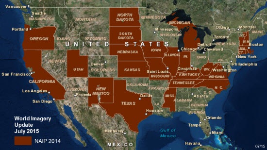
The World Imagery basemap was updated across much of the United States for the second time in four months. The addition of more recent 1-meter resolution USDA Farm Service Agency (FSA) imagery from the National Agriculture Imagery Program (NAIP) now provides NAIP 2014 imagery for 25 states (as shown at bottom). The imagery is available at scales ~1:36k to ~1:4k and replaces two or more year old imagery in these areas. The sub-meter imagery from DigitalGlobe and our community contributors is still visible at the two largest scales (~1:2k and ~1:1k) because of its higher resolution.
The selected images below illustrate some of the more readily noticeable changes. In each example, NAIP 2014 imagery is the lower image.
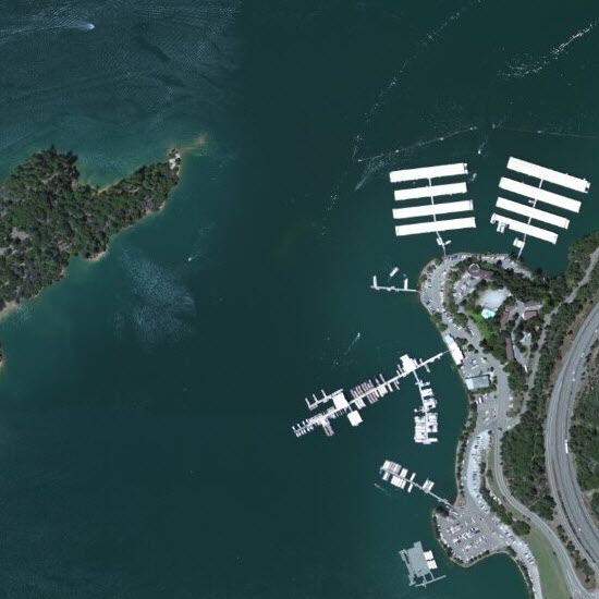
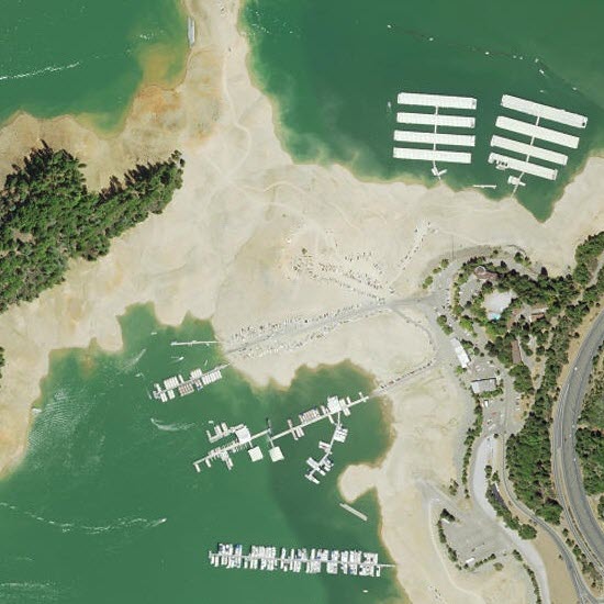
Shasta Lake, California’s largest reservoir, has seen its water levels dip during the on-going three year drought. The previous imagery is from June 2010.
Shasta Lake, June 2010
Shasta Lake, 2014
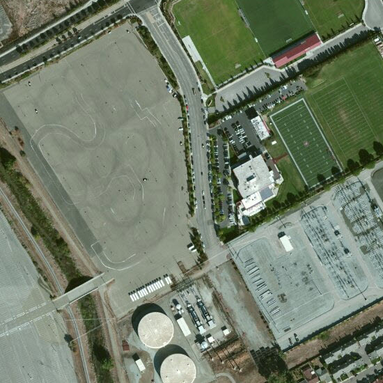
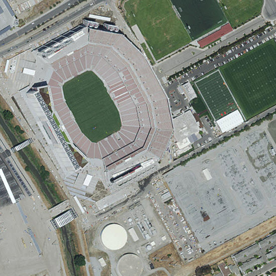
In Santa Clara, California, the NFL San Francisco 49ers new home, Levi’s Stadium, was built between 2012 and 2014. The previous imagery from 2010 shows the land as overflow parking for California’s Great America amusement park. In February 2016, the new stadium is hosting Super Bowl 50.
Levi’s Stadium, 2010
Levi’s Stadium, 2014
Elsewhere in California, the Ivanpah Solar Electric Generating System covers nearly 4,000 acres in the Mojave desert. Construction began in 2010 and the concentrated solar thermal power plant came online in 2014. The previous imagery from 2011 shows the arrays under construction.
Ivanpah Solar Electric Generating System, 2011
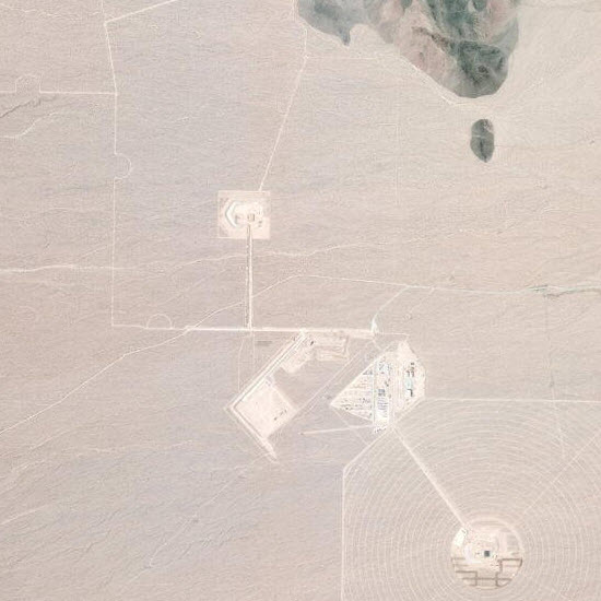
Ivanpah Solar Electric Generating System, 2014

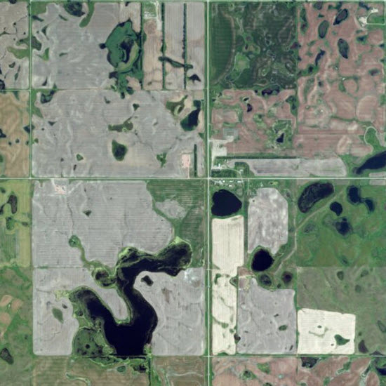
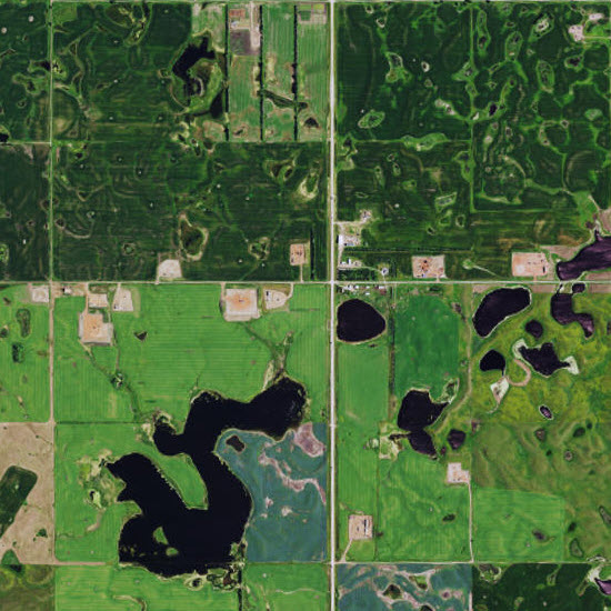
Other impact from the expansion of energy related development is seen in Mountrail County, North Dakota. Located in the heart of the Williston Basin, this area is home to the Parshall Oil Fields which helped launch North Dakota’s oil boom. The previous imagery from 2011 already shows change to the landscape five years after the start of the recent drilling boom. Expansion continued over the next three years as evidenced by the NAIP 2014 imagery.
Parshall Oil Fields, 2011
Parshall Oil Fields, 2014
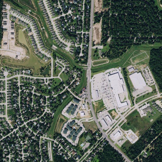
Harris County, Texas, led the nation in population growth by person between 2013 and 2014 according to the U.S. Census Bureau. In the Houston suburb of Tomball, both residential and retail expansion are visible since the 2011 imagery was flown.
Tomball, 2011
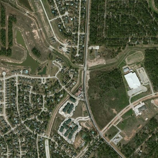
Tomball, 2014
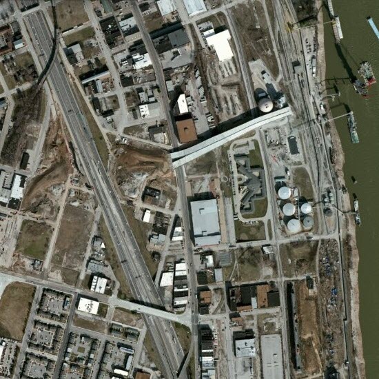
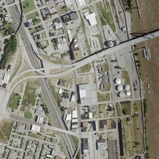
A new Mississippi River bridge opened in February 2014. Officially named the Stan Musial Veterans Memorial Bridge, this portion of Interstate 70 connects St. Clair County, Illinois, with St. Louis, Missouri. Incomplete approaches on both sides of the river are visible in the 2012 imagery.
Stan Musial Veterans Memorial Bridge, 2012
Stan Musial Veterans Memorial Bridge, 2014
The coverage area of the NAIP 2014 imagery updated across 25 states in this most recent release:
Metadata for Imagery Map: The imagery service is metadata-enabled. With the Identify tool in ArcMap or the World Imagery with Metadata web map, you can see the resolution, collection date, and source of the imagery at the location you click. The metadata applies only to the best available imagery at that location. You may need to zoom in to view the best available imagery.

Commenting is not enabled for this article.