Last year, Esri published a set of image layers featuring recent 1m resolution, multispectral imagery for the continental United States made available by the USDA Farm Service Agency. The National Agriculture Imagery Program (NAIP) acquires aerial imagery during the agricultural growing seasons in the continental United States. The image layer published by Esri provides access to NAIP imagery for each state in 4-bands (RGB and Near Infrared) with the option to display the imagery as false color or to display the NDVI showing relative biomass of an area.
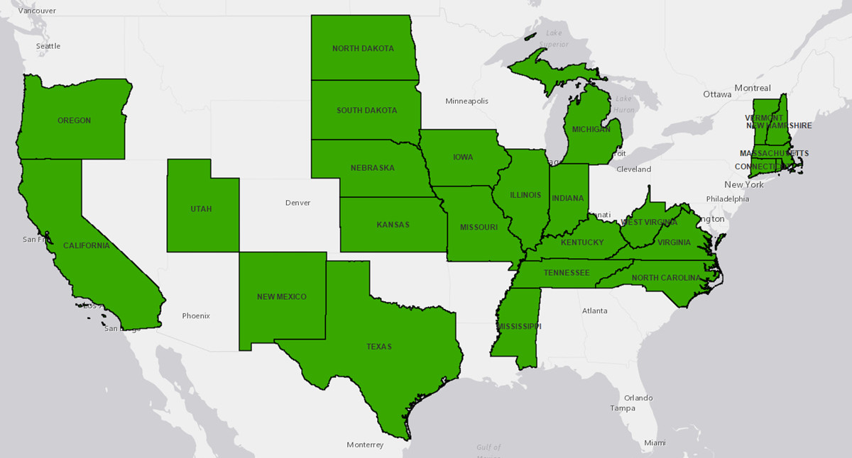
The image layers now are updated to include the NAIP 2014 imagery that is available for 25 states (as shown below). In most cases, imagery for a state is available for 2 or 3 years and can be used for comparison purposes (click the imagery to see a pop-up with info on the imagery that is available for a given location). You can discover and access these layers through the Living Atlas: Imagery collection as well as through the NAIP Imagery group.
NAIP 2014 Imagery Updated for 25 States
The NAIP image layer is no longer in Beta release. The NAIP image layer is available to users with an ArcGIS Organizational subscription at no additional cost. To access the NAIP imagery maps and layers, you’ll need to sign in with an account that is a member of an organizational subscription. If you don’t already have an organizational subscription, you can create a new account and then sign up for a 60 day trial of ArcGIS Online.

Commenting is not enabled for this article.