In the blog last week, I highlighted some of the new features of Esri Maps for Office, including the ability to have multiple maps in your workbook, being able to move your maps to other monitors, and the new tools and tool locations. If you missed it, you can find it here. This week I’ll focus on some of the new features that help you turn your data into maps.
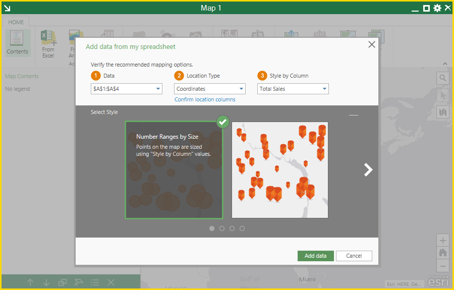
- Create beautiful maps without needing to be a GIS expert. We’ve added a brand new workflow to help you easily get your spreadsheet information on a map. You can start this workflow by clicking the ‘Add map’ button from the Excel ribbon or the ‘From Excel’ button on the map ribbon. We want the experience of adding a map to your spreadsheet to be simple and intuitive while helping you get the best visual insights, so we analyze your data and provide mapping suggestions based on what we find. Based on these recommendations, you are shown a number of map styles that let you see what your map might look like before you make it. You can scroll through the different map styles and pick the one you like, or you can change the suggested data, location, or style settings to see new styles.
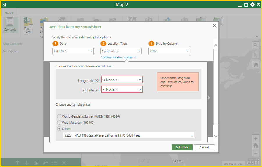
- Use the coordinate system of your choice and easily overlay other GIS datasets that are in your local coordinate system. You are no longer limited to using Web Mercator in your maps in Excel! Esri Maps for Office will now work with basemaps in many more coordinate systems, including WGS84. Basemaps now set the coordinate system for the map and all other layers added to the map are projected into that coordinate system on-the-fly. If you have locations in your spreadsheet data stored in one of the many supported projected and geographic coordinate systems, you can now add them to your maps as well.
- Add custom location types using line features. Many transportation and utility industry customers have been asking for the ability to map linear features, such as roads, rivers, or power lines based on data in their spreadsheet – and now you can! The ‘custom location type’ feature allows you to map points, areas, and now lines by matching your spreadsheet data to GIS layers already in ArcGIS. For example, you might be tracking the status of a gas pipeline upgrade project in a spreadsheet. As segments of the pipeline are upgraded in your sheet, you want to see the status change color on a map. To do this, you could use custom location types to match the pipeline segments in your sheet with the pipeline network your GIS department already published to ArcGIS. You could then easily share the pipeline project status map with your project team or organization using the ‘Share map’ tool.
That covers many of the big features in the new Esri Maps for Office 3.0 release. As you use the add-in, you will find many smaller improvements that we hope will delight and inspire you. If there are other areas of Maps for Office that you’d like to see covered in a future blog, please leave a comment below. To start using the add-in right away, you can get it here.


Article Discussion: