Last month we went to the AT&T Developer Summit Hackathon in Las Vegas. It was exciting to see so many developers (about 600!) working to build a useful mobile app with technology they’d often just been introduced to. Our team (John Gravois, Thad Tilton, Patrick Arlt, Justin Colville an Morakot Pilouk) enjoyed meeting many of those developers and showing them how to add routing, geocoding, geofencing and other ArcGIS for Developers technology to their app.
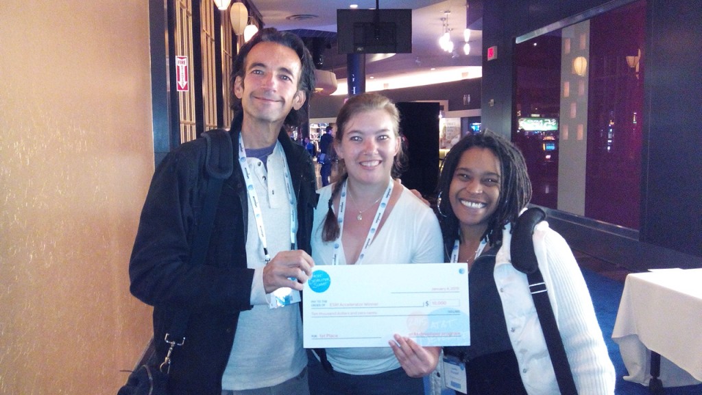
There were lots of technology companies and hackers present, so the Rain Nightclub in the Palms Casino was buzzing 24 hours a day. Esri was a sponsor and offered a $10,000 prize for the best use of our technology. As the hackathon drew to a close, 15 teams showed us what they’d built. Here’s the winner and some favorites.
Our Winner: I’m Almost There
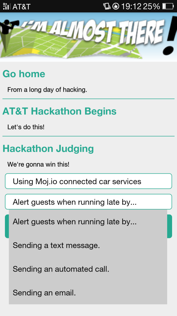 We gave the $10,000 prize for best use of Esri technology to the team behind the I’m Almost There app: Greg Buczek, Amy Buczek (father and daughter) and Lauren Russell. They wrote an Android app that uses Esri’s geocoding and routing to help you automatically let someone know when you’re running late. The app looks at your phone’s Google calendar, and for events that contain a location and an invitee with a phone number in your address book, the app will pay attention to your location and send a text message, automated call or email with your location and ETA if an event starts and you and your phone aren’t there yet. We thought I’m Almost There was an interesting, polished and functionally complete app that used Esri technology well.
Honorable Mentions
Sitter is an app for finding and interviewing a sitter for your baby, house or pet. They incorporated webRTC video chat for interviewing, plus home automation to unlock doors for your sitter during specified times, and an Esri map of available sitters in your area. We liked Sitter’s clean UI and design, and how focused the app was. Kudos to creators Annalisa Recio, Amanda Shebat and the other names we’re blanking on now (sorry!).
Race Day is an iOS app that tracks the time and position of runners in mass start races relative to others in their age group, along with other stats. It uses an Esri map as well as the Geotrigger Service to geofence and know when someone crossed the start and finish lines. We thought Race Day was an interesting app with a nice design and UI. Well done, Scott Sirowy, Richard Fickling and Daniel de Haas!
What could you create?
Want to hack with Esri technology? Sign up for a free developer account at developers.arcgis.com and try adding routing, GeoEnrichment, the Geotrigger Service or any of the many other possibilities to your app. We will be participating in more hackathons in the future, and we’ll update this page as we get them confirmed. If you have a suggestion for a hackathon we should participate in or any questions, tweet @EsriGeoDev.

Article Discussion: