By Don Cooke
ArcGIS now comes with so much free content that it has evolved into a Living Atlas of the World. Esri gets Content for the Living Atlas from three sources:
- Partners including Navteq, which is now known as “Here,” and Digital Globe
- Open sources such as OpenStreetMap
- The community of ArcGIS users, many of whom serve as data stewards for important foundational themes
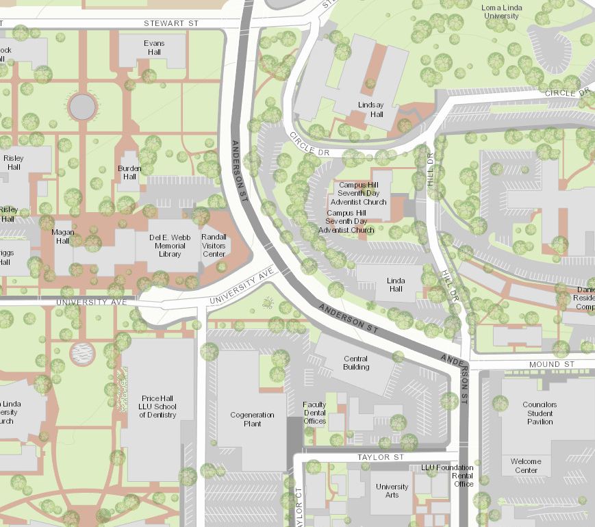
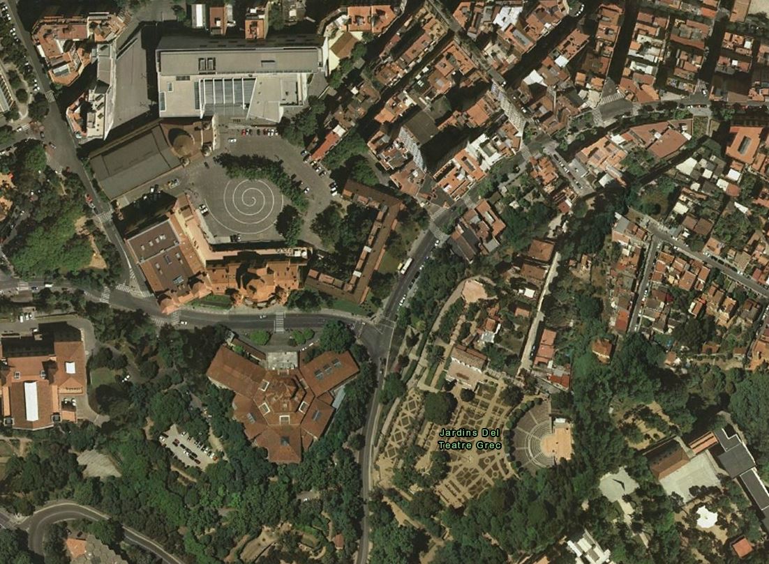
Recent Contributions by Loma Linda University in World Topographic and Imagery in Barcelona Spain
The Community Maps Program is critical to supporting ArcGIS users who want to contribute foundational content. That content is basic, universally-useful information, not data on crime incidents or migration paths.
The Program has evolved and is now much more user-friendly and robust. After reading these key facts about the current program, consider participating. In addition to contributing your authoritative data to the GIS community, you will make your data more easily accessible for your own GIS projects.
1) Community Maps is not just about Basemaps
The Community Maps Program is about all Content: Elevation, Imagery, Oceans, 3D buildings, Hydrography, the Urban Observatory, and of course, the Basemaps.
2) It’s easier than ever to participate
Community maps used to be a challenging exercise in Varsity-level GIS. You had to attend a three-day CM training session. There was a lengthy paper agreement to get signed. We required that you migrate your data to the Local Government Information Model. You had to come up with all the data layers for your area. You had to author the map and use Server to create the map cache.
We’ve changed all of that….
3) The Contribution Management Application (CMA) Streamlines Registration and More
No more lengthy email exchanges to get registered! The CMA lets you supply contact info, specify your Area-of-Interest, and name the layers you want to contribute. You can upload data, view edit results and approve the test map cache through the CMA.
4) Community Maps now uses a “Click-through” legal agreement
You don’t have to carry a paper agreement to the county or city attorney. There’s a “click through” agreement within the CMA. This saves weeks or months for most Participants. If you have a prior participation agreement with custom modifications, that remains in force.
5) You’re not just contributing to the World Topographic Map
Your Content will be used in the World Street Map, the Light-gray “Canvas” map and the World Topo Map. We have plans to add community content to other Basemaps in the near future.
6) Your content will be visible at many more scales
For years, we only used community content at the largest scales, between 1:1000 and 1:9000. This often created a discontinuity when people zoomed out to 1:18,000 and new streets in the contributor’s data disappeared. Now we use community data all the way out to 1:288,000 scale.
7) There’s a new, easy way to format your data for submission
You no longer have to migrate your data to the Local Government Information Model. About a year ago we introduced a free Data Prep Tools package – a suite of geoprocessing tools that you can tailor to migrate just the data we need to author the maps. This eliminates having to migrate data we don’t need and most importantly, sensitive name / phone data never leaves your shop.
Recently we moved the Data Prep Tools out of beta status and combined the USA, International and Campus versions. You just choose the Data Prep Tool for the theme(s) you want to submit. They’re really easy to use; the “Read Me” instruction is under two pages.
8) You don’t need to supply all the map layers to participate
You can participate by contributing a single layer. A lot of Participants are satisfied with the “Here” (Navteq) streets, but feel they can make their local basemaps “pop” just by adding building footprints and a tree layer. Get started with a single layer that makes a difference to the map, and add others as time goes on.
We’re counting on you to participate in Community Maps and the Living Atlas
Esri has invested millions of dollars getting the Community Maps Program launched in a wide spectrum of Content areas. We’re counting on the ArcGIS community to keep the Content updated. We are currently seeking basemap and imagery contributions in particular. Take control of the appearance and timeliness of your area’s data in three basemaps plus World Imagery.
Learn more at http://resources.arcgis.com/en/communities/community-maps/

Article Discussion: